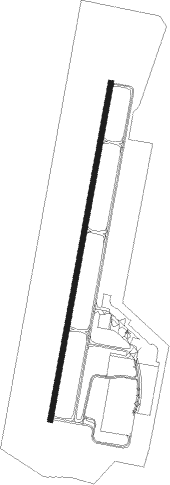
Nashville - John C Tune
Airport details
| Country | United States of America |
| State | Tennessee |
| Region | K7 |
| Airspace | Memphis Ctr |
| Municipality | Nashville-Davidson |
| Elevation | 495ft (151m) |
| Timezone | GMT -6 |
| Coordinates | 36.18302, -86.88650 |
| Magnetic var | |
| Type | land |
| Available since | X-Plane v10.40 |
| ICAO code | KJWN |
| IATA code | n/a |
| FAA code | JWN |
Communication
| John C Tune AWOS 3 | 127.075 |
| John C Tune CTAF/UNICOM | 122.700 |
| John C Tune NASHVILLE Approach | 119.350 |
| John C Tune NASHVILLE Departure | 119.350 |
Approach frequencies
| ILS-cat-I | RW20 | 110.3 | 18.00mi |
| 3° GS | RW20 | 110.3 | 18.00mi |
Nearby Points of Interest:
Richland Hall
-Dr. Richard and Mrs. Margaret Martin House
-Carnegie Library
-Gladstone Apartments
-Woodlawn
-Frederick Stump House
-Alexander Ewing House
-Old Gym
-Alumni Hall
-Dozier Farm
-Capers C.M.E. Church
-Gilbert Mansion
-Thomas W. Phillips Memorial
-Glen Oak
-Tennessee State Library and Archives
-Tennessee Supreme Court Building
-Little Sisters of the Poor Home for the Aged
-West Meade
-Young Women's Christian Association Building
-John Sevier State Office Building
-Savage House
-Bennie-Dillon Building
-Union Station
-Frost Building
-Castner-Knott Building
Nearby beacons
| code | identifier | dist | bearing | frequency |
|---|---|---|---|---|
| BNA | NASHVILLE VORTAC | 10.1 | 103° | 114.10 |
| FQW | WALTER HILL (MURFREESBORO) NDB | 28.3 | 113° | 371 |
| CK | SNUFF(FT CAMPBELL (CLARKSVILLE NDB | 31.8 | 305° | 335 |
| GHM | (CENTERVILLE) DME | 34.5 | 238° | 111.60 |
| CKV | CLARKSVILLE VOR/DME | 36.6 | 310° | 110.60 |
| HXW | SCREAMING EAGLE TACAN | 41.5 | 307° | 114.90 |
| FK | AIRBE(FT CAMPBELL/HOPKINSVILLE NDB | 41.9 | 316° | 273 |
| SYI | SHELBYVILLE VOR/DME | 43.1 | 144° | 113.55 |
| BW | NOORA (BOWLING GREEN) NDB | 46.1 | 30° | 236 |
| BWG | GREEN DME | 49.6 | 31° | 117.90 |
Instrument approach procedures
| runway | airway (heading) | route (dist, bearing) |
|---|---|---|
| RW02 | JOVNA (343°) | JOVNA FUNJO (17mi, 319°) 3000ft |
| RNAV | FUNJO 3000ft WOSOR (6mi, 18°) 2500ft HOKUG (3mi, 18°) 1540ft KJWN (4mi, 18°) 499ft (5254mi, 113°) 734ft BICOL (5252mi, 293°) 3000ft BICOL (turn) | |
| RW20 | BNA (283°) | BNA 5000ft BICOL (15mi, 328°) 4000ft BICOL (turn) 2700ft |
| RW20 | SPARE (178°) | SPARE BICOL (15mi, 163°) 2700ft |
| RW20 | TANDS (222°) | TANDS BICOL (16mi, 237°) 2700ft |
| RNAV | BICOL 2700ft TWITY (5mi, 198°) 2500ft JOGIS (3mi, 198°) 1560ft KJWN (4mi, 198°) 541ft (5254mi, 113°) 1200ft BEVEE (5267mi, 293°) 3000ft BEVEE (turn) |
Disclaimer
The information on this website is not for real aviation. Use this data with the X-Plane flight simulator only! Data taken with kind consent from X-Plane 12 source code and data files. Content is subject to change without notice.