Charleston - Charleston Executive
Airport details
| Country | United States of America |
| State | South Carolina |
| Region | K7 |
| Airspace | Jacksonville Ctr |
| Municipality | Charleston |
| Elevation | 17ft (5m) |
| Timezone | GMT -5 |
| Coordinates | 32.70103, -80.00325 |
| Magnetic var | |
| Type | land |
| Available since | X-Plane v10.40 |
| ICAO code | KJZI |
| IATA code | n/a |
| FAA code | JZI |
Communication
| Charleston Executive AWOS 3 | 123.775 |
| Charleston Executive CTAF/UNICOM | 122.800 |
| Charleston Executive Approach/Departure | 120.700 |
Approach frequencies
| ILS-cat-I | RW09 | 110.7 | 18.00mi |
| 3° GS | RW09 | 110.7 | 18.00mi |
Nearby Points of Interest:
Seashore Farmers' Lodge No. 767
-The Progressive Club
-Fenwick Hall
-West Point Rice Mill
-William Gibbes House
-Simmons-Edwards House
-Miles Brewton House
-Sword Gate House
-Gov. Thomas Bennett House
-Jonathan Lucas House
-Colonel John Stuart House
-Robert William Roper House
-Old Marine Hospital
-Isaac Jenkins Mikell House
-Edward Rutledge House
-Branford-Horry House
-Thomas Rose House
-Charleston
-United States Post Office and Courthouse
-Denmark Vesey House
-Blake Tenements
-Hibernian Hall
-Charleston Arsenal
-Fireproof Building
-Citizens and Southern National Bank of South Carolina
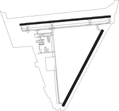
Runway info
Runway 9 / 27  | ||
| length | 1632m (5354ft) | |
| bearing | 89° / 269° | |
| width | 30m (100ft) | |
| surface | concrete | |
| displ threshold | 0m (0ft) / 113m (371ft) | |
| Runway 4 / 22 | ||
| length | 1528m (5013ft) | |
| bearing | 37° / 217° | |
| width | 46m (151ft) | |
| surface | concrete | |
| displ threshold | 0m (0ft) / 210m (689ft) | |
Nearby beacons
| code | identifier | dist | bearing | frequency |
|---|---|---|---|---|
| CHS | CHARLESTON VORTAC | 11.7 | 350° | 113.50 |
| CH | ASHLY (CHARLESTON) NDB | 17.2 | 341° | 329 |
| DYB | DORCHESTER COUNTY(SUMMERVILLE) NDB | 25.6 | 323° | 365 |
| NBC | BEAUFORT TACAN | 38.5 | 253° | 110.50 |
| PHH | ANDREWS NDB | 51 | 32° | 255 |
| VAN | VANCE VORTAC | 51.5 | 330° | 110.40 |
| MNI | MANNING NDB | 54.2 | 347° | 381 |
| SV | WASSA (SAVANNAH) NDB | 65.1 | 235° | 335 |
Departure and arrival routes
| Transition altitude | 18000ft |
| Transition level | 18000ft |
| SID end points | distance | outbound heading | |
|---|---|---|---|
| RW04 | |||
| KIAWA2 | 99mi | 221° | |
| EXTVE1 | 124mi | 295° | |
| RW09 | |||
| KIAWA2 | 99mi | 221° | |
| EXTVE1 | 124mi | 295° | |
| RW22 | |||
| KIAWA2 | 99mi | 221° | |
| EXTVE1 | 124mi | 295° | |
| RW27 | |||
| KIAWA2 | 99mi | 221° | |
| EXTVE1 | 124mi | 295° | |
| STAR starting points | distance | inbound heading | |
|---|---|---|---|
| ALL | |||
| OSPRI7 | 46.4 | 128° | |
| AMYLU3 | 75.7 | 215° | |
| RW04 | |||
| BAGGY2 | 23.2 | 79° | |
| RW09 | |||
| BAGGY2 | 23.2 | 79° | |
| RW27 | |||
| BAGGY2 | 23.2 | 79° | |
Instrument approach procedures
| runway | airway (heading) | route (dist, bearing) |
|---|---|---|
| RW04 | HONAP (80°) | HONAP COSOM (6mi, 146°) 1700ft |
| RNAV | COSOM 1700ft AVEGE (6mi, 65°) 1700ft CUDUL (3mi, 37°) 740ft KJZI (3mi, 32°) 50ft (4901mi, 112°) 420ft HONAP (4912mi, 292°) 2000ft HONAP (turn) | |
| RW09 | CHS (170°) | CHS RILEY (16mi, 227°) 2000ft RILEY (turn) 2000ft |
| RW09 | STOAS (110°) | STOAS RILEY (28mi, 119°) 2000ft |
| RNAV | RILEY 2000ft LOMBA (7mi, 89°) 1700ft CUDGU (4mi, 89°) 580ft KJZI (2mi, 95°) 70ft (4901mi, 112°) 219ft GEGDE (4889mi, 292°) 2100ft GEGDE (turn) | |
| RW27 | BASSO (64°) | BASSO GEGDE (29mi, 74°) 2100ft GEGDE (turn) 2100ft |
| RW27 | CHS (170°) | CHS GEGDE (18mi, 125°) 2100ft GEGDE (turn) 2100ft |
| RNAV | GEGDE 2100ft SUVAE (7mi, 269°) 1600ft CLINO (3mi, 269°) 640ft KJZI (2mi, 264°) 54ft (4901mi, 112°) 265ft RILEY (4913mi, 292°) 2000ft RILEY (turn) |
Holding patterns
| STAR name | hold at | type | turn | heading* | altitude | leg | speed limit |
|---|---|---|---|---|---|---|---|
| AMYLU3 | AMYLU | VHF | left | 39 (219)° | < 17999ft | DME 10.0mi | ICAO rules |
| AMYLU3 | CRAAW | VHF | left | 40 (220)° | < 17999ft | DME 10.0mi | ICAO rules |
| BAGGY2 | BAGGY | VHF | left | 239 (59)° | < 17999ft | DME 10.0mi | ICAO rules |
| OSPRI7 | BUBOO | VHF | right | 298 (118)° | DME 10.0mi | ICAO rules | |
| OSPRI7 | NINJA | VHF | left | 337 (157)° | DME 10.0mi | ICAO rules | |
| OSPRI7 | TRTLS | VHF | left | 321 (141)° | DME 10.0mi | ICAO rules | |
| *) magnetic outbound (inbound) holding course | |||||||
Disclaimer
The information on this website is not for real aviation. Use this data with the X-Plane flight simulator only! Data taken with kind consent from X-Plane 12 source code and data files. Content is subject to change without notice.