Jasper - Pickens Co
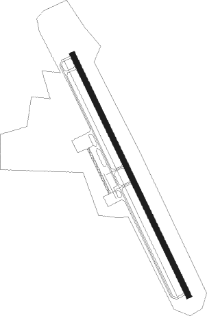
Airport details
| Country | United States of America |
| State | Georgia |
| Region | K7 |
| Airspace | Atlanta Ctr |
| Municipality | Jasper |
| Elevation | 1535ft (468m) |
| Timezone | GMT -5 |
| Coordinates | 34.45347, -84.45722 |
| Magnetic var | |
| Type | land |
| Available since | X-Plane v10.40 |
| ICAO code | KJZP |
| IATA code | JZP |
| FAA code | JZP |
Communication
| Pickens Co CTAF/UNICOM | 122.800 |
Nearby Points of Interest:
Pickens County Courthouse
-Griffeth-Pendley House
-Cagle House
-Tate Gymnasium
-Georgia Marble Company and Tate Historic District
-Tate House
-Ball Ground Historic District
-Cherokee County Courthouse
-Crescent Farm
-Gilmer County Courthouse
-Corra White Harris House, Study, and Chapel
-Boyd and Sallie Gilleland House
-New Echota
-Cassville Post Office
-Calhoun Mine
-Fields Place-Vickery House
-Price Memorial Hall
-Old Bartow County Courthouse
-Lumpkin County Jail
-Bartow County Courthouse
-Wright Hotel
-Roselawn Museum
-Murray County Courthouse
-Calhoun Depot
-Fannin County Courthouse
Nearby beacons
| code | identifier | dist | bearing | frequency |
|---|---|---|---|---|
| DJD | CHERO NDB | 12.1 | 189° | 415 |
| FKV | FLOWERY BRANCH (GAINESVILLE) NDB | 31.1 | 114° | 365 |
| DOB | DOBBINS (MARIETTA) TACAN | 32.4 | 185° | 113 |
| PDK | PEACHTREE (ATLANTA) VOR/DME | 35.5 | 165° | 116.60 |
| RMG | ROME VORTAC | 37.2 | 246° | 115.40 |
| TX | GWNET (LAWRENCEVILLE) NDB | 39.3 | 126° | 419 |
| HRS | HARRIS VORTAC | 39.7 | 48° | 109.80 |
| GQO | CHOO CHOO (CHATTANOOGA) VORTAC | 45.9 | 306° | 115.80 |
| AT | CATTA (ATLANTA) NDB | 48.6 | 186° | 375 |
| ATL | ATLANTA VORTAC | 49.5 | 178° | 116.90 |
| BMW | BARROW COUNTY (WINDER) NDB | 53.1 | 121° | 404 |
| CQN | DAISY (N.CHATTANOOGA) NDB | 55 | 316° | 341 |
| VOF | ALCOVY (COVINGTON) NDB | 59.8 | 141° | 370 |
| GPQ | CARROLLTON NDB | 62.9 | 217° | 278 |
Instrument approach procedures
| runway | airway (heading) | route (dist, bearing) |
|---|---|---|
| RW16 | ETONE (130°) | ETONE IPECA (14mi, 114°) 4400ft |
| RW16 | NELLO (221°) | NELLO IPECA (10mi, 316°) 4400ft IPECA (turn) 4400ft |
| RNAV | IPECA 4400ft JANEB (6mi, 155°) 3000ft KJZP (5mi, 155°) 1541ft (5131mi, 112°) 3000ft IPECA (5135mi, 292°) 4400ft IPECA (turn) | |
| RW34 | AWSON (267°) | AWSON FOTFE (18mi, 239°) 4000ft VIVIC (5mi, 252°) 4000ft |
| RW34 | NELLO (221°) | NELLO VIVIC (14mi, 169°) 5000ft VIVIC (turn) 4000ft |
| RW34 | RMG (66°) | RMG JASIV (33mi, 83°) 4000ft VIVIC (5mi, 72°) 4000ft |
| RNAV | VIVIC 4000ft CICCA (6mi, 335°) 3200ft KJZP (5mi, 335°) 1575ft IPECA (11mi, 335°) 5400ft IPECA (turn) |
Disclaimer
The information on this website is not for real aviation. Use this data with the X-Plane flight simulator only! Data taken with kind consent from X-Plane 12 source code and data files. Content is subject to change without notice.