King City - Mesa Del Rey
Airport details
| Country | United States of America |
| State | California |
| Region | K2 |
| Airspace | Oakland Ctr |
| Municipality | King City |
| Elevation | 370ft (113m) |
| Timezone | GMT -8 |
| Coordinates | 36.22696, -121.12081 |
| Magnetic var | |
| Type | land |
| Available since | X-Plane v10.40 |
| ICAO code | KKIC |
| IATA code | KIC |
| FAA code | KIC |
Communication
| Mesa Del Rey AWOS | 120.800 |
| Mesa Del Rey CTAF | 122.900 |
Nearby Points of Interest:
King City High School Auditorium
-Bear Valley School
-Odd Fellows Hall
-San Andreas Fault Observatory at Depth
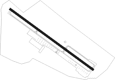
Runway info
| Runway 11 / 29 | ||
| length | 1366m (4482ft) | |
| bearing | 125° / 305° | |
| width | 30m (98ft) | |
| surface | asphalt | |
Nearby beacons
| code | identifier | dist | bearing | frequency |
|---|---|---|---|---|
| HGT | HUNTER LIGGETT NDB | 16.3 | 194° | 209 |
| UAD | CHUALAR (SALINAS) NDB | 23.3 | 307° | 263 |
| BSR | BIG SUR VORTAC | 25.4 | 265° | 114 |
| PXN | PANOCHE VORTAC | 33.6 | 35° | 112.60 |
| SNS | SALINAS VORTAC | 35 | 312° | 117.30 |
| PRB | PASO ROBLES VORTAC | 41 | 138° | 114.30 |
| MR | MUNSO (MONTEREY) NDB | 46 | 296° | 385 |
| MQO | MORRO BAY (SAN LUIS OBISP VORTAC | 61.1 | 160° | 112.40 |
| HYP | EL NIDO (MERCED) VOR/DME | 68.9 | 36° | 114.20 |
Disclaimer
The information on this website is not for real aviation. Use this data with the X-Plane flight simulator only! Data taken with kind consent from X-Plane 12 source code and data files. Content is subject to change without notice.