Lansing - Capital City
Airport details
| Country | United States of America |
| State | Michigan |
| Region | K5 |
| Airspace | Cleveland Ctr |
| Municipality | Lansing |
| Elevation | 857ft (261m) |
| Timezone | GMT -5 |
| Coordinates | 42.77864, -84.58620 |
| Magnetic var | |
| Type | land |
| Available since | X-Plane v10.40 |
| ICAO code | KLAN |
| IATA code | LAN |
| FAA code | LAN |
Communication
| Capital City ATIS | 119.750 |
| Capital City UNICOM | 122.950 |
| Capital City Clearance DEL | 123.675 |
| Capital City Ground Control | 121.900 |
| Capital City LANSING Tower | 119.900 |
| Capital City LANSING Approach/Departure | 118.650 |
| Capital City LANSING Approach/Departure | 133.475 |
Approach frequencies
| ILS-cat-I | RW10R | 111.7 | 18.00mi |
| ILS-cat-I | RW28L | 110.1 | 18.00mi |
| 3° GS | RW10R | 111.7 | 18.00mi |
| 3° GS | RW28L | 110.1 | 18.00mi |
Nearby Points of Interest:
Lansing Civil Air Patrol Quonset Huts
-Smith-Turner House
-Franklin Avenue Presbyterian Church
-Pulver Brothers Filling Station
-Brown-Price House
-Darius B. Moon House
-First Baptist Church
-Christman Building
-Michigan Millers Mutual Fire Insurance Company Building
-Lansing Woman's Club Building
-Ottawa Street Power Station
-Charles E. Chamberlain Federal Building & Post Office
-Boji Tower
-Elliott-Larsen Building
-Masonic Temple Building
-Strand Theatre and Arcade
-J.W. Knapp Company Building
-Union Depot
-Michigan State Medical Society Building
-Central School
-Toumey Woods
-Goetsch-Winckler House
-Eustace Hall
-Stony Creek Bridge
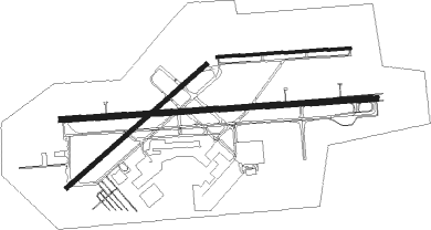
Runway info
Runway 10R / 28L  | ||
| length | 2596m (8517ft) | |
| bearing | 90° / 270° | |
| width | 46m (150ft) | |
| surface | concrete | |
| blast zone | 0m (0ft) / 109m (358ft) | |
| Runway 6 / 24 | ||
| length | 1524m (5000ft) | |
| bearing | 61° / 241° | |
| width | 37m (121ft) | |
| surface | asphalt | |
| Runway 10L / 28R | ||
| length | 1096m (3596ft) | |
| bearing | 91° / 271° | |
| width | 23m (75ft) | |
| surface | concrete | |
Nearby beacons
| code | identifier | dist | bearing | frequency |
|---|---|---|---|---|
| JXN | DME | 31.7 | 166° | 115.45 |
| GR | KNOBS (GRAND RAPIDS) NDB | 35.5 | 278° | 263 |
| BT | BATOL (BATTLE CREEK) NDB | 36.4 | 235° | 272 |
| FNT | FLINT VORTAC | 38.6 | 77° | 116.90 |
| VIO | VICTORY VOR/DME | 40.1 | 271° | 115.95 |
| LFD | LITCHFIELD VOR/DME | 43.7 | 194° | 111.20 |
| MB | OLSTE (SAGINAW) NDB | 44.7 | 31° | 257 |
| SVM | SALEM VORTAC | 49.1 | 110° | 114.30 |
| MBS | SAGINAW VOR/DME | 50.4 | 34° | 112.90 |
| MOP | MOUNT PLEASANT VOR/DME | 51.1 | 350° | 110.60 |
| AZO | KALAMAZOO VOR/DME | 53.7 | 241° | 109 |
| TCU | TECUMSEH NDB | 54.4 | 137° | 239 |
| AZ | AUSTN (KALAMAZOO) NDB | 57 | 236° | 371 |
| ADG | ADRIAN NDB | 59 | 151° | 278 |
| IRS | STURGIS NDB | 69.1 | 221° | 382 |
Instrument approach procedures
| runway | airway (heading) | route (dist, bearing) |
|---|---|---|
| RW06 | BOODY (27°) | BOODY EGUTY (7mi, 314°) 3000ft |
| RW06 | EGUTY (62°) | EGUTY 3000ft |
| RW06 | HOYTV (87°) | HOYTV EGUTY (7mi, 134°) 3000ft |
| RNAV | EGUTY 3000ft STJOE (6mi, 61°) 2100ft LEKPE (2mi, 61°) 1500ft KLAN (3mi, 63°) 899ft (5167mi, 117°) 1109ft FETUM (5159mi, 297°) 3000ft FETUM (turn) | |
| RW10R | ILLOV (66°) | ILLOV OCTEC (7mi, 1°) 3000ft |
| RW10R | JATVA (115°) | JATVA OCTEC (7mi, 181°) 3000ft |
| RW10R | OCTEC (90°) | OCTEC 3000ft |
| RNAV | OCTEC 3000ft AZDEZ (6mi, 90°) 2400ft CIRAT (2mi, 90°) 1640ft KLAN (3mi, 90°) 916ft (5167mi, 117°) 1061ft DUTVE (5155mi, 297°) 3000ft DUTVE (turn) | |
| RW24 | AFJEF (206°) | AFJEF FETUM (7mi, 134°) 3000ft |
| RW24 | FETUM (240°) | FETUM 3000ft |
| RW24 | GOYBU (267°) | GOYBU FETUM (7mi, 315°) 3000ft |
| RNAV | FETUM 3000ft HAKEK (6mi, 241°) 2400ft TIBRE (2mi, 241°) 1640ft KLAN (2mi, 238°) 890ft (5167mi, 117°) 1162ft EGUTY (5175mi, 297°) 3000ft EGUTY (turn) | |
| RW28L | DUTVE (271°) | DUTVE 3000ft |
| RNAV | DUTVE 3000ft BURYE (6mi, 271°) 2400ft KLAN (5mi, 271°) 901ft (5167mi, 117°) 1052ft OCTEC (5178mi, 297°) 3000ft OCTEC (turn) |
Disclaimer
The information on this website is not for real aviation. Use this data with the X-Plane flight simulator only! Data taken with kind consent from X-Plane 12 source code and data files. Content is subject to change without notice.