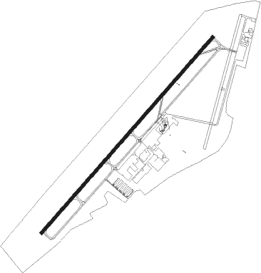
Latrobe - Arnold Palmer Regl
Airport details
| Country | United States of America |
| State | Pennsylvania |
| Region | K6 |
| Airspace | Cleveland Ctr |
| Municipality | Unity Township |
| Elevation | 1198ft (365m) |
| Timezone | GMT -5 |
| Coordinates | 40.27461, -79.40675 |
| Magnetic var | |
| Type | land |
| Available since | X-Plane v10.32 |
| ICAO code | KLBE |
| IATA code | LBE |
| FAA code | LBE |
Communication
| Arnold Palmer Regl ATIS | 118.375 |
| Arnold Palmer Regl CTAF | 125.000 |
| Arnold Palmer Regl Ground Control | 121.800 |
| Arnold Palmer Regl Tower | 125.000 |
| Arnold Palmer Regl Departure | 121.200 |
Approach frequencies
| ILS-cat-I | RW24 | 110.9 | 18.00mi |
| 3° GS | RW24 | 110.9 | 18.00mi |
Nearby Points of Interest:
St. Vincent Archabbey Gristmill
-Citizens National Bank of Latrobe
-Latrobe Armory
-Adam Fisher Homestead
-Hannastown Farm
-Greensburg Downtown Historic District
-Academy Hill Historic District
-Samuel Patterson House
-Ligonier Armory
-Ligonier Historic District
-Mount Pleasant Historic District
-Samuel Warden House
-Fairview Park
-Salem Crossroads Historic District
-Linn Run State Park Family Cabin District
-Blairsville Armory
-St. Peter's Episcopal Church and Rectory
-Slickville Historic District
-Saltsburg Historic District
-Scottdale Armory
-Brush Hill
-Scottdale Historic District
-Peter and Jonathan Newmyer Farm
-Kooser State Park Family Cabin District
-Ross Furnace
Nearby beacons
| code | identifier | dist | bearing | frequency |
|---|---|---|---|---|
| IHD | INDIAN HEAD VORTAC | 18.1 | 171° | 108.20 |
| SYS | STOYSTOWN (SOMERSET) NDB | 25.1 | 111° | 209 |
| JST | JOHNSTOWN VOR/DME | 26.3 | 86° | 113 |
| VV | CAMOR (CONNELLSVILLE) NDB | 28.1 | 221° | 299 |
| AGC | ALLEGHENY (PITTSBURGH) VOR/DME | 29 | 270° | 110 |
| REC | REVLOC VOR/DME | 34.3 | 68° | 110.60 |
| MMJ | (PITTSBURGH) DME | 38.2 | 285° | 112 |
| GRV | DME | 41.7 | 151° | 112.30 |
| MGW | MORGANTOWN VOR/DME | 47.9 | 212° | 111.60 |
| EWC | ELLWOOD CITY VOR/DME | 49.4 | 304° | 115.80 |
| CIP | DME | 52.4 | 357° | 112.90 |
Instrument approach procedures
| runway | airway (heading) | route (dist, bearing) |
|---|---|---|
| RW06 | WETAB (53°) | WETAB 4000ft |
| RNAV | WETAB 4000ft ARNIE (6mi, 53°) 2700ft KLBE (5mi, 54°) 1244ft (4921mi, 117°) 1449ft IGOCI (4912mi, 297°) 4200ft IGOCI (turn) | |
| RW24 | IGOCI (233°) | IGOCI 4200ft |
| RNAV | IGOCI 4200ft ZINTA (6mi, 233°) 3900ft XICBU (6mi, 233°) 2140ft KLBE (3mi, 233°) 1185ft (4921mi, 117°) 1345ft WETAB (4928mi, 297°) 4200ft WETAB (turn) 4200ft |
Disclaimer
The information on this website is not for real aviation. Use this data with the X-Plane flight simulator only! Data taken with kind consent from X-Plane 12 source code and data files. Content is subject to change without notice.
