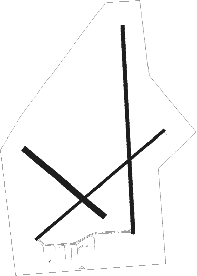
Wayne - Wayne Muni
Airport details
| Country | United States of America |
| State | Nebraska |
| Region | K3 |
| Airspace | Minneapolis Ctr |
| Municipality | Wayne County |
| Elevation | 1431ft (436m) |
| Timezone | GMT -6 |
| Coordinates | 42.24160, -96.98227 |
| Magnetic var | |
| Type | land |
| Available since | X-Plane v10.40 |
| ICAO code | KLCG |
| IATA code | n/a |
| FAA code | LCG |
Communication
| Wayne Muni AWOS 3 | 120.125 |
| Wayne Muni CTAF/UNICOM | 122.800 |
| Wayne Muni SIOUX CITY Approach/Departure | 124.600 |
Nearby Points of Interest:
Wayne United States Post Office
-Thurston County Courthouse
-First Thurston County Courthouse
-Ben Bonderson Farm
-Rattlesnake Creek Bridge
-Dixon County Courthouse
-Cook Blacksmith Shop
-Ponca Historic District
-Norfolk Community Theatre
-United States Post Office and Courthouse
-Norfolk Carnegie Library
-Cornelius O'Connor House
-Karl Stefan Memorial Airport Administration Building
-Cedar County Courthouse
-Hartington City Hall and Auditorium
-Hartington Hotel
-West Point City Auditorium
-Theophile Bruguier Cabin
-Great Northern Railway 1355
-Meisch House
-Sioux City Public Library
-Federal Building and United States Courthouse
-T.S. Martin and Company
-Williges Building
-Davidson Building
Nearby beacons
| code | identifier | dist | bearing | frequency |
|---|---|---|---|---|
| OFK | NORFOLK VOR/DME | 25.2 | 241° | 109.60 |
| OI | TOMMI (SIOUX CITY) NDB | 26.5 | 67° | 305 |
| SUX | SIOUX CITY TACAN | 29.9 | 81° | 116.50 |
| SU | SALIX (SOUIX CITY) NDB | 31.1 | 83° | 414 |
| YK | CAGUR (YANKTON) NDB | 38.8 | 332° | 347 |
| SCB | SCRIBNER VOR/DME | 41.3 | 151° | 111 |
| YKN | YANKTON VOR/DME | 44.3 | 329° | 111.40 |
| PLT | PLATTE CENTER (COLUMBUS) NDB | 48.1 | 208° | 407 |
| OLU | COLUMBUS VOR/DME | 50.1 | 204° | 111.80 |
Instrument approach procedures
| runway | airway (heading) | route (dist, bearing) |
|---|---|---|
| RW18 | ACKEG (183°) | ACKEG 3500ft |
| RW18 | HARDS (128°) | HARDS SEWAH (15mi, 114°) 3500ft ACKEG (6mi, 91°) 3500ft |
| RW18 | VEYWA (212°) | VEYWA ACKEG (5mi, 271°) 3500ft |
| RNAV | ACKEG 3500ft CESZI (5mi, 182°) 3500ft ZALZI (4mi, 182°) 2200ft KLCG (3mi, 184°) 1469ft (5715mi, 114°) 1678ft ERHOS (5716mi, 293°) 3500ft ERHOS (turn) | |
| RW23 | CAGAL (242°) | CAGAL 3200ft |
| RW23 | HURLI (206°) | HURLI DOYPA (11mi, 196°) 3400ft CAGAL (6mi, 136°) 3200ft |
| RW23 | PENDE (293°) | PENDE FAXAK (8mi, 55°) 3600ft CAGAL (6mi, 316°) 3200ft |
| RNAV | CAGAL 3200ft BUCAG (6mi, 242°) 3100ft KLCG (5mi, 242°) 1466ft (5715mi, 114°) 1832ft CEKAC (5724mi, 293°) 3400ft CEKAC (turn) | |
| RW36 | DECKA (293°) | DECKA VEPOW (27mi, 281°) 3500ft ERHOS (6mi, 271°) 3500ft |
| RW36 | ERHOS (1°) | ERHOS 3500ft |
| RW36 | OFK (61°) | OFK SERWU (14mi, 79°) 3500ft ERHOS (6mi, 91°) 3500ft |
| RNAV | ERHOS 3500ft BILEH (5mi, 2°) 3500ft ACAYO (4mi, 2°) 2160ft KLCG (2mi, 359°) 1473ft (5715mi, 114°) 1682ft ACKEG (5714mi, 294°) 3500ft ACKEG (turn) |
Disclaimer
The information on this website is not for real aviation. Use this data with the X-Plane flight simulator only! Data taken with kind consent from X-Plane 12 source code and data files. Content is subject to change without notice.

