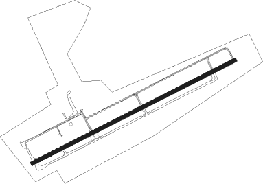
Laconia - Laconia Muni
Airport details
| Country | United States of America |
| State | New Hampshire |
| Region | K6 |
| Airspace | Boston Ctr |
| Municipality | Gilford |
| Elevation | 544ft (166m) |
| Timezone | GMT -5 |
| Coordinates | 43.57304, -71.41784 |
| Magnetic var | |
| Type | land |
| Available since | X-Plane v10.40 |
| ICAO code | KLCI |
| IATA code | LCI |
| FAA code | LCI |
Communication
| Laconia Muni AWOS | 133.525 |
| Laconia Muni CTAF/UNICOM | 123.000 |
| Laconia Muni BOSTON Approach/Departure | 134.750 |
Approach frequencies
| ILS-cat-I | RW08 | 108.5 | 18.00mi |
| 3° GS | RW08 | 108.5 | 18.00mi |
Nearby Points of Interest:
John J. Morrill Store
-Benjamin Rowe House
-Ossian Wilbur Goss Reading Room
-New Hampshire Veterans' Association Historic District
-District No. 9 Schoolhouse
-Federal Building
-John W. Busiel House
-Busiel-Seeburg Mill
-Gale Memorial Library
-Colonial Theatre Complex
-US Post Office-Laconia Main
-Windermere
-Bay Meeting House and Vestry
-Meredith Public Library
-First Free Will Baptist Church
-Swallow Boathouse
-Belmont Public Library
-Sanbornton Square Historic District
-Washington Mooney House
-Dana Meeting House
-Gordon-Nash Library
-Union Church
-House by the Side of the Road
-Gilmanton Ironworks Library
-Moultonborough Town House
Nearby beacons
| code | identifier | dist | bearing | frequency |
|---|---|---|---|---|
| LC | BLNAP (LACONIA) NDB | 5.6 | 253° | 328 |
| CON | CONCORD VOR/DME | 22.3 | 204° | 112.90 |
| CO | EPSOM (CONCORD) NDB | 27.3 | 184° | 216 |
| SF | SANFD (SANFORD) NDB | 29.1 | 112° | 349 |
| ESG | ROLLINS (ROLLINSFORD) NDB | 33.3 | 121° | 260 |
| LAH | HANOVER (LEBANON) NDB | 33.9 | 280° | 276 |
| LEB | DME | 35.2 | 278° | 113.70 |
| ENE | KENNEBUNK VOR/DME | 36.1 | 100° | 117.10 |
| PSM | (PORTSMOUTH) DME | 38.9 | 130° | 116.50 |
| MHT | MANCHESTER VOR/DME | 42.3 | 176° | 114.40 |
| MJ | FITZY (MANCHESTER) NDB | 42.8 | 189° | 209 |
| CNH | CLAREMONT NDB | 43.3 | 258° | 233 |
| GMA | MAHN (WHITEFIELD) NDB | 48.7 | 341° | 386 |
| LWM | DME | 51.9 | 159° | 112.50 |
| EEN | DME | 60.4 | 228° | 109.40 |
Instrument approach procedures
| runway | airway (heading) | route (dist, bearing) |
|---|---|---|
| RW08 | BILLS (97°) | BILLS TUYUC (11mi, 133°) 4400ft |
| RW08 | GRUMP (309°) | GRUMP TUYUC (15mi, 258°) 4400ft TUYUC (turn) 4400ft |
| RW08 | KERSY (59°) | KERSY TUYUC (8mi, 22°) 4400ft |
| RNAV | TUYUC 4400ft OSPEE (6mi, 73°) 3100ft TUBUY (4mi, 73°) 1860ft KLCI (4mi, 73°) 589ft KOSHI (13mi, 73°) 3000ft KOSHI (turn) | |
| RW26 | CON (24°) | CON DOJEN (30mi, 53°) 4000ft KOSHI (5mi, 331°) 3000ft |
| RW26 | GRUMP (309°) | GRUMP KOSHI (12mi, 67°) 4000ft KOSHI (turn) 3000ft |
| RW26 | LIMER (258°) | LIMER KOSHI (10mi, 263°) 3000ft |
| RNAV | KOSHI 3000ft ZUROT (4mi, 253°) 2900ft REZDI (3mi, 253°) 2200ft KLCI (5mi, 253°) 566ft (4603mi, 121°) 1420ft TUYUC (4615mi, 301°) 4400ft TUYUC (turn) |
Disclaimer
The information on this website is not for real aviation. Use this data with the X-Plane flight simulator only! Data taken with kind consent from X-Plane 12 source code and data files. Content is subject to change without notice.
