Ludington - Mason Co
Airport details
| Country | United States of America |
| State | Michigan |
| Region | K5 |
| Airspace | Minneapolis Ctr |
| Municipality | Pere Marquette Charter Township |
| Elevation | 645ft (197m) |
| Timezone | GMT -5 |
| Coordinates | 43.96253, -86.40791 |
| Magnetic var | |
| Type | land |
| Available since | X-Plane v10.30 |
| ICAO code | KLDM |
| IATA code | LDM |
| FAA code | LDM |
Communication
| Mason Co AWOS 3 | 119.925 |
| Mason Co CTAF/UNICOM | 123.000 |
| Mason Co App/Dep Minneapolis | 120.850 |
Nearby Points of Interest:
Warren A. and Catherine Cartier House
-Mason County Courthouse
-Ludington United States Coast Guard Station
-Dumaw Creek Site
-Pentwater South Pierhead Light
-Navigation Structures at Pentwater Harbor
-Jared H. Gay House
-Hart Downtown Historic District
-Our Saviour's Evangelical Lutheran Church
-Simeon Babcock House
-First Congregational Church
-Manistee Harbor, South Breakwater
-Manistee Central Business District
-Camp Tosebo
-Sandenburgh-Rogers Summer Resort Complex
-Marlborough Historic District
-Idlewild

Nearby beacons
| code | identifier | dist | bearing | frequency |
|---|---|---|---|---|
| MBL | DME | 19.6 | 27° | 111.40 |
| MB | JEPOT (MANISTEE) NDB | 21.7 | 41° | 254 |
| HIC | WHITE CLOUD VOR/DME | 37.9 | 119° | 117.60 |
| MA | WEXOR (CADILLAC) NDB | 40.6 | 72° | 336 |
| MKG | MUSKEGON TACAN | 50.2 | 155° | 115.20 |
| TVC | TRAVERSE CITY VOR/DME | 56.1 | 51° | 114.60 |
| TV | GWENN (TRAVERSE CITY) NDB | 62.5 | 52° | 365 |
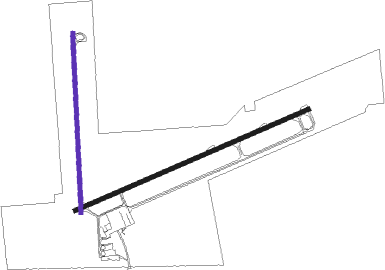
Instrument approach procedures
| runway | airway (heading) | route (dist, bearing) |
|---|---|---|
| RW08 | FINOB (76°) | FINOB 3000ft |
| RW08 | HIKAS (58°) | HIKAS FINOB (5mi, 334°) 3000ft |
| RW08 | YULNU (104°) | YULNU JAMAG (9mi, 129°) 3000ft FINOB (5mi, 154°) 3000ft |
| RNAV | FINOB 3000ft ZEKOP (7mi, 76°) 2500ft KLDM (6mi, 75°) 691ft (5250mi, 117°) 1046ft CEYNA (5246mi, 297°) WELKO (14mi, 141°) 3000ft WELKO (turn) | |
| RW26 | PECOF (256°) | PECOF TULHE (5mi, 256°) 2500ft |
| RNAV | TULHE 2500ft SAYXE (6mi, 256°) 2500ft JILIN (3mi, 256°) 1480ft KLDM (3mi, 258°) 686ft (5250mi, 117°) 975ft EMGEF (5255mi, 297°) 2500ft EMGEF (turn) |
Disclaimer
The information on this website is not for real aviation. Use this data with the X-Plane flight simulator only! Data taken with kind consent from X-Plane 12 source code and data files. Content is subject to change without notice.