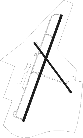
Auburn/lewiston - Auburn Lewiston Muni
Airport details
| Country | United States of America |
| State | Maine |
| Region | K6 |
| Airspace | Boston Ctr |
| Municipality | Auburn |
| Elevation | 288ft (88m) |
| Timezone | GMT -5 |
| Coordinates | 44.04847, -70.28351 |
| Magnetic var | |
| Type | land |
| Available since | X-Plane v10.32 |
| ICAO code | KLEW |
| IATA code | LEW |
| FAA code | LEW |
Communication
| Auburn Lewiston Muni AWOS 3 | 118.025 |
| Auburn Lewiston Muni CTAF/UNICOM | 122.800 |
| Auburn Lewiston Muni PORTLAND Approach | 124.050 |
| Auburn Lewiston Muni PORTLAND Approach | 125.500 |
| Auburn Lewiston Muni PORTLAND Departure | 125.500 |
Approach frequencies
| ILS-cat-I | RW04 | 108.9 | 18.00mi |
| 3° GS | RW04 | 108.9 | 18.00mi |
Nearby Points of Interest:
Former Gilead Railroad Station
-Keystone Mineral Springs
-Horace Munroe House
-Charles L. Cushman House
-Barker Mill
-United States Post Office–Lewiston Main
-Poland Spring Bottling Plant and Spring House
-William A. Robinson House
-Charles A. Jordan House
-Horatio G. Foss House
-A. A. Garcelon House
-Edward Little House
-Frank L. Dingley House
-Poland Springs Historic District
-Holman Day House
-Gay-Munroe House
-Auburn Public Library
-Continental Mill Housing
-Engine House
-Androscoggin County Courthouse and Jail
-Dominican Block
-Auburn Commercial Historic District
-Maine Supply Company Building
-Bates Mill
-Lord Block
Nearby beacons
| code | identifier | dist | bearing | frequency |
|---|---|---|---|---|
| LE | LEWIE (AUBURN-LEWISTON) NDB | 5.6 | 212° | 240 |
| AUG | AUGUSTA VOR/DME | 26.5 | 61° | 114.95 |
| AU | DUNNS (AUGUSTA) NDB | 28.3 | 49° | 366 |
| ENE | KENNEBUNK VOR/DME | 40 | 208° | 117.10 |
| SF | SANFD (SANFORD) NDB | 49.1 | 218° | 349 |
| BML | DME | 52.3 | 303° | 116.55 |
| ESG | ROLLINS (ROLLINSFORD) NDB | 55 | 213° | 260 |
| BUP | BURNHAM (PITTSFIELD) NDB | 55.6 | 55° | 348 |
| RQM | RANGELEY NDB | 56.8 | 332° | 221 |
| PSM | (PORTSMOUTH) DME | 62.6 | 210° | 116.50 |
Instrument approach procedures
| runway | airway (heading) | route (dist, bearing) |
|---|---|---|
| RW04 | AUBIN (32°) | AUBIN 3100ft |
| RW04 | CUMBR (349°) | CUMBR AUBIN (8mi, 288°) 3100ft |
| RW04 | SUMNA (65°) | SUMNA AUBIN (8mi, 108°) 3100ft |
| RNAV | AUBIN 3100ft CHWDA (6mi, 32°) 2200ft HOGOK (3mi, 32°) 1240ft KLEW (3mi, 33°) 319ft (4562mi, 122°) 470ft WUDDE (4560mi, 302°) 3100ft WUDDE (turn) | |
| RW22 | AYUHH (235°) | AYUHH 3400ft WUDDE (5mi, 288°) 3100ft |
| RW22 | PROUT (183°) | PROUT 3400ft WUDDE (5mi, 108°) 3100ft |
| RW22 | WUDDE (212°) | WUDDE 3100ft |
| RNAV | WUDDE 3100ft DANOH (6mi, 212°) 2200ft FALMO (3mi, 212°) 1080ft KLEW (3mi, 212°) 318ft AUBIN (12mi, 212°) 3100ft AUBIN (turn) |
Disclaimer
The information on this website is not for real aviation. Use this data with the X-Plane flight simulator only! Data taken with kind consent from X-Plane 12 source code and data files. Content is subject to change without notice.

