Lexington - Lexington Blue Grass
Airport details
| Country | United States of America |
| State | Kentucky |
| Region | K5 |
| Airspace | Indianapolis Ctr |
| Municipality | Lexington |
| Elevation | 979ft (298m) |
| Timezone | GMT -5 |
| Coordinates | 38.03675, -84.60864 |
| Magnetic var | |
| Type | land |
| Available since | X-Plane v10.40 |
| ICAO code | KLEX |
| IATA code | LEX |
| FAA code | LEX |
Communication
Approach frequencies
| ILS-cat-I | RW22 | 111.75 | 18.00mi |
| ILS-cat-I | RW04 | 110.1 | 18.00mi |
| 3° GS | RW22 | 111.75 | 18.00mi |
| 3° GS | RW04 | 110.1 | 18.00mi |
Nearby Points of Interest:
Keeneland
-Floral Hall
-Lexington National Cemetery
-Botherum
-Liggett and Myers Harpring Tobacco Storage Warehouse
-Waveland State Historic Site
-Opera House and Yates Bookshop Building
-Monsieur Giron's Confectionery
-McAdams and Morford Building
-Fayette National Bank Building
-Central Kentucky Blue Grass Seed Co.
-Odd Fellows Temple
-Higgins Block
-Downtown Commercial District
-Lexington Herald Building
-United States Post Office and Court House
-Second Presbyterian Church
-Episcopal Burying Ground and Chapel
-Confederate Monument in Versailles
-Providence Church
-Cleveland House
-Hurricane Hall
-First African Baptist Church
-Ebenezer Presbyterian Church
-Midway Historic District
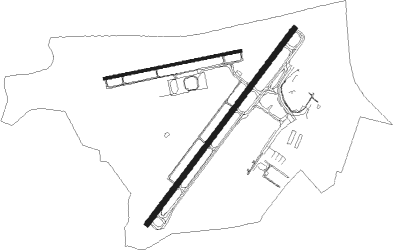
Runway info
Runway 4 / 22  | ||
| length | 2138m (7014ft) | |
| bearing | 48° / 228° | |
| width | 46m (150ft) | |
| surface | asphalt | |
| Runway 9 / 27 | ||
| length | 1218m (3996ft) | |
| bearing | 84° / 264° | |
| width | 23m (75ft) | |
| surface | concrete | |
Nearby beacons
| code | identifier | dist | bearing | frequency |
|---|---|---|---|---|
| LE | BLAYD (LEXINGTON) NDB | 3.8 | 226° | 242 |
| GN | BRIDL (LEXINGTON) NDB | 7.1 | 49° | 340 |
| HYK | LEXINGTON VOR/DME | 7.7 | 117° | 112.60 |
| FFT | FRANKFORT VOR | 16.6 | 296° | 109.40 |
| DVK | GOODALL (DANVILLE) NDB | 28.6 | 199° | 311 |
| IOB | MOUNT STERLING NDB | 29.6 | 88° | 210 |
| FLM | FALMOUTH VOR/DME | 39.3 | 26° | 117 |
| IIU | LOUISVILLE VORTAC | 45.9 | 274° | 114.80 |
| CVG | CINCINNATI VORTAC | 58.9 | 354° | 117.30 |
| GVR | (MADISON) DME | 59.3 | 310° | 114.65 |
Departure and arrival routes
| Transition altitude | 18000ft |
| Transition level | 18000ft |
| STAR starting points | distance | inbound heading | |
|---|---|---|---|
| ALL | |||
| CLEGG5 | 16.5 | 117° | |
Instrument approach procedures
| runway | airway (heading) | route (dist, bearing) |
|---|---|---|
| RW04 | FRNZI (23°) | FRNZI 3200ft SAAPP (5mi, 305°) 3200ft |
| RW04 | SAAPP (48°) | SAAPP 3200ft |
| RW04 | UUKAY (68°) | UUKAY 3200ft SAAPP (5mi, 125°) 3200ft |
| RNAV | SAAPP 3200ft TUBBE (8mi, 48°) 2200ft KLEX (4mi, 46°) 1000ft (5150mi, 114°) 1274ft UPRAW (5142mi, 294°) 3200ft UPRAW (turn) | |
| RW09 | CUBEE (104°) | CUBEE 3000ft OVMAW (5mi, 171°) 3000ft |
| RW09 | ESOME (66°) | ESOME 3100ft OVMAW (5mi, 351°) 3000ft |
| RW09 | OVMAW (85°) | OVMAW 3000ft |
| RNAV | OVMAW 3000ft YIBUP (6mi, 84°) 2600ft KLEX (5mi, 86°) 993ft REBAA (11mi, 84°) 3000ft REBAA (turn) | |
| RW22 | SIRBE (248°) | SIRBE 3200ft UPRAW (5mi, 305°) 3200ft |
| RW22 | UPRAW (229°) | UPRAW 3200ft |
| RW22 | VICGO (207°) | VICGO 3200ft UPRAW (5mi, 125°) 3200ft |
| RNAV | UPRAW 3200ft MUMME (6mi, 228°) 3200ft KLEX (7mi, 229°) 1028ft (5150mi, 114°) 1267ft SAAPP (5158mi, 294°) 3200ft SAAPP (turn) | |
| RW27 | GRAVI (244°) | GRAVI 3000ft REBAA (5mi, 171°) 3000ft |
| RW27 | PHISH (283°) | PHISH 3100ft REBAA (5mi, 351°) 3000ft |
| RW27 | REBAA (264°) | REBAA 3000ft |
| RNAV | REBAA 3000ft SMAIL (6mi, 265°) 2600ft LAKWA (3mi, 264°) 1680ft KLEX (2mi, 260°) 1017ft OVMAW (12mi, 265°) 3000ft OVMAW (turn) |
Holding patterns
| STAR name | hold at | type | turn | heading* | altitude | leg | speed limit |
|---|---|---|---|---|---|---|---|
| CLEGG5 | NERVE | VHF | left | 41 (221)° | 1.0min timed | ICAO rules | |
| *) magnetic outbound (inbound) holding course | |||||||
Disclaimer
The information on this website is not for real aviation. Use this data with the X-Plane flight simulator only! Data taken with kind consent from X-Plane 12 source code and data files. Content is subject to change without notice.