Lufkin - Angelina Co
Airport details
| Country | United States of America |
| State | Texas |
| Region | K4 |
| Airspace | Houston Oceanic Ctr |
| Municipality | Angelina County |
| Elevation | 293ft (89m) |
| Timezone | GMT -6 |
| Coordinates | 31.23403, -94.75000 |
| Magnetic var | |
| Type | land |
| Available since | X-Plane v10.32 |
| ICAO code | KLFK |
| IATA code | LFK |
| FAA code | LFK |
Communication
| Angelina Co ASOS | 120.625 |
| Angelina Co CTAF/UNICOM | 123.000 |
| Angelina Co Houston ARTCC | 125.175 |
Approach frequencies
| ILS-cat-I | RW07 | 111.3 | 18.00mi |
| 3° GS | RW07 | 111.3 | 18.00mi |
Nearby Points of Interest:
Sterne-Hoya House Museum and Library
-Woodmen of the World Building
-Tyler County Courthouse
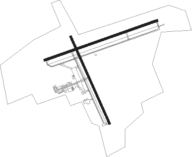
Runway info
Runway 7 / 25  | ||
| length | 1647m (5404ft) | |
| bearing | 77° / 257° | |
| width | 30m (100ft) | |
| surface | asphalt | |
| Runway 16 / 34 | ||
| length | 1315m (4314ft) | |
| bearing | 157° / 337° | |
| width | 30m (100ft) | |
| surface | asphalt | |
| displ threshold | 0m (0ft) / 33m (108ft) | |
| blast zone | 90m (295ft) / 90m (295ft) | |
Nearby beacons
| code | identifier | dist | bearing | frequency |
|---|---|---|---|---|
| LF | FLUFY (LUFKIN) NDB | 3.9 | 259° | 350 |
| LFK | LUFKIN VORTAC | 4.6 | 155° | 112.10 |
| OC | NADOS (NACOGDOCHES) NDB | 15.1 | 7° | 253 |
| CZJ | AMASON (CENTER) NDB | 47.1 | 45° | 341 |
| UTS | HUNTSVILLE NDB | 52.4 | 240° | 308 |
| CX | ALIBI (HOUSTON) NDB | 61 | 222° | 281 |
| RPF | CARTHAGE NDB | 61.3 | 26° | 332 |
| FZT | FRANKSTON VOR/DME | 64.3 | 317° | 111.40 |
Instrument approach procedures
| runway | airway (heading) | route (dist, bearing) |
|---|---|---|
| RW07 | LFK (335°) | LFK SIRTE (12mi, 278°) 2000ft SIRTE (turn) 2000ft |
| RNAV | SIRTE 2000ft BOVIN (6mi, 77°) 1500ft KLFK (4mi, 79°) 334ft (5649mi, 108°) 537ft MIBER (5638mi, 288°) 2000ft MIBER (turn) | |
| RW16 | LFK (335°) | LFK POLEH (16mi, 336°) 2100ft POLEH (turn) 2100ft |
| RW16 | RAFTO (273°) | RAFTO AFRUH (39mi, 290°) 2400ft POLEH (6mi, 251°) 2100ft |
| RNAV | POLEH 2100ft NOAAH (6mi, 157°) 1900ft ZEBGO (3mi, 157°) 940ft KLFK (2mi, 154°) 337ft (5649mi, 108°) 680ft EXISE (5646mi, 288°) 2000ft EXISE (turn) | |
| RW25 | LFK (335°) | LFK MIBER (12mi, 56°) 2000ft MIBER (turn) 2000ft |
| RNAV | MIBER 2000ft JEDZE (6mi, 257°) 1900ft HUSUN (3mi, 257°) 880ft KLFK (2mi, 255°) 341ft (5649mi, 108°) 660ft SIRTE (5659mi, 288°) 2000ft SIRTE (turn) | |
| RW34 | LFK (335°) | LFK EXISE (7mi, 160°) 2000ft EXISE (turn) 2000ft |
| RNAV | EXISE 2000ft PAICE (6mi, 337°) 1900ft JOROM (3mi, 337°) 840ft KLFK (2mi, 341°) 330ft (5649mi, 108°) 660ft POLEH (5652mi, 288°) 2100ft POLEH (turn) |
Disclaimer
The information on this website is not for real aviation. Use this data with the X-Plane flight simulator only! Data taken with kind consent from X-Plane 12 source code and data files. Content is subject to change without notice.