Lagrange - Lagrange Callaway
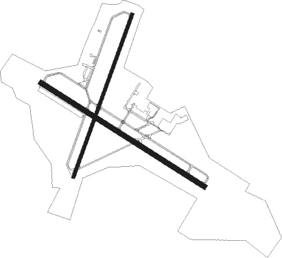
Airport details
| Country | United States of America |
| State | Georgia |
| Region | K7 |
| Airspace | Atlanta Ctr |
| Municipality | LaGrange |
| Elevation | 691ft (211m) |
| Timezone | GMT -5 |
| Coordinates | 33.00886, -85.07261 |
| Magnetic var | |
| Type | land |
| Available since | X-Plane v10.40 |
| ICAO code | KLGC |
| IATA code | LGC |
| FAA code | LGC |
Communication
| LAGRANGE CALLAWAY AWOS 3 | 126.325 |
| LAGRANGE CALLAWAY CTAF/UNICOM | 122.975 |
| LAGRANGE CALLAWAY ATLANTA Approach/Departure | 126.550 |
| LAGRANGE CALLAWAY ATLANTA Approach/Departure | 125.500 |
Approach frequencies
| ILS-cat-I | RW31 | 110.9 | 18.00mi |
| 3° GS | RW31 | 110.9 | 18.00mi |
Nearby Points of Interest:
Bellevue
-Troup County Courthouse, Annex, and Jail
-Nutwood
-Liberty Hill
-R. M. Jones General Store
-Hawkes Children's Library of West Point
-McCosh Grist Mill
-New Hope Rosenwald School
-Langdale Historic District
-Riverview Historic District
-Fairfax Historic District
-Heard County Jail
-Roanoke Downtown Historic District
-Chambers County Courthouse Square Historic District
-Harris County Courthouse
-Greenville Historic District
-Meriwether County Courthouse
-Greenville Presbyterian Church and Cemetery
-Eleanor Roosevelt School
-Warm Springs Historic District
-Wadley Railroad Depot
-Coweta County Courthouse
-Mary Ray Memorial School
-G.W. Andrews Federal Building
-Lee County Courthouse

Nearby beacons
| code | identifier | dist | bearing | frequency |
|---|---|---|---|---|
| LGC | LA GRANGE VORTAC | 7.1 | 287° | 115.60 |
| EQQ | COWETA COUNTY (NEWNAN) NDB | 23.4 | 55° | 234 |
| CSG | COLUMBUS VORTAC | 23.8 | 172° | 117.10 |
| CS | FENIX (COLUMBUS) NDB | 33.4 | 177° | 355 |
| GPQ | CARROLLTON NDB | 33.5 | 354° | 278 |
| FFC | PECAT (ATLANTA) NDB | 34.2 | 64° | 316 |
| LSF | LAWSON (COLUMBUS) VOR/DME | 40.8 | 173° | 111.40 |
| AWS | LAWSON (COLUMBUS) NDB | 43 | 176° | 335 |
| TGE | TUSKEGEE VOR/DME | 43.5 | 229° | 117.30 |
| OP | YATES (THOMASTON) NDB | 44.9 | 96° | 339 |
| AT | CATTA (ATLANTA) NDB | 46.6 | 40° | 375 |
| ATL | ATLANTA VORTAC | 49.1 | 46° | 116.90 |
| AN | BOGGA (ANNISTON) NDB | 53.4 | 301° | 211 |
| TDG | DME | 59.3 | 300° | 108.80 |
| DOB | DOBBINS (MARIETTA) TACAN | 61.3 | 32° | 113 |
| PDK | PEACHTREE (ATLANTA) VOR/DME | 64.9 | 42° | 116.60 |
| LKG | LINDBERGH (AMERICUS) NDB | 69.9 | 131° | 242 |
| ACJ | SOUTHER (AMERICUS) NDB | 70 | 135° | 242 |
Instrument approach procedures
| runway | airway (heading) | route (dist, bearing) |
|---|---|---|
| RW03 | SUMDE (29°) | SUMDE 3000ft |
| RNAV | SUMDE 3000ft TOGBE (7mi, 28°) 2400ft HUNOG (3mi, 28°) 1460ft KLGC (3mi, 30°) 736ft (5157mi, 111°) 1300ft WERTU (5167mi, 291°) 3500ft WERTU (turn) 3500ft | |
| RW13 | WERTU (122°) | WERTU 3500ft |
| RNAV | WERTU 3500ft OSDOW (7mi, 122°) 2400ft JEPNU (3mi, 122°) 1360ft KLGC (3mi, 121°) 722ft (5157mi, 111°) 1094ft WAGUS (5146mi, 291°) 3000ft WAGUS (turn) | |
| RW31 | WAGUS (302°) | WAGUS 3000ft |
| RNAV | WAGUS 3000ft ARIVE (7mi, 302°) 2400ft HIPUN (2mi, 302°) 1600ft KLGC (3mi, 303°) 716ft (5157mi, 111°) 881ft WERTU (5167mi, 291°) 3500ft WERTU (turn) |
Disclaimer
The information on this website is not for real aviation. Use this data with the X-Plane flight simulator only! Data taken with kind consent from X-Plane 12 source code and data files. Content is subject to change without notice.