La Grande - La Grande Union Co
Airport details
| Country | United States of America |
| State | Oregon |
| Region | K1 |
| Airspace | Seattle Ctr |
| Municipality | Union County |
| Elevation | 2715ft (828m) |
| Timezone | GMT -7 |
| Coordinates | 45.28981, -118.00636 |
| Magnetic var | |
| Type | land |
| Available since | X-Plane v10.40 |
| ICAO code | KLGD |
| IATA code | LGD |
| FAA code | LGD |
Communication
| LA GRANDE UNION CO AWOS 3 | 135.075 |
| LA GRANDE UNION CO CTAF/UNICOM | 122.800 |
Nearby Points of Interest:
Inlow Hall
-Anthony–Buckley House
-John Anthony House
-Abel E. Eaton House
-Union Main Street Historic District
-Ascension Episcopal Church
-Wallowa Ranger Station
-Hunter–Morelock House
-Lostine Pharmacy
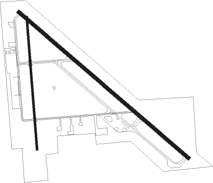
Runway info
Runway 12 / 30  | ||
| length | 1925m (6316ft) | |
| bearing | 125° / 305° | |
| width | 30m (100ft) | |
| surface | asphalt | |
| displ threshold | 235m (771ft) / 0m (0ft) | |
| Runway 16 / 34 | ||
| length | 1141m (3743ft) | |
| bearing | 180° / 0° | |
| width | 18m (60ft) | |
| surface | asphalt | |
| displ threshold | 88m (289ft) / 0m (0ft) | |
| blast zone | 60m (197ft) / 250m (820ft) | |
Nearby beacons
| code | identifier | dist | bearing | frequency |
|---|---|---|---|---|
| LGD | LA GRANDE NDB | 3.6 | 40° | 296 |
| BKE | BAKER CITY VOR/DME | 28.2 | 156° | 115.30 |
| PDT | PENDLETON VORTAC | 46.2 | 294° | 114.70 |
| ALW | WALLA WALLA VOR/DME | 49.3 | 340° | 116.40 |
| AL | TRINA (WALLA WALLA) NDB | 53.7 | 348° | 353 |
Instrument approach procedures
| runway | airway (heading) | route (dist, bearing) |
|---|---|---|
| RW17 | ATOKE (222°) | ATOKE USOWE (26mi, 246°) 7100ft |
| RW17 | TOLGA (161°) | TOLGA ZALKU (10mi, 139°) 7100ft USOWE (7mi, 139°) 7100ft |
| RNAV | USOWE 7100ft EGHEB (4mi, 184°) 6400ft CEPIP (7mi, 184°) 5200ft LIPMY (2mi, 184°) 5100ft KLGD (8mi, 178°) 2749ft (6564mi, 111°) 4600ft NUDEQ (6564mi, 291°) 9000ft NUDEQ (turn) 9000ft |
Disclaimer
The information on this website is not for real aviation. Use this data with the X-Plane flight simulator only! Data taken with kind consent from X-Plane 12 source code and data files. Content is subject to change without notice.