Fort Stewart(hinesville) - Wright Army Airfield
Airport details
| Country | United States of America |
| State | Georgia |
| Region | K7 |
| Airspace | Jacksonville Ctr |
| Municipality | Liberty County |
| Elevation | 42ft (13m) |
| Timezone | GMT -5 |
| Coordinates | 31.88831, -81.56162 |
| Magnetic var | |
| Type | land |
| Available since | X-Plane v10.40 |
| ICAO code | KLHW |
| IATA code | LIY |
| FAA code | LHW |
Communication
| Wright Army Airfield ATIS | 118.475 |
| Wright Army Airfield CTAF | 126.250 |
| Wright Army Airfield Ground Control | 121.700 |
| Wright Army Airfield Tower | 126.250 |
| Wright Army Airfield SAVANNAH Approach | 120.400 |
| Wright Army Airfield SAVANNAH Departure | 120.400 |
Nearby Points of Interest:
Bacon-Fraser House
-Liberty County Courthouse
-Liberty County Jail
-Midway Historic District
-Long County Courthouse
-Bryan County Courthouse
-Glen Echo
-Fort Morris Historic Site
-Strathy Hall
-Wild Heron
-Kilkenny
-Lebanon Plantation
-Fort McAllister Historic Park
-Savannah–Ogeechee Canal
-Wayne County Courthouse
-John W. C. Trowell House
-Leonard Carter House
-Dr. James W. Daniel House
-Evans County Courthouse
-Bethesda Academy
-Fort Barrington
-Carver Village Historic District
-George W. DeLoach House
-Wormsloe Historic Site
-St. Catherines Island
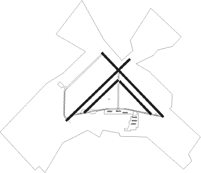
Runway info
Runway 6L / 24R  | ||
| length | 1523m (4997ft) | |
| bearing | 55° / 235° | |
| width | 30m (100ft) | |
| surface | asphalt | |
| blast zone | 255m (837ft) / 0m (0ft) | |
| Runway 15L / 33R | ||
| length | 1525m (5003ft) | |
| bearing | 136° / 316° | |
| width | 30m (100ft) | |
| surface | asphalt | |
| Runway 6R / 24L | ||
| length | 796m (2612ft) | |
| bearing | 55° / 235° | |
| width | 30m (100ft) | |
| surface | asphalt | |
| blast zone | 0m (0ft) / 30m (98ft) | |
| Runway 15R / 33L | ||
| length | 769m (2523ft) | |
| bearing | 136° / 316° | |
| width | 30m (100ft) | |
| surface | asphalt | |
| blast zone | 33m (108ft) / 30m (98ft) | |
Nearby beacons
| code | identifier | dist | bearing | frequency |
|---|---|---|---|---|
| MOQ | MC INTOSH (HINESVILLE) NDB | 4.3 | 138° | 263 |
| SVN | HUNTER (SAVANNAH) VOR/DME | 22.6 | 74° | 111.60 |
| SAV | SAVANNAH VORTAC | 24 | 55° | 115.95 |
| SV | WASSA (SAVANNAH) NDB | 30.1 | 79° | 335 |
| BZ | BULLO (STATESBORO) NDB | 32 | 349° | 407 |
| UQN | ONYUN (VIDALIA) NDB | 42.5 | 295° | 372 |
| BHC | BAXLEY NDB | 43.5 | 258° | 376 |
| JYL | SYLVANIA NDB | 45.7 | 358° | 245 |
| SSI | BRUNSWICK (ST SIMONS I) VORTAC | 50.6 | 172° | 109.80 |
| AMG | ALMA VORTAC | 52.7 | 250° | 115.10 |
| AY | WIKET (WAYCROSS) NDB | 54.5 | 236° | 219 |
| NBC | BEAUFORT TACAN | 55.6 | 55° | 110.50 |
| AYS | WAYCROSS VORTAC | 63 | 238° | 110.20 |
| EEX | EMANUEL COUNTY (SWAINSBORO) NDB | 65 | 311° | 309 |
Instrument approach procedures
| runway | airway (heading) | route (dist, bearing) |
|---|---|---|
| RW06L | BARWU (55°) | BARWU 3000ft |
| RNAV | BARWU 3000ft AGOMY (9mi, 55°) 1700ft KLHW (6mi, 56°) 91ft (4975mi, 111°) 446ft BARWU (4986mi, 291°) 3000ft BARWU (turn) | |
| RW33R | HARPS (303°) | HARPS RICBO (9mi, 288°) 2000ft |
| RNAV | RICBO 2000ft BAARD (6mi, 316°) 1600ft TYNES (3mi, 316°) 560ft KLHW (2mi, 312°) 84ft (4975mi, 111°) 500ft HARPS (4959mi, 291°) 4000ft HARPS (turn) |
Disclaimer
The information on this website is not for real aviation. Use this data with the X-Plane flight simulator only! Data taken with kind consent from X-Plane 12 source code and data files. Content is subject to change without notice.