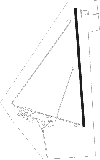
Lakeview - Lake Co
Airport details
| Country | United States of America |
| State | Oregon |
| Region | K1 |
| Airspace | Seattle Ctr |
| Municipality | Lake County |
| Elevation | 4730ft (1442m) |
| Timezone | GMT -8 |
| Coordinates | 42.16111, -120.39909 |
| Magnetic var | |
| Type | land |
| Available since | X-Plane v10.40 |
| ICAO code | KLKV |
| IATA code | LKV |
| FAA code | LKV |
Communication
| Lake Co AWOS 3 | 135.525 |
| Lake Co CTAF/UNICOM | 122.800 |
Nearby Points of Interest:
Nevada–California–Oregon Railway Passenger Station
-Lake County Round Sale Barn
-John N. and Cornelia Watson House
-William P. Heryford House
-Heryford Brothers Building
-Bailey and Massingill Store
-Post and King Saloon
-Fandango Pass
-Greaser Petroglyph Site
-Stone Bridge and the Oregon Central Military Wagon Road
Runway info
| Runway 17 / 35 | ||
| length | 1623m (5325ft) | |
| bearing | 180° / 0° | |
| width | 30m (100ft) | |
| surface | asphalt | |
Nearby beacons
| code | identifier | dist | bearing | frequency |
|---|---|---|---|---|
| LKV | LAKEVIEW VORTAC | 20.4 | 342° | 112 |
Instrument approach procedures
| runway | airway (heading) | route (dist, bearing) |
|---|---|---|
| RW17 | CHOIR (344°) | CHOIR FASAB (53mi, 349°) 10500ft FASAB (turn) 9000ft |
| RW17 | LKV (162°) | LKV FASAB (7mi, 130°) 9000ft |
| RNAV | FASAB 9000ft ZIKEX (5mi, 180°) 7700ft YOCKU (2mi, 180°) 7000ft BEPVE (4mi, 180°) 5620ft KLKV (3mi, 180°) 4779ft (6728mi, 109°) 4984ft EYIGO (6730mi, 289°) CHOIR (33mi, 162°) 11000ft CHOIR (turn) | |
| RW35 | CHOIR (344°) | CHOIR NUSME (23mi, 342°) 9800ft |
| RW35 | LKV (162°) | LKV NUSME (37mi, 165°) 9800ft NUSME (turn) 9800ft |
| RNAV | NUSME 9800ft WIPUL (7mi, 341°) 7500ft EYIGO (3mi, 341°) 6500ft SABPO (4mi, 0°) 5160ft KLKV (2mi, 0°) 4770ft (6728mi, 109°) 5200ft NUSME (6732mi, 289°) CHOIR (23mi, 162°) 11000ft CHOIR (turn) |
Disclaimer
The information on this website is not for real aviation. Use this data with the X-Plane flight simulator only! Data taken with kind consent from X-Plane 12 source code and data files. Content is subject to change without notice.
