Levelland - Levelland Muni
Airport details
| Country | United States of America |
| State | Texas |
| Region | K4 |
| Airspace | Ft Worth Ctr |
| Municipality | Levelland |
| Elevation | 3514ft (1071m) |
| Timezone | GMT -6 |
| Coordinates | 33.55253, -102.37253 |
| Magnetic var | |
| Type | land |
| Available since | X-Plane v10.40 |
| ICAO code | KLLN |
| IATA code | n/a |
| FAA code | LLN |
Communication
| Levelland Muni CTAF/UNICOM | 122.800 |
| Levelland Muni LUBBOCK Approach/Departure | 119.900 |
Nearby Points of Interest:
Tubbs-Carlisle House
-William Curry and Olive Price Holden House
-Texas Technological College Dairy Barn
-Texas Technological College Historic District
-Warren and Myrta Bacon House
-Carlock Building
-Lubbock Post Office and Federal Building
-Kress Building (Lubbock, Texas)
-Muleshoe National Wildlife Refuge
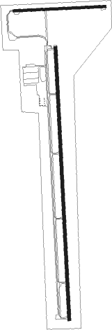
Runway info
Runway 17 / 35  | ||
| length | 1867m (6125ft) | |
| bearing | 182° / 2° | |
| width | 23m (75ft) | |
| surface | asphalt | |
| Runway 8 / 26 | ||
| length | 630m (2067ft) | |
| bearing | 91° / 271° | |
| width | 17m (55ft) | |
| surface | asphalt | |
Nearby beacons
| code | identifier | dist | bearing | frequency |
|---|---|---|---|---|
| LBB | LUBBOCK VORTAC | 24.6 | 72° | 109.20 |
| LD | LUBBI (LUBBOCK) NDB | 33.1 | 80° | 272 |
| PVW | PLAINVIEW VOR/DME | 43.2 | 47° | 112.90 |
| TXO | TEXICO VORTAC | 61.1 | 334° | 112.20 |
| CV | HISAN (CLOVIS) NDB | 62.3 | 315° | 335 |
| CVS | CANNON (CLOVIS) TACAN | 68.6 | 311° | 111.60 |
| HOB | HOBBS VORTAC | 71 | 224° | 111 |
Instrument approach procedures
| runway | airway (heading) | route (dist, bearing) |
|---|---|---|
| RW17 | LBB (252°) | LBB VITVY (17mi, 285°) 5500ft SOMKE (6mi, 254°) 5500ft |
| RW17 | SOMKE (182°) | SOMKE 10000ft SOMKE (turn) 5500ft |
| RW17 | WINNS (95°) | WINNS JATMI (20mi, 56°) 5500ft SOMKE (7mi, 108°) 5500ft |
| RNAV | SOMKE 5500ft RAWNI (7mi, 182°) 5200ft KLLN (6mi, 182°) 3552ft (6023mi, 108°) 3856ft HEGTA (6025mi, 288°) 5500ft HEGTA (turn) | |
| RW35 | HEGTA (2°) | HEGTA 10000ft HEGTA (turn) 5500ft |
| RNAV | HEGTA 5500ft ADORY (7mi, 2°) 5200ft FEVOL (3mi, 2°) 4300ft KLLN (3mi, 2°) 3549ft (6023mi, 108°) 3862ft SOMKE (6021mi, 288°) 5500ft SOMKE (turn) |
Disclaimer
The information on this website is not for real aviation. Use this data with the X-Plane flight simulator only! Data taken with kind consent from X-Plane 12 source code and data files. Content is subject to change without notice.