Lincoln
Airport details
| Country | United States of America |
| State | Nebraska |
| Region | K3 |
| Airspace | Minneapolis Ctr |
| Municipality | Lincoln |
| Elevation | 1219ft (372m) |
| Timezone | GMT -6 |
| Coordinates | 40.85089, -96.75911 |
| Magnetic var | |
| Type | land |
| Available since | X-Plane v10.40 |
| ICAO code | KLNK |
| IATA code | LNK |
| FAA code | LNK |
Communication
| Lincoln ATIS | 118.050 |
| Lincoln CTAF | 118.500 |
| Lincoln UNICOM | 122.950 |
| Lincoln CLEARANCE DELIVERY | 120.700 |
| Lincoln GROUND | 121.900 |
| Lincoln TOWER | 118.500 |
| Lincoln TOWER | 125.700 |
| Lincoln OMAHA ApproachROACH | 124.000 |
| Lincoln OMAHA DepartureARTURE | 124.800 |
Approach frequencies
| ILS-cat-I | RW36 | 109.9 | 18.00mi |
| ILS-cat-I | RW18 | 111.1 | 18.00mi |
| 3° GS | RW36 | 109.9 | 18.00mi |
| 3° GS | RW18 | 111.1 | 18.00mi |
Nearby Points of Interest:
City Hall
-Terminal Building
-First National Bank Building
-Lincoln Liberty Life Insurance Building
-Lewis-Syford House
-Stuart Building
-South Bottoms Historic District
-Federal Trust Building
-Jasper Newton Bell House
-Scottish Rite Temple
-Masonic Temple
-Rock Island Depot
-Nebraska Governor's Mansion
-William H. Ferguson House
-Thomas P. Kennard House
-Aeneas Yates-Charles Hurlbut House
-Burckhardt House
-Edgar A. Burnett House
-William L. and Sydney V. Murphy House
-R.O. Phillips House
-Antelope Grocery
-R.O. Stake House
-James D. Calhoun House
-Frank E. and Emma A. Gillen House
-John H. and Christina Yost House
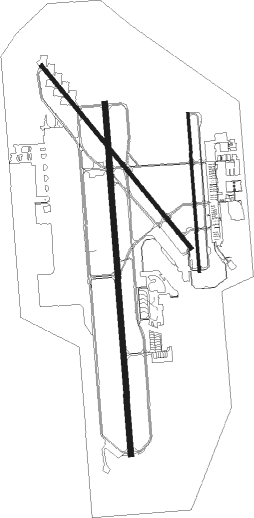
Runway info
Runway 18 / 36  | ||
| length | 3938m (12920ft) | |
| bearing | 180° / 0° | |
| width | 61m (200ft) | |
| surface | concrete | |
| Runway 14 / 32 | ||
| length | 2637m (8652ft) | |
| bearing | 137° / 317° | |
| width | 46m (150ft) | |
| surface | asphalt | |
| displ threshold | 110m (361ft) / 143m (469ft) | |
| Runway 17 / 35 | ||
| length | 1771m (5810ft) | |
| bearing | 180° / 0° | |
| width | 30m (100ft) | |
| surface | asphalt | |
Nearby beacons
| code | identifier | dist | bearing | frequency |
|---|---|---|---|---|
| LNK | LINCOLN VORTAC | 4.4 | 13° | 116.10 |
| LN | POTTS (LINCOLN) NDB | 6.2 | 182° | 385 |
| AHQ | WAHOO NDB | 24.4 | 22° | 400 |
| BIE | BEATRICE VOR | 32.9 | 180° | 110.60 |
| PMV | PLATTSMOUTH NDB | 38.8 | 84° | 329 |
| JYR | YORK NDB | 39 | 273° | 257 |
| FMZ | BEKLOF (FAIRMONT) NDB | 40 | 252° | 392 |
| OFF | OFFUTT (OMAHA) TACAN | 42.1 | 73° | 111.70 |
| AFK | NEBRASKA CITY NDB | 43.4 | 105° | 347 |
| FBY | FAIRBURY NDB | 44.5 | 211° | 293 |
| OLU | COLUMBUS VOR/DME | 44.5 | 316° | 111.80 |
| SCB | SCRIBNER VOR/DME | 45.6 | 10° | 111 |
| PWE | PAWNEE CITY VORTAC | 46.5 | 140° | 112.40 |
| PLT | PLATTE CENTER (COLUMBUS) NDB | 47.9 | 316° | 407 |
Instrument approach procedures
| runway | airway (heading) | route (dist, bearing) |
|---|---|---|
| RW14 | ZUBTO (138°) | ZUBTO 3200ft |
| RNAV | ZUBTO 3200ft OPIZU (7mi, 137°) 3000ft HAGTI (3mi, 137°) 1960ft KLNK (3mi, 140°) 1247ft (5712mi, 113°) 1449ft OWSEW (5705mi, 293°) 3100ft OWSEW (turn) | |
| RW17 | DWELL (145°) | DWELL HIREK (8mi, 102°) 3800ft |
| RW17 | HIREK (183°) | HIREK 3800ft |
| RW17 | YUTAN (221°) | YUTAN HIREK (11mi, 254°) 3800ft |
| RNAV | HIREK 3800ft ZAKRI (6mi, 180°) 3000ft WUVTI (3mi, 180°) 1920ft KLNK (3mi, 191°) 1263ft (5712mi, 113°) 1419ft HIVUV (5713mi, 293°) 3300ft HIVUV (turn) | |
| RW18 | AYARE (180°) | AYARE 3800ft |
| RW18 | CUSUP (151°) | CUSUP AYARE (5mi, 90°) 3800ft |
| RW18 | SEVOY (209°) | SEVOY AYARE (5mi, 270°) 3800ft |
| RNAV | AYARE 3800ft FIMUK (6mi, 180°) 2900ft MAXOE (3mi, 180°) 2000ft KLNK (3mi, 177°) 1250ft (5712mi, 113°) 1445ft GONBE (5713mi, 293°) 3700ft GONBE (turn) | |
| RW32 | OWSEW (317°) | OWSEW 3100ft |
| RNAV | OWSEW 3100ft YAPUL (7mi, 317°) 3000ft ZULNO (3mi, 317°) 2020ft KLNK (3mi, 314°) 1229ft (5712mi, 113°) 1442ft ZUBTO (5719mi, 293°) 3200ft ZUBTO (turn) | |
| RW35 | HIVUV (358°) | HIVUV 3300ft |
| RW35 | PANNY (308°) | PANNY HIVUV (12mi, 270°) 3300ft |
| RW35 | VACUS (26°) | VACUS HIVUV (13mi, 51°) 3300ft |
| RNAV | HIVUV 3300ft SAICE (7mi, 0°) 3000ft UKOGE (4mi, 0°) 1880ft KLNK (2mi, 349°) 1218ft (5712mi, 113°) 1446ft HIREK (5711mi, 293°) 3800ft HIREK (turn) | |
| RW36 | GONBE (1°) | GONBE 3700ft |
| RW36 | HEGLU (29°) | HEGLU GONBE (5mi, 90°) 3700ft |
| RW36 | JESUR (333°) | JESUR GONBE (5mi, 270°) 3700ft |
| RNAV | GONBE 3700ft JUDAD (6mi, 0°) 2800ft KLNK (6mi, 2°) 1231ft (5712mi, 113°) 1493ft AYARE (5711mi, 293°) 3800ft AYARE (turn) |
Disclaimer
The information on this website is not for real aviation. Use this data with the X-Plane flight simulator only! Data taken with kind consent from X-Plane 12 source code and data files. Content is subject to change without notice.