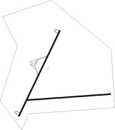
Lovelock - Derby Fld
Airport details
| Country | United States of America |
| State | Nevada |
| Region | K2 |
| Airspace | Oakland Ctr |
| Municipality | Pershing County |
| Elevation | 3902ft (1189m) |
| Timezone | GMT -8 |
| Coordinates | 40.06647, -118.56509 |
| Magnetic var | |
| Type | land |
| Available since | X-Plane v10.40 |
| ICAO code | KLOL |
| IATA code | LOL |
| FAA code | LOL |
Communication
| Derby Fld ASOS | 120.675 |
| Derby Fld CTAF/UNICOM | 122.800 |
Nearby Points of Interest:
Pershing County Courthouse
-Lovelock Cave
-Central Pacific Railroad Depot
Nearby beacons
| code | identifier | dist | bearing | frequency |
|---|---|---|---|---|
| LLC | LOVELOCK VORTAC | 3.5 | 348° | 116.50 |
| HZN | HAZEN VORTAC | 38.5 | 218° | 114.10 |
| NFL | FALLON TACAN | 39.5 | 192° | 113.50 |
| INA | WINNEMUCCA VOR/DME | 60.6 | 42° | 108.20 |
Instrument approach procedures
| runway | airway (heading) | route (dist, bearing) |
|---|---|---|
| RW02 | HOTIC (42°) | HOTIC URCIV (8mi, 21°) 7000ft |
| RW02 | WADDS (65°) | WADDS HIXUP (26mi, 61°) 9500ft URCIV (6mi, 107°) 7000ft |
| RNAV | URCIV 7000ft MAZBE (4mi, 66°) 6300ft XOPIW (6mi, 47°) 4460ft LOLXU (1mi, 47°) 4027ft (6695mi, 109°) 4160ft ZISNO (6687mi, 289°) WIMEG (19mi, 9°) ROBUD (17mi, 294°) 10000ft ROBUD (turn) | |
| RW20 | FESKO (244°) | FESKO PEVIC (34mi, 263°) 11300ft JUDMI (7mi, 190°) 8700ft |
| RW20 | LLC (168°) | LLC JUDMI (13mi, 47°) 8700ft JUDMI (turn) 8700ft |
| RNAV | JUDMI 8700ft ZENUM (10mi, 218°) 5700ft XOQAT (3mi, 217°) 4800ft KLOL (3mi, 214°) 3952ft (6694mi, 109°) 4158ft HOTIC (6709mi, 289°) WADDS (25mi, 260°) 10000ft WADDS (turn) |
Disclaimer
The information on this website is not for real aviation. Use this data with the X-Plane flight simulator only! Data taken with kind consent from X-Plane 12 source code and data files. Content is subject to change without notice.

