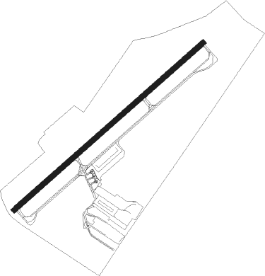
Philadelphia - Wings Field
Airport details
| Country | United States of America |
| State | Pennsylvania |
| Region | K6 |
| Airspace | New York Ctr |
| Municipality | Whitpain Township |
| Elevation | 296ft (90m) |
| Timezone | GMT -5 |
| Coordinates | 40.13755, -75.26514 |
| Magnetic var | |
| Type | land |
| Available since | X-Plane v10.40 |
| ICAO code | KLOM |
| IATA code | BBX |
| FAA code | LOM |
Communication
| Wings Field WX AWOS-3 | 118.925 |
| Wings Field CTAF/UNICOM | 123.000 |
| Wings Field PHILADELPHIA Approach | 126.850 |
| Wings Field PHILADELPHIA Departure | 126.850 |
Nearby Points of Interest:
Whitpain Public School
-Dawesfield
-Alan West Corson Homestead
-Cold Point Historic District
-Plymouth Meeting Historic District
-Hovenden House, Barn and Abolition Hall
-Union School
-County Bridge No. 54
-Farmar Mill
-Hope Lodge
-Carson College for Orphan Girls
-Keefe-Mumbower Mill
-David Rittenhouse Junior High School
-Springfield Mill
-Globe Knitting Mills
-Jacob Kastner Loghouse
-Quaker Manor House
-Central Norristown Historic District
-Gen. Thomas J. Stewart Memorial Armory
-Yeakle and Miller Houses
-Miller's House at Spring Mill
-Lee Tire and Rubber Company
-Gwynedd Hall
-West Norristown Historic District
-John Welsh House
Nearby beacons
| code | identifier | dist | bearing | frequency |
|---|---|---|---|---|
| ING | AMBLER NDB | 1.1 | 240° | 275 |
| PTW | POTTSTOWN VORTAC | 14.4 | 286° | 116.50 |
| ARD | YARDLEY VOR/DME | 17.8 | 72° | 108.20 |
| MXE | MODENA VORTAC | 22.8 | 242° | 113.20 |
| OOD | WOODSTOWN VORTAC | 30.1 | 184° | 112.80 |
| GXU | MC GUIRE (WRIGHTSTOWN) VORTAC | 31.6 | 101° | 110.60 |
| DQO | DUPONT (WILMINGTON) VORTAC | 31.7 | 217° | 114 |
| ETX | EAST TEXAS VOR/DME | 32.8 | 317° | 110.20 |
| RBV | ROBBINSVILLE VORTAC | 35.5 | 85° | 113.80 |
| SBJ | SOLBERG VOR/DME | 35.9 | 50° | 112.90 |
| FJC | ALLENTOWN VORTAC | 36.4 | 342° | 117.50 |
| IL | HADIN (WILMINGTON) NDB | 37 | 212° | 248 |
| VCN | CEDAR LAKE (MILLVILLE) VOR/DME | 38.5 | 154° | 115.20 |
| NEL | LAKEHURST TACAN | 42.3 | 96° | 111.80 |
| CYN | COYLE VORTAC | 42.9 | 111° | 113.40 |
| NEL | LAKEHURST NDB | 43 | 96° | 396 |
| RNB | RAINBOW (MILLVILLE) NDB | 43.6 | 170° | 363 |
| BWZ | BROADWAY (SCHOOLEY'S MT) VOR/DME | 44.5 | 34° | 114.20 |
| ACY | ATLANTIC CITY VORTAC | 51.8 | 135° | 108.60 |
| CAT | CHATHAM NDB | 52.6 | 54° | 254 |
| STW | STILLWATER VOR/DME | 54.6 | 25° | 109.60 |
| ENO | SMYRNA (KENTON) VORTAC | 55.6 | 195° | 111.40 |
| MM | MOREE (MORRISTOWN) NDB | 61.5 | 51° | 392 |
| SAX | SPARTA VORTAC | 64.9 | 38° | 115.70 |
Instrument approach procedures
| runway | airway (heading) | route (dist, bearing) |
|---|---|---|
| RW06 | MXE (62°) | MXE PHILA (11mi, 63°) 2200ft |
| RW06 | PHILA (60°) | PHILA 2200ft |
| RW06 | PTW (106°) | PTW LASBE (10mi, 172°) 2200ft PHILA (4mi, 116°) 2200ft |
| RNAV | PHILA 2200ft PLAYS (6mi, 60°) 2000ft KLOM (5mi, 60°) 363ft HOMWE (11mi, 60°) 2000ft HOMWE (turn) | |
| RW24 | ARD (252°) | ARD HOMWE (7mi, 269°) 2000ft |
| RW24 | HOMWE (240°) | HOMWE 2000ft |
| RW24 | MAZIE (220°) | MAZIE HOMWE (5mi, 151°) 2000ft |
| RNAV | HOMWE 2000ft YUWSO (6mi, 240°) 1900ft JEKEP (3mi, 240°) 880ft KLOM (2mi, 240°) 338ft PHILA (11mi, 240°) 2200ft PHILA (turn) |
Disclaimer
The information on this website is not for real aviation. Use this data with the X-Plane flight simulator only! Data taken with kind consent from X-Plane 12 source code and data files. Content is subject to change without notice.