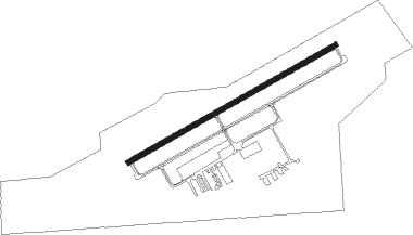
Lorain/elyria - Lorain Co Rgnl
Airport details
| Country | United States of America |
| State | Ohio |
| Region | K5 |
| Airspace | Cleveland Ctr |
| Municipality | New Russia Township |
| Elevation | 791ft (241m) |
| Timezone | GMT -5 |
| Coordinates | 41.34428, -82.17764 |
| Magnetic var | |
| Type | land |
| Available since | X-Plane v10.40 |
| ICAO code | KLPR |
| IATA code | LPR |
| FAA code | LPR |
Communication
| Lorain Co Rgnl ASOS | 121.425 |
| Lorain Co Rgnl CTAF/UNICOM | 122.700 |
Approach frequencies
| ILS-cat-I | RW07 | 111.7 | 18.00mi |
| 3° GS | RW07 | 111.7 | 18.00mi |
Nearby Points of Interest:
Old St. John's Church
-Elyria Elks Club
-John Mercer Langston House
-Wilson Bruce Evans House
-Amherst Town Hall
-Oberlin Lake Shore and Michigan Southern Station
-Reamer Barn
-Eagles Building
-Lorain Fire Station No. 1
-Dean Road Bridge
-Franks Site
-Carlos Avery House
-Wilbur Cahoon House
-Avon Isle
-First Baptist Church
-Masonic Temple Building
-Mosher House
-First Universalist Church of Olmsted
-John and Maria Adams House
-Aaron Aldrich House
-Darlon Allen House
-Rocket Engine Test Facility
-United Church of Huntington
-Huntington Grange
-Zero Gravity Research Facility
Nearby beacons
| code | identifier | dist | bearing | frequency |
|---|---|---|---|---|
| DJB | DRYER VOR/DME | 1 | 49° | 113.60 |
| BF | TABEY (CLEVELAND) NDB | 30.3 | 70° | 248 |
| PCW | PORT CLINTON NDB | 32.8 | 284° | 423 |
| MFD | MANSFIELD VORTAC | 34.1 | 221° | 108.80 |
| MF | MANNS (MANSFIELD) NDB | 36.7 | 205° | 372 |
| AK | AKRON NDB | 39.3 | 109° | 362 |
| LQL | LAKELAND (WILLOUGHBY) NDB | 41.2 | 67° | 263 |
| ACO | AKRON VOR/DME | 46.3 | 104° | 114.40 |
| BSV | BRIGGS VOR/DME | 49.5 | 129° | 112.40 |
| BUD | BUCKEYE (MARION) VOR | 59.3 | 231° | 109.80 |
| RYS | GROSSE ILE (DETROIT) NDB | 63 | 308° | 419 |
| QG | WINDSOR NDB | 65.8 | 324° | 353 |
Departure and arrival routes
| Transition altitude | 18000ft |
| Transition level | 18000ft |
| SID end points | distance | outbound heading | |
|---|---|---|---|
| RW07 | |||
| MYCAR4 | 71mi | 67° | |
| AHMET4 | 100mi | 134° | |
| CAVVS4 | 74mi | 199° | |
| ZAAPA5 | 198mi | 249° | |
| GTLKE4 | 159mi | 271° | |
| RW25 | |||
| MYCAR4 | 71mi | 67° | |
| AHMET4 | 100mi | 134° | |
| CAVVS4 | 74mi | 199° | |
| ZAAPA5 | 198mi | 249° | |
| GTLKE4 | 159mi | 271° | |
| STAR starting points | distance | inbound heading | |
|---|---|---|---|
| ALL | |||
| ROKNN3 | 28.8 | 38° | |
| BRWNZ4 | 30.5 | 176° | |
| ROLLN2 | 33.9 | 317° | |
Instrument approach procedures
| runway | airway (heading) | route (dist, bearing) |
|---|---|---|
| RW07 | HUDDZ (84°) | HUDDZ CUNER (6mi, 114°) 3000ft |
| RW07 | NEWLO (41°) | NEWLO CUNER (10mi, 357°) 3000ft |
| RNAV | CUNER 3000ft HAVIN (6mi, 71°) 2400ft KLPR (5mi, 71°) 847ft (5053mi, 117°) 993ft WELAL (5051mi, 297°) OTOCE (12mi, 22°) 3000ft OTOCE (turn) |
Holding patterns
| STAR name | hold at | type | turn | heading* | altitude | leg | speed limit |
|---|---|---|---|---|---|---|---|
| BRWNZ4 | BRWNZ | VHF | left | 293 (113)° | DME 10.0mi | ICAO rules | |
| BRWNZ4 | DETMR | VHF | left | 282 (102)° | DME 10.0mi | ICAO rules | |
| BRWNZ4 | FRYYE | VHF | left | 284 (104)° | DME 10.0mi | ICAO rules | |
| ROKNN3 | ROKNN | VHF | right | 232 (52)° | DME 10.0mi | ICAO rules | |
| ROLLN2 | ROLLN | VHF | right | 198 (18)° | DME 10.0mi | ICAO rules | |
| *) magnetic outbound (inbound) holding course | |||||||
Disclaimer
The information on this website is not for real aviation. Use this data with the X-Plane flight simulator only! Data taken with kind consent from X-Plane 12 source code and data files. Content is subject to change without notice.