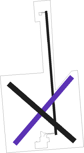
Larned - Larned-pawnee Co
Airport details
| Country | United States of America |
| State | Kansas |
| Region | K3 |
| Airspace | Kansas City Ctr |
| Municipality | Pawnee County |
| Elevation | 2011ft (613m) |
| Timezone | GMT -5 |
| Coordinates | 38.20858, -99.08598 |
| Magnetic var | |
| Type | land |
| Available since | X-Plane v10.40 |
| ICAO code | KLQR |
| IATA code | n/a |
| FAA code | LQR |
Communication
| Larned-Pawnee Co AWOS | 119.875 |
| Larned-Pawnee Co CTAF/UNICOM | 122.800 |
| Larned-Pawnee Co KC CNTR APR | 124.400 |
| Larned-Pawnee Co KC CNTR Departure | 124.400 |
Nearby Points of Interest:
Nagel House
-Rush County Courthouse
-Cheyenne Bottoms
-Stafford Reformed Presbyterian Church
-Stafford First United Methodist Church
Nearby beacons
| code | identifier | dist | bearing | frequency |
|---|---|---|---|---|
| GB | BABSY NDB | 11.1 | 79° | 419 |
| HY | NETTE (HAYS) NDB | 34.5 | 344° | 374 |
| HYS | HAYS VORTAC | 39.4 | 343° | 110.40 |
| DDC | DODGE CITY VORTAC | 48.5 | 249° | 108.20 |
Instrument approach procedures
| runway | airway (heading) | route (dist, bearing) |
|---|---|---|
| RW17 | DISKS (235°) | DISKS CULMI (11mi, 287°) 4500ft CULMI (turn) 4500ft |
| RW17 | HYS (163°) | HYS CULMI (27mi, 156°) 4500ft |
| RNAV | CULMI 4500ft JIXIT (7mi, 180°) 3800ft HUTAM (4mi, 180°) 2620ft KLQR (2mi, 181°) 2051ft (5833mi, 111°) 2320ft CUKTO (5835mi, 291°) 4300ft CUKTO (turn) | |
| RW35 | CUKTO (360°) | CUKTO 4300ft |
| RNAV | CUKTO 4300ft WENIL (12mi, 360°) 3800ft OTEGE (4mi, 360°) 2580ft KLQR (2mi, 358°) 2048ft (5833mi, 111°) 2259ft CULMI (5832mi, 291°) 4500ft CULMI (turn) |
Disclaimer
The information on this website is not for real aviation. Use this data with the X-Plane flight simulator only! Data taken with kind consent from X-Plane 12 source code and data files. Content is subject to change without notice.

