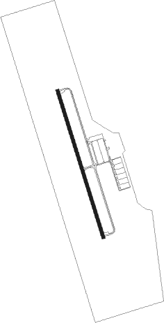
Mount Pleasant - Mt Pleasant Regl Faison
Airport details
| Country | United States of America |
| State | South Carolina |
| Region | K7 |
| Airspace | Jacksonville Ctr |
| Municipality | Mount Pleasant |
| Elevation | 11ft (3m) |
| Timezone | GMT -5 |
| Coordinates | 32.89783, -79.78286 |
| Magnetic var | |
| Type | land |
| Available since | X-Plane v10.40 |
| ICAO code | KLRO |
| IATA code | LRO |
| FAA code | LRO |
Communication
| Mt Pleasant Regl Faison AWOS-3 | 118.625 |
| Mt Pleasant Regl Faison CTAF/UNICOM | 122.700 |
| Mt Pleasant Regl Faison CHS Approach/Departure | 119.300 |
Nearby beacons
| code | identifier | dist | bearing | frequency |
|---|---|---|---|---|
| CHS | CHARLESTON VORTAC | 12.8 | 269° | 113.50 |
| CH | ASHLY (CHARLESTON) NDB | 16.5 | 284° | 329 |
| DYB | DORCHESTER COUNTY(SUMMERVILLE) NDB | 26.7 | 288° | 365 |
| PHH | ANDREWS NDB | 35.6 | 25° | 255 |
| MNI | MANNING NDB | 46.5 | 328° | 381 |
| VAN | VANCE VORTAC | 48.1 | 311° | 110.40 |
| NBC | BEAUFORT TACAN | 53.5 | 246° | 110.50 |
| CFY | EVANS (LAKE CITY) NDB | 57.5 | 1° | 420 |
| HYW | HORRY (CONWAY) NDB | 64.5 | 35° | 370 |
Instrument approach procedures
| runway | airway (heading) | route (dist, bearing) |
|---|---|---|
| RW17 | CUBBY (203°) | CUBBY JOGLI (9mi, 246°) 2000ft |
| RW17 | GINNE (140°) | GINNE JOGLI (8mi, 108°) 2000ft |
| RNAV | JOGLI 2000ft FESJY (6mi, 165°) 1600ft GIYEG (2mi, 165°) 800ft KLRO (3mi, 165°) 46ft (4891mi, 112°) 306ft UTACU (4887mi, 292°) 3000ft UTACU (turn) | |
| RW35 | CUBBY (203°) | CUBBY UTACU (26mi, 188°) 3100ft UTACU (turn) 3000ft |
| RW35 | GINNE (140°) | GINNE JOGLI (8mi, 108°) 3000ft UTACU (22mi, 165°) 3000ft UTACU (turn) 3000ft |
| RNAV | UTACU 3000ft EDNAH (6mi, 345°) 1500ft HEFKA (2mi, 345°) 840ft KLRO (3mi, 345°) 46ft (4891mi, 112°) 360ft JOGLI (4894mi, 293°) 3000ft JOGLI (turn) |
Disclaimer
The information on this website is not for real aviation. Use this data with the X-Plane flight simulator only! Data taken with kind consent from X-Plane 12 source code and data files. Content is subject to change without notice.
