Las Cruces - Las Cruces Intl
Airport details
| Country | United States of America |
| State | New Mexico |
| Region | K2 |
| Airspace | Albuquerque Ctr |
| Municipality | Las Cruces |
| Elevation | 4456ft (1358m) |
| Timezone | GMT -7 |
| Coordinates | 32.28942, -106.92197 |
| Magnetic var | |
| Type | land |
| Available since | X-Plane v10.40 |
| ICAO code | KLRU |
| IATA code | LRU |
| FAA code | LRU |
Communication
| Las Cruces Intl AWOS 3 | 119.025 |
| Las Cruces Intl CTAF/UNICOM | 122.700 |
Approach frequencies
| ILS-cat-I | RW30 | 109.3 | 18.00mi |
| 3° GS | RW30 | 109.3 | 18.00mi |
Nearby Points of Interest:
Mesilla Plaza
-Alameda-Depot Historic District
-Rio Grande Theatre
-Thomas Branigan Memorial Library
-Mesilla Park Historic District
-Mesilla Park Elementary School
-Dona Ana Village Historic District
-Hadley-Ludwick House
-Nason House
-Goddard Hall
-Foster Hall
-Rio Grande Bridge at Radium Springs
-Frank and Amelia Jones House
-White Sands V-2 Launching Site
-O. T. Bassett Tower
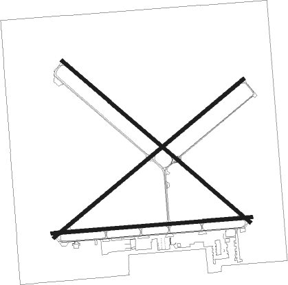
Runway info
Runway 12 / 30  | ||
| length | 2289m (7510ft) | |
| bearing | 130° / 310° | |
| width | 30m (100ft) | |
| surface | concrete | |
| blast zone | 59m (194ft) / 61m (200ft) | |
| Runway 8 / 26 | ||
| length | 1845m (6053ft) | |
| bearing | 90° / 270° | |
| width | 30m (100ft) | |
| surface | asphalt | |
| blast zone | 30m (98ft) / 30m (98ft) | |
| Runway 4 / 22 | ||
| length | 2282m (7487ft) | |
| bearing | 59° / 239° | |
| width | 32m (105ft) | |
| surface | asphalt | |
| blast zone | 34m (112ft) / 31m (102ft) | |
Nearby beacons
| code | identifier | dist | bearing | frequency |
|---|---|---|---|---|
| DMN | DEMING VORTAC | 34.7 | 269° | 108.60 |
| EWM | NEWMAN VORTAC | 38.7 | 117° | 112.40 |
| EL | VALTR (EL PASO) NDB | 40.1 | 125° | 242 |
| ELP | EL PASO VORTAC | 43.2 | 126° | 115.20 |
| CUS | COLUMBUS VOR/DME | 43.6 | 234° | 111.20 |
| CJS | JUAREZ (CIUDAD JUAREZ) VOR/DME | 46.6 | 143° | 116.70 |
| HMN | HOLLOMAN (ALAMOGORDO) TACAN | 53.6 | 55° | 114.50 |
| BWS | (ALAMOGORDO) DME | 56 | 60° | 109.60 |
| TCS | TRUTH OR CONSEQUENCES VORTAC | 62.3 | 340° | 112.70 |
Instrument approach procedures
| runway | airway (heading) | route (dist, bearing) |
|---|---|---|
| RW12 | AXARY (83°) | AXARY OXAME (12mi, 59°) 8100ft IPATE (9mi, 50°) 8100ft |
| RW12 | CAGEV (173°) | CAGEV IPATE (11mi, 230°) 8100ft |
| RW12 | COSES (327°) | COSES IPATE (27mi, 319°) 8100ft IPATE (turn) 8100ft |
| RNAV | IPATE 8100ft HUXEM (6mi, 130°) 6600ft WEKVO (4mi, 130°) 5180ft KLRU (3mi, 133°) 4512ft (6261mi, 107°) 5800ft IPATE (6268mi, 287°) 8100ft IPATE (turn) | |
| RW30 | MOLLY (319°) | MOLLY MENDZ (6mi, 338°) 7000ft |
| RNAV | MENDZ 7000ft JOSPO (5mi, 310°) 6400ft KLRU (7mi, 309°) 4483ft (6261mi, 107°) 4644ft IPATE (6268mi, 287°) 9000ft IPATE (turn) |
Disclaimer
The information on this website is not for real aviation. Use this data with the X-Plane flight simulator only! Data taken with kind consent from X-Plane 12 source code and data files. Content is subject to change without notice.