La Crosse - La Crosse Muni
Airport details
| Country | United States of America |
| State | Wisconsin |
| Region | K5 |
| Airspace | Minneapolis Ctr |
| Municipality | La Crosse |
| Elevation | 649ft (198m) |
| Timezone | GMT -6 |
| Coordinates | 43.87928, -91.25664 |
| Magnetic var | |
| Type | land |
| Available since | X-Plane v10.40 |
| ICAO code | KLSE |
| IATA code | LSE |
| FAA code | LSE |
Communication
| La Crosse Muni ATIS | 124.950 |
| La Crosse Muni CTAF | 118.450 |
| La Crosse Muni UNICOM | 122.950 |
| La Crosse Muni Ground Control | 121.800 |
| La Crosse Muni Tower | 118.450 |
| La Crosse Muni Approach/Dep Minneapolis ARTCC | 128.600 |
Approach frequencies
| ILS-cat-I | RW18 | 111.1 | 18.00mi |
| 3° GS | RW18 | 111.1 | 18.00mi |
Nearby Points of Interest:
Frank Eugene Nichols House
-Gideon C. Hixon House
-La Crosse Commercial Historic District
-Wittich Hall
-LaCrosse State Teachers College Training School Building
-23rd and 24th Streets Historic District
-Mons Anderson House
-St. Rose of Viterbo Convent
-Our Lady of Sorrows Chapel
-La Crosse Armory
-Palmer Brothers Octagons
-Hamlin Garland House
-Coman House
-Church of the Holy Comforter
-Pickwick Mill
-John F. Cance House
-Downtown Historic District
-Gale College
-Ridge Avenue Historic District
-Tollef Jensen House
-Houston County Courthouse and Jail
-Sugar Loaf Brewery
-Schech Mill
-Watkins Incorporated
-Watkins Manor House
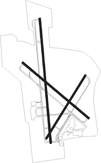
Runway info
Runway 4 / 22  | ||
| length | 1585m (5200ft) | |
| bearing | 46° / 226° | |
| width | 46m (150ft) | |
| surface | asphalt | |
| Runway 18 / 36 | ||
| length | 2667m (8750ft) | |
| bearing | 179° / 359° | |
| width | 46m (151ft) | |
| surface | concrete | |
| displ threshold | 0m (0ft) / 345m (1132ft) | |
| blast zone | 4m (13ft) / 0m (0ft) | |
| Runway 13 / 31 | ||
| length | 1842m (6043ft) | |
| bearing | 125° / 305° | |
| width | 46m (150ft) | |
| surface | asphalt | |
| displ threshold | 0m (0ft) / 223m (732ft) | |
Nearby beacons
| code | identifier | dist | bearing | frequency |
|---|---|---|---|---|
| LSE | CROSSE DME | 0.1 | 169° | 108.40 |
| LS | MINDI (LA CROSSE) NDB | 7.4 | 358° | 272 |
| ODI | NODINE VORTAC | 9.3 | 279° | 117.90 |
| CMY | MC COY NDB | 26.8 | 85° | 412 |
| UKN | DME | 38 | 205° | 116.60 |
| VOK | VOLK (CAMP DOUGLAS) TACAN | 43.3 | 86° | 110.40 |
Instrument approach procedures
| runway | airway (heading) | route (dist, bearing) |
|---|---|---|
| RW04 | FALAR (39°) | FALAR ZEGTU (9mi, 32°) 3000ft |
| RW04 | ZEGTU (44°) | ZEGTU 3000ft |
| RNAV | ZEGTU 3000ft PUCYI (6mi, 45°) 2500ft RORLE (2mi, 45°) 1700ft KLSE (4mi, 42°) 687ft (5460mi, 116°) 1056ft HEKOR (5452mi, 296°) 3000ft HEKOR (turn) | |
| RW13 | LAKRE (125°) | LAKRE 3000ft |
| RW13 | PEGGS (113°) | PEGGS LAKRE (10mi, 99°) 3000ft |
| RNAV | LAKRE 3000ft JAKVI (6mi, 125°) 2800ft KLSE (7mi, 125°) 701ft (5460mi, 116°) 958ft COSUT (5458mi, 296°) WEVBA (12mi, 112°) 3000ft WEVBA (turn) | |
| RW18 | CALMS (154°) | CALMS POGOC (15mi, 134°) 3500ft |
| RW18 | POGOC (179°) | POGOC 3500ft |
| RNAV | POGOC 3500ft CIVCA (4mi, 179°) 3000ft OCIPO (2mi, 179°) 2900ft CITID (4mi, 179°) 1620ft KLSE (4mi, 177°) 708ft (5460mi, 116°) 925ft PKRNA (5460mi, 296°) 3000ft PKRNA (turn) | |
| RW22 | HEKOR (227°) | HEKOR 3000ft |
| RW22 | SAUCY (228°) | SAUCY HEKOR (12mi, 229°) 3000ft |
| RNAV | HEKOR 3000ft PUPIC (6mi, 226°) 2500ft KLSE (6mi, 228°) 693ft (5460mi, 116°) 1056ft WEROK (5467mi, 296°) 3100ft WEROK (turn) | |
| RW31 | WEBYE (302°) | WEBYE WEVBA (9mi, 316°) 3000ft |
| RW31 | WEVBA (293°) | WEVBA 3000ft |
| RNAV | WEVBA 3000ft MUGDE (6mi, 292°) 2800ft WAKEP (6mi, 292°) 837ft (5459mi, 116°) 1056ft HISUN (5461mi, 296°) LAKRE (12mi, 308°) 3000ft LAKRE (turn) | |
| RW36 | PKRNA (360°) | PKRNA 3000ft |
| RNAV | PKRNA 3000ft CIVMI (8mi, 359°) 2500ft KLSE (6mi, 0°) 698ft (5460mi, 116°) 953ft POGOC (5460mi, 296°) 3500ft POGOC (turn) |
Disclaimer
The information on this website is not for real aviation. Use this data with the X-Plane flight simulator only! Data taken with kind consent from X-Plane 12 source code and data files. Content is subject to change without notice.