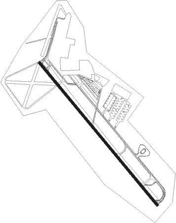
Fort Benning(columbus) - Lawson Aaf
Airport details
| Country | United States of America |
| State | Georgia |
| Region | K7 |
| Airspace | Atlanta Ctr |
| Municipality | Chattahoochee County |
| Elevation | 230ft (70m) |
| Timezone | GMT -5 |
| Coordinates | 32.33179, -84.98716 |
| Magnetic var | |
| Type | land |
| Available since | X-Plane v10.40 |
| ICAO code | KLSF |
| IATA code | LSF |
| FAA code | LSF |
Communication
| Lawson AAF ATIS | 134.375 |
| Lawson AAF Ground Control | 121.700 |
| Lawson AAF Tower | 119.050 |
| Lawson AAF ATLANTA Approach/Departure | 125.500 |
| Lawson AAF ATLANTA Approach/Departure | 126.550 |
Approach frequencies
| ILS-cat-I | RW33 | 110.7 | 18.00mi |
| 3° GS | RW33 | 110.7 | 18.00mi |
Nearby Points of Interest:
Yuchi Town Site
-Fort Mitchell Historic Site
-Riverside
-Octagon House
-Bass-Perry House
-Columbus Historic District
-Pemberton House
-Shapre-Monte House
-Brooks-Hughes House
-First African Baptist Church Parsonage
-Columbus Ironworks
-First National Bank
-United States Post Office and Courthouse
-Swift-Kyle House
-Dinglewood House
-Morgan-Curtis House
-City Fire Department
-Rankin House
-Mott House
-Bullard-Hart House
-Hilton
-Columbus Historic Riverfront Industrial District
-Floyd-Newsome House
-Secondary Industrial School
-St. Elmo
Nearby beacons
| code | identifier | dist | bearing | frequency |
|---|---|---|---|---|
| LSF | LAWSON (COLUMBUS) VOR/DME | 0.3 | 275° | 111.40 |
| AWS | LAWSON (COLUMBUS) NDB | 2.9 | 223° | 335 |
| CS | FENIX (COLUMBUS) NDB | 7.7 | 335° | 355 |
| CSG | COLUMBUS VORTAC | 17 | 354° | 117.10 |
| EUF | EUFAULA VORTAC | 24 | 201° | 109.20 |
| TGE | TUSKEGEE VOR/DME | 35.7 | 283° | 117.30 |
| ACJ | SOUTHER (AMERICUS) NDB | 42.7 | 105° | 242 |
| LGC | LA GRANGE VORTAC | 44.4 | 343° | 115.60 |
| LKG | LINDBERGH (AMERICUS) NDB | 45.6 | 100° | 242 |
| IZS | MONTEZUMA NDB | 49.7 | 88° | 426 |
| OP | YATES (THOMASTON) NDB | 53.6 | 54° | 339 |
| PZD | PECAN (ALBANY) VOR/DME | 53.8 | 134° | 116.10 |
| EQQ | COWETA COUNTY (NEWNAN) NDB | 57.2 | 16° | 234 |
| FFC | PECAT (ATLANTA) NDB | 63.4 | 27° | 316 |
| HEY | HANCHEY (FT RUCKER) VOR | 66.7 | 215° | 110.60 |
| HYE | HANCHEY (FT RUCKER) NDB | 66.7 | 215° | 221 |
| LOR | LOWE (FORT RUCKER) NDB | 69.8 | 218° | 269 |
Instrument approach procedures
| runway | airway (heading) | route (dist, bearing) |
|---|---|---|
| RW15 | CSG (174°) | CSG OPROE (9mi, 225°) 2200ft |
| RW15 | EUF (21°) | EUF JEDOM (33mi, 348°) 2200ft OPROE (6mi, 85°) 2200ft |
| RW15 | TGE (103°) | TGE JEDOM (21mi, 89°) 2200ft OPROE (6mi, 85°) 2200ft |
| RNAV | OPROE 2200ft GOPDE (6mi, 140°) 2100ft PIMDE (3mi, 140°) 1040ft KLSF (3mi, 140°) 271ft (5151mi, 111°) 632ft JEDOM (5164mi, 291°) 2200ft JEDOM (turn) | |
| RW33 | EUF (21°) | EUF LICEV (15mi, 60°) 2200ft FIDUK (5mi, 28°) 2200ft |
| RW33 | OMAHO (32°) | OMAHO FIDUK (13mi, 88°) 2200ft FIDUK (turn) 2200ft |
| RW33 | PREST (297°) | PREST FIDUK (8mi, 266°) 2200ft |
| RNAV | FIDUK 2200ft ROCOD (7mi, 320°) 1700ft KLSF (5mi, 320°) 281ft (5151mi, 111°) 632ft LICEV (5145mi, 291°) 2200ft LICEV (turn) |
Disclaimer
The information on this website is not for real aviation. Use this data with the X-Plane flight simulator only! Data taken with kind consent from X-Plane 12 source code and data files. Content is subject to change without notice.