Lewisburg - Ellington
Airport details
| Country | United States of America |
| State | Tennessee |
| Region | K7 |
| Airspace | Memphis Ctr |
| Municipality | Marshall County |
| Elevation | 715ft (218m) |
| Timezone | GMT -6 |
| Coordinates | 35.50697, -86.80389 |
| Magnetic var | |
| Type | land |
| Available since | X-Plane v10.40 |
| ICAO code | KLUG |
| IATA code | n/a |
| FAA code | LUG |
Communication
| Ellington AWOS 3 | 135.775 |
| Ellington CTAF/UNICOM | 122.800 |
Nearby Points of Interest:
Joe Chase Adams House
-Nathan Bedford Forrest Boyhood Home
-Union Station
-Polk Sisters' House
-Athenaeum
-Mercer Hall
-Elisha White House
-Columbia Arsenal
-Lairdland Farm House
-Rippavilla Plantation
-Grassland Farm
-Clifton Place
-Ritter-Morton House
-White Hall
-St. Mark United Primitive Baptist Church
-Milky Way Farm
-Pine Hill
-Olivet United Methodist Church, Parsonage and School
-Fly Manufacturing Company Building
-Old Bedford County Jail
-Frierson-Coble House
-Winston Evans House
-Gov. Prentice Cooper House
-Dr. Urban Owen House
-The Bank of College Grove
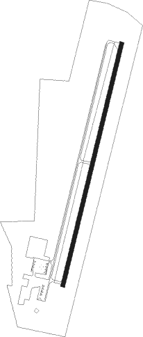
Runway info
| Runway 2 / 20 | ||
| length | 1526m (5007ft) | |
| bearing | 22° / 202° | |
| width | 23m (75ft) | |
| surface | asphalt | |
Nearby beacons
| code | identifier | dist | bearing | frequency |
|---|---|---|---|---|
| SYI | SHELBYVILLE VOR/DME | 18.1 | 81° | 113.55 |
| FQW | WALTER HILL (MURFREESBORO) NDB | 34.4 | 44° | 371 |
| GHM | (CENTERVILLE) DME | 37.2 | 297° | 111.60 |
| BNA | NASHVILLE VORTAC | 38.2 | 11° | 114.10 |
| RQZ | ROCKET (HUNTSVILLE) VORTAC | 43.4 | 167° | 112.20 |
| DCU | DME | 51.9 | 189° | 112.80 |
| MSL | MUSCLE SHOALS VORTAC | 58.7 | 221° | 116.50 |
Instrument approach procedures
| runway | airway (heading) | route (dist, bearing) |
|---|---|---|
| RW02 | HUROG (22°) | HUROG 3000ft |
| RW02 | WOSKU (46°) | WOSKU 3000ft HUROG (6mi, 88°) 3000ft |
| RW02 | ZOKOL (355°) | ZOKOL 3000ft HUROG (6mi, 303°) 3000ft |
| RNAV | HUROG 3000ft JIGLU (7mi, 22°) 2500ft JOROT (2mi, 22°) 1680ft KLUG (3mi, 22°) 772ft (5249mi, 112°) 992ft OXSEZ (5246mi, 292°) 3000ft OXSEZ (turn) | |
| RW20 | EPZUF (226°) | EPZUF 3800ft OXSEZ (6mi, 269°) 3000ft |
| RW20 | OXSEZ (202°) | OXSEZ 3000ft |
| RW20 | UZLEV (176°) | UZLEV 3000ft OXSEZ (6mi, 123°) 3000ft |
| RNAV | OXSEZ 3000ft MATAW (6mi, 202°) 2500ft EYVAK (4mi, 202°) 1320ft KLUG (2mi, 202°) 749ft (5249mi, 112°) 976ft HUROG (5252mi, 292°) 3000ft HUROG (turn) |
Disclaimer
The information on this website is not for real aviation. Use this data with the X-Plane flight simulator only! Data taken with kind consent from X-Plane 12 source code and data files. Content is subject to change without notice.