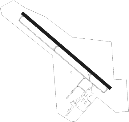
Laurel - Hesler-noble Fld
Airport details
| Country | United States of America |
| State | Mississippi |
| Region | K7 |
| Airspace | Memphis Ctr |
| Municipality | Laurel |
| Elevation | 237ft (72m) |
| Timezone | GMT -6 |
| Coordinates | 31.67303, -89.17281 |
| Magnetic var | |
| Type | land |
| Available since | X-Plane v10.40 |
| ICAO code | KLUL |
| IATA code | LUL |
| FAA code | LUL |
Communication
| Hesler-Noble Fld AWOS 3 | 119.275 |
| Hesler-Noble Fld CTAF/UNICOM | 123.050 |
Nearby Points of Interest:
Newell Rogers House
-Laurel Central Historic District
-Covington County Courthouse
-Eaton Elementary School
-Walthall School
-Longleaf Trace
-Beverly Drive-In Theater
-Mahned Bridge
-Old Augusta Historic Site
-Quitman Depot
Nearby beacons
| code | identifier | dist | bearing | frequency |
|---|---|---|---|---|
| LBY | EATON (HATTIESBURG) VORTAC | 17.4 | 213° | 110.60 |
| MEI | MERIDIAN VORTAC | 46.3 | 28° | 117 |
| GCV | GREENE CO. (LEAKESVILLE) VORTAC | 49.3 | 130° | 115.70 |
| EWA | DME | 55.3 | 46° | 113.80 |
| GVB | BOGALUSA NDB | 59.2 | 221° | 353 |
| NMM | MERIDIAN TACAN | 63 | 35° | 111.90 |
| JA | ALLEN (JACKSON) NDB | 65.5 | 308° | 365 |
| MHZ | MAGNOLIA (MADISON) VORTAC | 65.6 | 309° | 113.20 |
| SJI | SEMMES (MOBILE) VORTAC | 70.5 | 139° | 115.30 |
| MOB | WISLE (MOBILE) NDB | 70.6 | 136° | 248 |
Instrument approach procedures
| runway | airway (heading) | route (dist, bearing) |
|---|---|---|
| RW13 | TUGKU (130°) | TUGKU 2000ft |
| RNAV | TUGKU 2000ft EKLOW (8mi, 130°) 2000ft OCOJY (4mi, 130°) 840ft KLUL (2mi, 130°) 269ft (5363mi, 110°) 488ft IPAXE (5353mi, 289°) 2000ft IPAXE (turn) | |
| RW31 | IPAXE (310°) | IPAXE 2000ft |
| RNAV | IPAXE 2000ft GULCO (8mi, 310°) 2000ft OPUYA (4mi, 310°) 800ft KLUL (2mi, 310°) 274ft (5363mi, 110°) 524ft TUGKU (5373mi, 290°) 2000ft TUGKU (turn) |
Disclaimer
The information on this website is not for real aviation. Use this data with the X-Plane flight simulator only! Data taken with kind consent from X-Plane 12 source code and data files. Content is subject to change without notice.