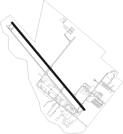
Houston - Pearland
Airport details
| Country | United States of America |
| State | Texas |
| Region | K4 |
| Airspace | Houston Oceanic Ctr |
| Municipality | Brazoria County |
| Elevation | 41ft (12m) |
| Timezone | GMT -6 |
| Coordinates | 29.52128, -95.24214 |
| Magnetic var | |
| Type | land |
| Available since | X-Plane v10.40 |
| ICAO code | KLVJ |
| IATA code | n/a |
| FAA code | LVJ |
Communication
| Pearland ASOS | 118.525 |
| Pearland CTAF/UNICOM | 122.800 |
| Pearland HOUSTON Approach/Departure | 134.450 |
Nearby Points of Interest:
Christopher C. Kraft Jr. Mission Control Center
-Lunar and Planetary Institute
-Washburn Tunnel
-Houston Negro Hospital School of Nursing Building
-Almeda Road Bridge over Brays Bayou
-Houston Negro Hospital
-Aviary at the Houston Zoo
-James L. Autry House
-Logue House
-Isabella Court
-First Evangelical Church
-Boulevard Oaks
-Benjamin Apartments
-Simon and Mamie Minchen House
-Link–Lee House
-Courtlandt Place Historic District
-Houston Fire Station No. 7
-Arthur B. Cohn House
-National Biscuit Company Building
-Antioch Missionary Baptist Church
-United States Customhouse
-Humble Oil Building
-City National Bank Building
-Stowers Building
Nearby beacons
| code | identifier | dist | bearing | frequency |
|---|---|---|---|---|
| EFD | ELLINGTON (HOUSTON) TACAN | 6.6 | 44° | 109.40 |
| VUH | SCHOLES (GALVESTON) VOR/DME | 24.7 | 124° | 113 |
| MHF | TRINITY (SMITH POINT) VOR/DME | 25.8 | 87° | 113.60 |
| IAH | HUMBLE (HOUSTON) VORTAC | 26.7 | 347° | 116.60 |
| BVP | NIXIN (HOUSTON) NDB | 28.3 | 3° | 326 |
| DAS | DAISETTA VORTAC | 50.7 | 42° | 116.90 |
| CX | ALIBI (HOUSTON) NDB | 56 | 346° | 281 |
| TNV | NAVASOTA VOR/DME | 62.6 | 313° | 115.90 |
Departure and arrival routes
| Transition altitude | 18000ft |
| Transition level | 18000ft |
| SID end points | distance | outbound heading | |
|---|---|---|---|
| ALL | |||
| PSX2 | 168mi | 272° | |
| RW14 | |||
| INDIE8 | 228mi | 28° | |
| LURIC8 | 223mi | 40° | |
| STRYA8 | 230mi | 65° | |
| MMALT5 | 150mi | 87° | |
| HOODO7 | 88mi | 108° | |
| WATFO5 | 100mi | 141° | |
| KARRR6 | 136mi | 231° | |
| BORRN4 | 71mi | 282° | |
| STYCK8 | 168mi | 340° | |
| BLTWY7 | 112mi | 347° | |
| WYLSN8 | 121mi | 351° | |
| RW32 | |||
| INDIE8 | 228mi | 28° | |
| LURIC8 | 223mi | 40° | |
| STRYA8 | 230mi | 65° | |
| MMALT5 | 150mi | 87° | |
| HOODO7 | 88mi | 108° | |
| WATFO5 | 100mi | 141° | |
| KARRR6 | 136mi | 231° | |
| BORRN4 | 71mi | 282° | |
| STYCK8 | 168mi | 340° | |
| BLTWY7 | 112mi | 347° | |
| WYLSN8 | 121mi | 351° | |
| STAR starting points | distance | inbound heading | |
|---|---|---|---|
| ALL | |||
| TSHRT1 | 45.8 | 77° | |
| BLUBL4 | 72.5 | 126° | |
| OHIIO4 | 37.9 | 194° | |
| HUDZY4 | 41.6 | 217° | |
| CESAN4 | 81.6 | 226° | |
| WAPPL6 | 63.8 | 232° | |
| TKNIQ3 | 43.9 | 290° | |
Instrument approach procedures
| runway | airway (heading) | route (dist, bearing) |
|---|---|---|
| RW32 | HETUG (294°) | HETUG IDYAK (6mi, 238°) 3000ft |
| RW32 | TEYOC (351°) | TEYOC IDYAK (6mi, 58°) 3000ft |
| RNAV | IDYAK 3000ft FAFOD (6mi, 321°) 1700ft ZEDBA (3mi, 321°) 620ft KLVJ (2mi, 321°) 79ft (5679mi, 107°) 500ft ACOLA (5693mi, 287°) 3000ft ACOLA (turn) |
Holding patterns
| STAR name | hold at | type | turn | heading* | altitude | leg | speed limit |
|---|---|---|---|---|---|---|---|
| BLUBL4 | ELLVR | VHF | right | 351 (171)° | 18000ft - 45000ft | 1.5min timed | ICAO rules |
| HUDZY4 | BRWCK | VHF | left | 55 (235)° | DME 20.0mi | ICAO rules | |
| HUDZY4 | WAPPL | VHF | left | 55 (235)° | DME 10.0mi | ICAO rules | |
| OHIIO4 | LYMBO | VHF | right | 71 (251)° | DME 20.0mi | ICAO rules | |
| OHIIO4 | ZEEKK | VHF | right | 46 (226)° | DME 10.0mi | ICAO rules | |
| TKNIQ3 | TKNIQ | VHF | left | 91 (271)° | DME 10.0mi | ICAO rules | |
| TSHRT1 | ALIEF | VHF | right | 209 (29)° | DME 10.0mi | ICAO rules | |
| TSHRT1 | HYDRL | VHF | right | 209 (29)° | DME 10.0mi | ICAO rules | |
| WAPPL6 | BRWCK | VHF | left | 55 (235)° | DME 20.0mi | ICAO rules | |
| WAPPL6 | WAPPL | VHF | left | 55 (235)° | DME 10.0mi | ICAO rules | |
| *) magnetic outbound (inbound) holding course | |||||||
Disclaimer
The information on this website is not for real aviation. Use this data with the X-Plane flight simulator only! Data taken with kind consent from X-Plane 12 source code and data files. Content is subject to change without notice.