Livermore
Airport details
| Country | United States of America |
| State | California |
| Region | K2 |
| Airspace | Oakland Ctr |
| Municipality | Livermore |
| Elevation | 398ft (121m) |
| Timezone | GMT -8 |
| Coordinates | 37.69204, -121.81416 |
| Magnetic var | |
| Type | land |
| Available since | X-Plane v10.40 |
| ICAO code | KLVK |
| IATA code | LVK |
| FAA code | LVK |
Communication
| Livermore ATIS | 119.650 |
| Livermore CTAF | 118.100 |
| Livermore UNICOM | 122.950 |
| Livermore Ground Control | 121.600 |
| Livermore Tower | 118.100 |
| Livermore NORCAL Approach/Departure | 123.850 |
| Livermore NORCAL Approach/Departure | 125.350 |
Approach frequencies
| ILS-cat-I | RW25R | 110.5 | 18.00mi |
| 3° GS | RW25R | 110.5 | 18.00mi |
Nearby Points of Interest:
Livermore Carnegie Library and Park
-Danville station
-Meek Mansion
-Old Borges Ranch
-Jose Maria Alviso Adobe
-Black Diamond Mines Regional Preserve
-Milpitas Grammar School
-Rancho San Antonio
-Peralta Home
-Coyote Creek
-Moraga Adobe
-James Lick Mansion
-Tracy City Hall and Jail
-Bank of Tracy
-Bank of Italy
-Agnews Developmental Center
-Riverview Union High School Building
-Roswell Butler Hard House
-Maynard Buehler House
-Don Francisco Galindo House
-Patrick Rodgers Farm
-Unitary Plan Wind Tunnel
-Hangar One
-San Francisco Bay
-Rengstorff House
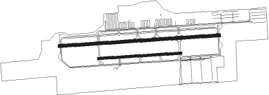
Runway info
Runway 7L / 25R  | ||
| length | 1598m (5243ft) | |
| bearing | 90° / 270° | |
| width | 30m (98ft) | |
| surface | asphalt | |
| blast zone | 46m (151ft) / 46m (151ft) | |
| Runway 7R / 25L | ||
| length | 821m (2694ft) | |
| bearing | 90° / 270° | |
| width | 23m (75ft) | |
| surface | asphalt | |
Nearby beacons
| code | identifier | dist | bearing | frequency |
|---|---|---|---|---|
| LV | REIGA (LIVERMORE) NDB | 6.1 | 90° | 374 |
| NUQ | MOFFETT (MOUNTAIN VIEW) TACAN | 19.4 | 223° | 117.60 |
| OAK | OAKLAND VOR/DME | 19.5 | 275° | 116.80 |
| SJC | SAN JOSE VOR/DME | 20 | 202° | 114.10 |
| CCR | CONCORD VOR/DME | 23.8 | 327° | 117 |
| SFO | SAN FRANCISCO VOR/DME | 26.9 | 263° | 115.80 |
| OSI | WOODSIDE VOR/DME | 28.6 | 237° | 113.90 |
| SUU | TRAVIS (FAIRFIELD) TACAN | 33.8 | 347° | 116.60 |
| SAU | SAUSALITO VOR/DME | 35 | 283° | 116.20 |
| SGD | SCAGGS ISLAND (NAPA) VORTAC | 39.4 | 311° | 112.10 |
| MOD | MODESTO VOR/DME | 40.8 | 94° | 114.60 |
| LIN | LINDEN VOR/DME | 44.7 | 65° | 114.80 |
| SAC | SACRAMENTO VORTAC | 46.8 | 19° | 115.20 |
| MCC | MC CLELLAN (SACRAMENTO) VOR/DME | 61.6 | 23° | 109.20 |
| STS | ROSA DME | 67.9 | 309° | 116.15 |
Instrument approach procedures
| runway | airway (heading) | route (dist, bearing) |
|---|---|---|
| RW25R | EVETT (245°) | EVETT UHHUT (26mi, 230°) 3700ft |
| RW25R | OOWEN (268°) | OOWEN UHHUT (11mi, 266°) 3700ft |
| RW25R | SMONE (289°) | SMONE ZORIR (6mi, 316°) 4900ft UHHUT (6mi, 316°) 3700ft |
| RW25R | UHHUT (270°) | UHHUT 3700ft |
| RNAV | UHHUT 3700ft GAYNS (6mi, 271°) 3200ft OYAHI (3mi, 271°) 2320ft TORCS (4mi, 271°) 1180ft KLVK (2mi, 268°) 447ft (6886mi, 107°) 600ft DRNAY (6889mi, 287°) WHYEE (15mi, 327°) 4000ft |
Disclaimer
The information on this website is not for real aviation. Use this data with the X-Plane flight simulator only! Data taken with kind consent from X-Plane 12 source code and data files. Content is subject to change without notice.