Lawrenceville - Lawrenceville Brunswick Muni
Airport details
| Country | United States of America |
| State | Virginia |
| Region | K6 |
| Airspace | Washington Ctr |
| Municipality | Brunswick County |
| Elevation | 328ft (100m) |
| Timezone | GMT -5 |
| Coordinates | 36.77283, -77.79425 |
| Magnetic var | |
| Type | land |
| Available since | X-Plane v10.40 |
| ICAO code | KLVL |
| IATA code | LVL |
| FAA code | LVL |
Communication
| Lawrenceville Brunswick Muni CTAF/UNICOM | 122.800 |
Nearby Points of Interest:
Brunswick County Courthouse Square
-Hobson's Choice (Alberta, Virginia)
-St. Paul's School
-Brick House (White Plains, Virginia)
-Mason-Tillett House
-Zehmer Farm
-Hicksford-Emporia Historic District
-Greensville County Courthouse Complex
-Old Merchants and Farmers Bank Building
-Greensville County Training School
-Washington Avenue Historic District (Fredericksburg, Virginia)
-Belfield-Emporia Historic District
-Franklin Historic District
-H. T. Klugel Architectural Sheet Metal Work Building
-Village View (Emporia, Virginia)
-Alexander Watson Batte House
-Weaver House
-Montrose (McKenney, Virginia)
-O.H.P. Tanner House
-Brickland
-Rose Bower
-Jones Farm (Kenbridge, Virginia)
-Aspen Lawn
-Fortsville
-Glenview (Stony Creek, Virginia)
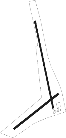
Runway info
Runway 18 / 36  | ||
| length | 922m (3025ft) | |
| bearing | 171° / 351° | |
| width | 15m (50ft) | |
| surface | asphalt | |
| Runway 06 / 24 | ||
| length | 581m (1906ft) | |
| bearing | 62° / 242° | |
| width | 21m (70ft) | |
| surface | grass | |
Nearby beacons
| code | identifier | dist | bearing | frequency |
|---|---|---|---|---|
| LVL | LAWRENCEVILLE VORTAC | 5.8 | 293° | 112.90 |
| BKT | BLACKSTONE NDB | 24.4 | 325° | 326 |
| FKN | FRANKLIN VORTAC | 37.7 | 94° | 110.60 |
| AKQ | WAKEFIELD NDB | 40.1 | 75° | 274 |
| FAK | FLAT ROCK VORTAC | 45.4 | 357° | 113.30 |
| HPW | HOPEWELL VORTAC | 46.6 | 51° | 112 |
| TYI | TAR RIVER (ROCKY MOUNT) VORTAC | 48 | 174° | 117.80 |
| HXO | HUNTSBORO (OXFORD) NDB | 48.8 | 240° | 271 |
| RIC | RICHMOND VORTAC | 49.3 | 33° | 114.10 |
| CVI | COFIELD VORTAC | 50.5 | 113° | 114.60 |
| LE | LEEVY (RALEIGH/DURHAM) NDB | 67.7 | 228° | 350 |
| RDU | RALEIGH-DURHAM VORTAC | 72.2 | 228° | 117.20 |
Instrument approach procedures
| runway | airway (heading) | route (dist, bearing) |
|---|---|---|
| RWNVA | MANGE (195°) | MANGE APOYU (7mi, 222°) 2000ft |
| RNAV | APOYU 2000ft BINAC (5mi, 171°) 1600ft KLVL (4mi, 171°) 369ft (4820mi, 115°) 729ft GEPKE (4806mi, 295°) 4000ft GEPKE (turn) | |
| RWNVB | FITIK (350°) | FITIK 2800ft |
| RNAV | FITIK 2800ft WEMBU (6mi, 351°) 1900ft KLVL (5mi, 350°) 351ft (4820mi, 115°) 729ft FITIK (4817mi, 295°) 3000ft FITIK (turn) |
Disclaimer
The information on this website is not for real aviation. Use this data with the X-Plane flight simulator only! Data taken with kind consent from X-Plane 12 source code and data files. Content is subject to change without notice.