Lewistown - Lewistown Muni
Airport details
| Country | United States of America |
| State | Montana |
| Region | K1 |
| Airspace | Salt Lake City Ctr |
| Municipality | Lewistown |
| Elevation | 4166ft (1270m) |
| Timezone | GMT -7 |
| Coordinates | 47.04925, -109.46670 |
| Magnetic var | |
| Type | land |
| Available since | X-Plane v10.40 |
| ICAO code | KLWT |
| IATA code | LWT |
| FAA code | LWT |
Communication
| Lewistown Muni ASOS | 118.375 |
| Lewistown Muni CTAF/UNICOM | 123.000 |
Nearby Points of Interest:
Anderson House
-Lewistown Courthouse Historic District
-Lewistown Central Business Historic District
-Masonic Temple
-Lewistown Silk Stocking District
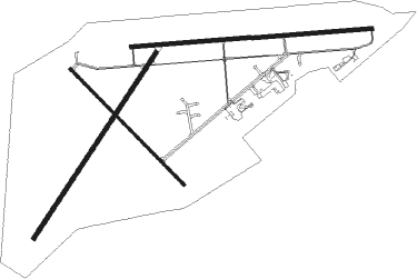
Runway info
Runway 8 / 26  | ||
| length | 1854m (6083ft) | |
| bearing | 90° / 270° | |
| width | 30m (100ft) | |
| surface | asphalt | |
| blast zone | 255m (837ft) / 45m (148ft) | |
| Runway 3 / 21 | ||
| length | 1705m (5594ft) | |
| bearing | 49° / 229° | |
| width | 31m (101ft) | |
| surface | asphalt | |
| Runway 13 / 31 | ||
| length | 1249m (4098ft) | |
| bearing | 129° / 309° | |
| width | 19m (62ft) | |
| surface | asphalt | |
Nearby beacons
| code | identifier | dist | bearing | frequency |
|---|---|---|---|---|
| LWT | LEWISTOWN VOR/DME | 5.7 | 272° | 115.45 |
Instrument approach procedures
| runway | airway (heading) | route (dist, bearing) |
|---|---|---|
| RW08 | AXABE (83°) | AXABE EVBUJ (10mi, 74°) 6800ft |
| RW08 | LWT (92°) | LWT EVBUJ (5mi, 270°) 6800ft EVBUJ (turn) 6800ft |
| RW08 | UFXIT (99°) | UFXIT EVBUJ (5mi, 118°) 6800ft |
| RNAV | EVBUJ 6800ft OKVUJ (6mi, 90°) 5800ft KLWT (5mi, 92°) 4179ft (6193mi, 113°) 4600ft CIWXU (6186mi, 293°) 7700ft CIWXU (turn) | |
| RW26 | ESTRO (282°) | ESTRO ITEVE (8mi, 297°) 7200ft |
| RW26 | LWT (92°) | LWT ITEVE (18mi, 92°) 7200ft ITEVE (turn) 7200ft |
| RNAV | ITEVE 7200ft ZUTOG (5mi, 277°) 6000ft GAJMA (3mi, 270°) 5020ft KLWT (4mi, 268°) 4162ft (6193mi, 113°) 4600ft UFXIT (6207mi, 293°) 8400ft UFXIT (turn) |
Disclaimer
The information on this website is not for real aviation. Use this data with the X-Plane flight simulator only! Data taken with kind consent from X-Plane 12 source code and data files. Content is subject to change without notice.