Little Falls - Little Falls Morrison Co
Airport details
| Country | United States of America |
| State | Minnesota |
| Region | K3 |
| Airspace | Minneapolis Ctr |
| Municipality | Morrison County |
| Elevation | 1122ft (342m) |
| Timezone | GMT -6 |
| Coordinates | 45.94942, -94.34705 |
| Magnetic var | |
| Type | land |
| Available since | X-Plane v10.40 |
| ICAO code | KLXL |
| IATA code | n/a |
| FAA code | LXL |
Communication
| Little Falls Morrison Co CTAF/UNICOM | 122.800 |
Nearby Points of Interest:
Morrison County Courthouse
-Church of Our Savior-Episcopal
-Little Falls Commercial Historic District
-Charles A. Lindbergh State Park WPA/Rustic Style Historic Resources
-Northern Pacific Railway Depot (Little Falls, Minnesota)
-Pine Tree Lumber Company Office Building
-Camp Ripley Bridge
-St. Joseph's Church-Catholic
-Fort Ripley
-Church of St. Stephen-Catholic
-Church of the Immaculate Conception-Catholic
-Anton Gogala Farmstead
-Hotel Reichert
-Bank of Long Prairie
-Todd County Courthouse, Sheriff's House, and Jail
-Batcher Opera House Block
-Church of the Sacred Heart
-Swany White Flour Mills
-Francis Arnold House
-First State Bank
-Church of St. Joseph-Catholic
-Saint Benedict's Monastery
-Pan Motor Company Office and Sheet Metal Works
-Carter Block
-Stearns County Courthouse
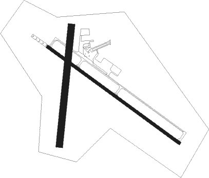
Runway info
Runway 13 / 31  | ||
| length | 1220m (4003ft) | |
| bearing | 121° / 301° | |
| width | 23m (75ft) | |
| surface | asphalt | |
| Runway 18 / 36 | ||
| length | 885m (2904ft) | |
| bearing | 194° / 14° | |
| width | 52m (170ft) | |
| surface | grass | |
| displ threshold | 147m (482ft) / 0m (0ft) | |
Nearby beacons
| code | identifier | dist | bearing | frequency |
|---|---|---|---|---|
| XCR | RIPLEY NDB | 7.7 | 2° | 404 |
| STC | SAINT CLOUD VOR/DME | 26.8 | 144° | 112.10 |
| ST | HUSSK (ST CLOUD) NDB | 32.4 | 141° | 342 |
| BR | LAREW (BRAINERD) NDB | 33.3 | 33° | 251 |
| AXN | ALEXANDRIA VOR/DME | 36.9 | 271° | 112.80 |
| PNM | PRINCETON NDB | 38.6 | 117° | 368 |
| DWN | DARWIN VORTAC | 51.9 | 187° | 109 |
| PK | SPIDA (PARK RAPIDS) NDB | 59.1 | 325° | 269 |
| BDH | WILLMAR VOR/DME | 59.7 | 223° | 113.70 |
| GEP | GOPHER (MINNEAPOLIS) VORTAC | 63.3 | 130° | 117.30 |
| PKD | RAPIDS DME | 64.3 | 323° | 110.60 |
Instrument approach procedures
| runway | airway (heading) | route (dist, bearing) |
|---|---|---|
| RW31 | DAYLE (308°) | DAYLE URENE (15mi, 314°) 4000ft |
| RW31 | GOLLF (287°) | GOLLF URENE (19mi, 279°) 4000ft |
| RW31 | SIYON (349°) | SIYON URENE (9mi, 58°) 4000ft URENE (turn) 4000ft |
| RNAV | URENE 4000ft TUNCI (6mi, 301°) 2800ft KLXL (5mi, 301°) 1168ft (5587mi, 116°) 1517ft ZUGUT (5598mi, 296°) 3000ft ZUGUT (turn) |
Disclaimer
The information on this website is not for real aviation. Use this data with the X-Plane flight simulator only! Data taken with kind consent from X-Plane 12 source code and data files. Content is subject to change without notice.