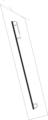
Leadville - Lake Co
Airport details
| Country | United States of America |
| State | Colorado |
| Region | K2 |
| Airspace | Denver Ctr |
| Municipality | Lake County |
| Elevation | 9925ft (3025m) |
| Timezone | GMT -7 |
| Coordinates | 39.21947, -106.31641 |
| Magnetic var | |
| Type | land |
| Available since | X-Plane v10.40 |
| ICAO code | KLXV |
| IATA code | LXV |
| FAA code | LXV |
Communication
| Lake Co ASOS | 118.375 |
| Lake Co CTAF/UNICOM | 122.800 |
Nearby Points of Interest:
Mineral Belt National Recreation Trail
-Leadville Historic District
-Dexter Cabin
-Leadville National Fish Hatchery
-Derry Mining Site Camp
-Twin Lakes District
-Park County Courthouse and Jail
-South Park Community Church
-Independence
-Smuggler Mine
-Sheely Bridge
-Pitkin County Courthouse
-La Fave Block
-Aspen City Hall
-Brand Building
-Collins Block
-Riede's City Bakery
-Thomas Hynes House
-Aspen Community Church
-Newberry House
-Dixon–Markle House
-Bowles–Cooley House
-Shilling–Lamb House
-Davis Waite House
-Smith–Elisha House
Runway info
| Runway 16 / 34 | ||
| length | 1953m (6407ft) | |
| bearing | 168° / 348° | |
| width | 23m (75ft) | |
| surface | asphalt | |
| blast zone | 61m (200ft) / 0m (0ft) | |
Nearby beacons
| code | identifier | dist | bearing | frequency |
|---|---|---|---|---|
| DBL | RED TABLE (EAGLE) VOR/DME | 29.9 | 291° | 113 |
| SXW | SNOW (EAGLE) VOR/DME | 39.8 | 301° | 109.20 |
| RLG | KREMMLING VOR/DME | 47.3 | 351° | 113.80 |
| HBU | BLUE MESA (GUNNISON) VOR/DME | 57.1 | 223° | 114.90 |
Departure and arrival routes
| Transition altitude | 18000ft |
| Transition level | 18000ft |
| SID end points | distance | outbound heading | |
|---|---|---|---|
| RW16 | |||
| LOZUL4 | 27mi | 153° | |
| RW34 | |||
| DAVVY2 | 19mi | 352° | |
Instrument approach procedures
| runway | airway (heading) | route (dist, bearing) |
|---|---|---|
| RW16 | DAVVY (172°) | DAVVY 17500ft DAVVY (turn) 16000ft |
| RNAV | DAVVY 16000ft SKKID (9mi, 177°) 13000ft INGRR (2mi, 168°) 12460ft TALUE (3mi, 168°) 11440ft KLXV (5mi, 168°) 9982ft (6160mi, 110°) 10184ft MORYU (6160mi, 290°) LOZUL (17mi, 144°) 16000ft LOZUL (turn) 16000ft |
Disclaimer
The information on this website is not for real aviation. Use this data with the X-Plane flight simulator only! Data taken with kind consent from X-Plane 12 source code and data files. Content is subject to change without notice.
