Lynchburg - Lynchburg Rgnl Preston Glenn Fld
Airport details
| Country | United States of America |
| State | Virginia |
| Region | K6 |
| Airspace | Washington Ctr |
| Municipality | Campbell County |
| Elevation | 937ft (286m) |
| Timezone | GMT -5 |
| Coordinates | 37.32539, -79.20123 |
| Magnetic var | |
| Type | land |
| Available since | X-Plane v10.40 |
| ICAO code | KLYH |
| IATA code | LYH |
| FAA code | LYH |
Communication
| LYNCHBURG RGNL PRESTON GLENN FLD ATIS | 119.800 |
| LYNCHBURG RGNL PRESTON GLENN FLD UNICOM | 122.950 |
| LYNCHBURG RGNL PRESTON GLENN FLD CTAF | 127.650 |
| LYNCHBURG RGNL PRESTON GLENN FLD Ground Control | 121.900 |
| LYNCHBURG RGNL PRESTON GLENN FLD Tower | 127.650 |
| LYNCHBURG RGNL PRESTON GLENN FLD ROANOKE Approach/Departure | 135.000 |
| LYNCHBURG RGNL PRESTON GLENN FLD ROANOKE Approach/Departure | 125.475 |
Approach frequencies
| ILS-cat-I | RW04 | 110.1 | 18.00mi |
| 3° GS | RW04 | 110.1 | 18.00mi |
Nearby Points of Interest:
Montview
-Samuel Miller House
-South River Friends Meetinghouse
-Sandusky House
-Rosedale
-Walnut Hill (Lynchburg, Virginia)
-Federal Hill
-Doyle Florist Inc.-H.R. Schenkel Inc. Greenhouse Range
-Hopwood Hall
-Woodbourne (Forest, Virginia)
-Rothsay (Forest, Virginia)
-Pierce Street Historic District
-Liberty Hall (Forest, Virginia)
-Campbell County Courthouse
-Dr. Robert Walter Johnson House and Tennis Court
-Lynch's Brickyard House
-William Phaup House
-Diamond Hill Historic District
-Pyramid Motors
-Fifth Street Historic District
-John Marshall Warwick House
-St. Paul's Church
-Carter Glass House
-Court House Hill-Downtown Historic District
-Saint Paul's Vestry House
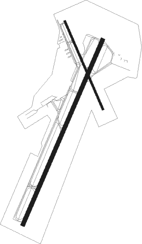
Runway info
Runway 4 / 22  | ||
| length | 2167m (7110ft) | |
| bearing | 33° / 213° | |
| width | 46m (150ft) | |
| surface | asphalt | |
| Runway 17 / 35 | ||
| length | 1034m (3392ft) | |
| bearing | 157° / 337° | |
| width | 23m (75ft) | |
| surface | asphalt | |
| blast zone | 91m (299ft) / 91m (299ft) | |
Nearby beacons
| code | identifier | dist | bearing | frequency |
|---|---|---|---|---|
| LY | BOJAR (LYNCHBURG) NDB | 4.2 | 214° | 385 |
| LYH | LYNCHBURG VOR/DME | 4.5 | 206° | 109.20 |
| VIT | VINTON (ROANOKE) NDB | 33.3 | 260° | 277 |
| MOL | MONTEBELLO VOR/DME | 34.8 | 9° | 115.30 |
| ODR | WOODRUM (ROANOKE) VOR | 37.1 | 270° | 114.90 |
| SBV | SOUTH BOSTON VORTAC | 40 | 164° | 110.40 |
| ROA | ROANOKE VOR/DME | 41.5 | 271° | 109.40 |
| DAN | DANVILLE VOR | 45.8 | 190° | 113.10 |
| SH | STAUT(STAUNTON-WAYNESBORO-HARR NDB | 53.8 | 16° | 375 |
| UV | BALES (MARTINSVILLE) NDB | 55.9 | 224° | 396 |
| SIF | SLAMMER (REIDSVILLE) NDB | 62.7 | 211° | 423 |
Departure and arrival routes
| Transition altitude | 18000ft |
| Transition level | 18000ft |
| SID end points | distance | outbound heading | |
|---|---|---|---|
| RW04 | |||
| LIBRT3 | 54mi | 45° | |
| RW22 | |||
| HURTT4 | 54mi | 45° | |
Instrument approach procedures
| runway | airway (heading) | route (dist, bearing) |
|---|---|---|
| RW04 | AYARA (51°) | AYARA KILBE (9mi, 75°) 3000ft |
| RW04 | LYH (26°) | LYH KILBE (10mi, 216°) 3000ft KILBE (turn) 3000ft |
| RW04 | SYCAM (13°) | SYCAM KILBE (7mi, 323°) 3000ft |
| RNAV | KILBE 3000ft KOECK (8mi, 33°) 2900ft CAPAB (3mi, 33°) 1900ft KLYH (4mi, 33°) 951ft (4891mi, 115°) 1175ft JIXOX (4889mi, 295°) SWARM (12mi, 72°) 3500ft SWARM (turn) | |
| RW17 | RADIA (154°) | RADIA WOPIT (5mi, 144°) 4600ft |
| RNAV | WOPIT 4600ft ZUMOP (5mi, 157°) 3400ft JITGU (5mi, 157°) 1900ft KLYH (4mi, 160°) 962ft (4891mi, 115°) 1400ft CONCO (4880mi, 295°) 3400ft CONCO (turn) | |
| RW22 | CLYFF (188°) | CLYFF KUJUM (11mi, 161°) 4400ft |
| RW22 | LYH (26°) | LYH KUJUM (16mi, 32°) 4400ft KUJUM (turn) 4400ft |
| RW22 | RADIA (154°) | RADIA KUJUM (14mi, 115°) 4400ft |
| RW22 | SWARM (241°) | SWARM KUJUM (8mi, 275°) 4400ft |
| RNAV | KUJUM 4400ft JIXOX (6mi, 214°) 2500ft KLYH (5mi, 214°) 989ft (4891mi, 115°) 1250ft KUCEC (4891mi, 295°) LYH (3mi, 203°) 3000ft LYH (turn) 3000ft | |
| RW35 | CONCO (275°) | CONCO VUVUC (11mi, 229°) 3400ft VUVUC (turn) 3400ft |
| RW35 | SYCAM (13°) | SYCAM VUVUC (11mi, 43°) 3400ft |
| RNAV | VUVUC 3400ft HIJOK (5mi, 337°) 2500ft KLYH (5mi, 334°) 961ft (4891mi, 115°) 1338ft RADIA (4899mi, 295°) 4900ft RADIA (turn) |
Disclaimer
The information on this website is not for real aviation. Use this data with the X-Plane flight simulator only! Data taken with kind consent from X-Plane 12 source code and data files. Content is subject to change without notice.