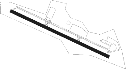
Danielson
Airport details
| Country | United States of America |
| State | Connecticut |
| Region | K6 |
| Airspace | Boston Ctr |
| Municipality | Killingly |
| Elevation | 235ft (72m) |
| Timezone | GMT -5 |
| Coordinates | 41.81975, -71.90097 |
| Magnetic var | |
| Type | land |
| Available since | X-Plane v10.40 |
| ICAO code | KLZD |
| IATA code | n/a |
| FAA code | LZD |
Communication
| Danielson AWOS 3 | 119.125 |
| Danielson CTAF/Unicom | 123.000 |
Nearby Points of Interest:
Old Killingly High School
-Putnam Farm
-Elliottville Lower Mill
-Pomfret Town House
-Israel Putnam Wolf Den
-Cady-Copp House
-Gwyn Careg
-Putnam station
-Cargill Falls Mill
-Jonathan Wheeler House
-Putnam High School
-Plainfield Woolen Company Mill
-Aldrich Free Public Library
-Mount Hygeia
-Capt. George Dorrance House
-George Pickering Nichols House
-Foster Center
-Hezekiah S. Ramsdell Farm
-Mathew Bowen Homestead
-Moosup Valley Historic District
-Natchaug Forest Lumber Shed
-Roseland Cottage
-Woodstock Academy Classroom Building
-Brayton Grist Mill
-Hopkins Mill Historic District
Nearby beacons
| code | identifier | dist | bearing | frequency |
|---|---|---|---|---|
| PUT | PUTNAM VOR/DME | 8.5 | 23° | 117.40 |
| ORW | NORWICH VOR/DME | 16.4 | 200° | 110 |
| PVD | PROVIDENCE VOR/DME | 21.8 | 101° | 115.60 |
| GON | GROTON VOR/DME | 30.1 | 197° | 110.85 |
| HFD | HARTFORD VOR/DME | 30.8 | 255° | 114.90 |
| CEF | WESTOVER(SPRINGFIELD/CHIC TACAN | 35.9 | 301° | 114 |
| OW | STOGE (NORWOOD) NDB | 38.9 | 69° | 397 |
| BAF | BARNES (WESTFIELD/SPRINGF VORTAC | 41.7 | 293° | 113 |
| SEY | SANDY POINT (BLOCK ISLAND VOR/DME | 41.8 | 154° | 117.80 |
| GDM | GARDNER VOR/DME | 44.1 | 348° | 110.60 |
| MAD | MADISON VOR/DME | 46.7 | 237° | 110.40 |
| BOS | BOSTON VOR/DME | 51.8 | 59° | 112.70 |
| HVN | HAVEN DME | 55.4 | 240° | 109.80 |
| HTO | HAMPTON (EAST HAMPTON) VORTAC | 57.2 | 205° | 113.60 |
| EEN | DME | 61 | 338° | 109.40 |
| LWM | DME | 65.8 | 41° | 112.50 |
| CCC | CALVERTON VOR/DME | 67 | 225° | 117.20 |
| FOK | SUFFOLK CO (WESTHAMPTON B TACAN | 67.5 | 217° | 111 |
Disclaimer
The information on this website is not for real aviation. Use this data with the X-Plane flight simulator only! Data taken with kind consent from X-Plane 12 source code and data files. Content is subject to change without notice.