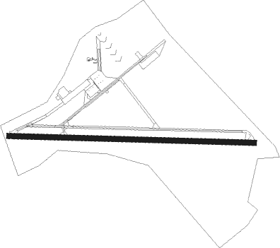
Macon - Macon Downtown
Airport details
| Country | United States of America |
| State | Georgia |
| Region | K7 |
| Airspace | Atlanta Ctr |
| Municipality | Macon |
| Elevation | 437ft (133m) |
| Timezone | GMT -5 |
| Coordinates | 32.82176, -83.56194 |
| Magnetic var | |
| Type | land |
| Available since | X-Plane v10.40 |
| ICAO code | KMAC |
| IATA code | MAC |
| FAA code | MAC |
Communication
| Macon Downtown CTAF/UNICOM | 123.000 |
| Macon Downtown ATLANTA Approach/Departure | 124.200 |
Approach frequencies
| LOC | RW10 | 111.9 | 18.00mi |
Nearby Points of Interest:
Bowden Golf Course
-Luther Williams Field
-Fort Benjamin Hawkins
-Old U.S. Post Office and Federal Building
-Emerson–Holmes Building
-Macon Historic District
-Grand Opera House
-Saint Joseph's Catholic Church
-Cowles-Woodruff House
-Munroe–Dunlap–Snow House
-Thomas C. Burke House
-Holt–Peeler–Snow House
-Hatcher-Groover-Schwartz House
-Carmichael House
-Ellamae Ellis League House
-Joseph and Mary Jane League House
-Small House
-Solomon–Smith–Martin House
-Ingleside Historic District
-Villa Albicini
-Lemuel and Mary James House
-Myrick's Mill
-Jones County High School
-Jones County Courthouse
-Roberts-Bush-Roberts House
Nearby beacons
| code | identifier | dist | bearing | frequency |
|---|---|---|---|---|
| MCN | MACON VORTAC | 8.9 | 213° | 114.20 |
| WRB | ROBINS (WARNER ROBINS) TACAN | 10.9 | 189° | 135.30 |
| UMB | CULVR (MILLEDGEVILLE) NDB | 28.3 | 51° | 380 |
| OP | YATES (THOMASTON) NDB | 32 | 279° | 339 |
| DB | CREKE (DUBLIN) NDB | 34.4 | 122° | 251 |
| IZS | MONTEZUMA NDB | 35.3 | 224° | 426 |
| VNA | VIENNA VORTAC | 36.6 | 174° | 116.50 |
| DBN | DUBLIN VORTAC | 40.1 | 109° | 113.10 |
| EZM | EASTMAN NDB | 46.3 | 149° | 366 |
| LKG | LINDBERGH (AMERICUS) NDB | 47.7 | 220° | 242 |
| VOF | ALCOVY (COVINGTON) NDB | 49.7 | 345° | 370 |
| OHY | CONEY (CORDELE) NDB | 51.7 | 200° | 400 |
| ACJ | SOUTHER (AMERICUS) NDB | 53 | 221° | 242 |
| FFC | PECAT (ATLANTA) NDB | 54.7 | 297° | 316 |
| MQW | MC RAE NDB | 55.5 | 137° | 280 |
| VV | JUNNE (GREENSBORO) NDB | 56.4 | 33° | 353 |
| AA | CEDAR (THOMSON) NDB | 63.9 | 53° | 341 |
| ATL | ATLANTA VORTAC | 65.3 | 313° | 116.90 |
| AT | CATTA (ATLANTA) NDB | 69.8 | 310° | 375 |
| AZE | HAZLEHURST NDB | 73.1 | 136° | 414 |
Instrument approach procedures
| runway | airway (heading) | route (dist, bearing) |
|---|---|---|
| RW10 | HAVIM (95°) | HAVIM 3000ft |
| RNAV | HAVIM 3000ft KODRE (6mi, 95°) 2100ft DOBCE (3mi, 95°) 1280ft KMAC (3mi, 95°) 453ft (5080mi, 111°) 712ft JOBRA (5069mi, 291°) 3000ft JOBRA (turn) | |
| RW28 | JOBRA (275°) | JOBRA 3000ft |
| RNAV | JOBRA 3000ft HONKA (6mi, 275°) 2100ft WURAS (3mi, 275°) 1280ft KMAC (3mi, 275°) 455ft (5080mi, 111°) 712ft HAVIM (5092mi, 291°) 3000ft HAVIM (turn) |
Disclaimer
The information on this website is not for real aviation. Use this data with the X-Plane flight simulator only! Data taken with kind consent from X-Plane 12 source code and data files. Content is subject to change without notice.
