Midland - Midland Intl
Airport details
| Country | United States of America |
| State | Texas |
| Region | K4 |
| Airspace | Ft Worth Ctr |
| Municipality | Midland |
| Elevation | 2871ft (875m) |
| Timezone | GMT -6 |
| Coordinates | 31.94253, -102.20192 |
| Magnetic var | |
| Type | land |
| Available since | X-Plane v10.40 |
| ICAO code | KMAF |
| IATA code | MAF |
| FAA code | MAF |
Communication
| Midland Intl ATIS | 126.800 |
| Midland Intl CTAF | 118.700 |
| Midland Intl UNICOM | 122.950 |
| Midland Intl Clearance DEL | 118.050 |
| Midland Intl Ground Control | 121.900 |
| Midland Intl Tower | 118.700 |
| Midland Intl Approach/Departure | 121.100 |
Approach frequencies
| ILS-cat-I | RW10 | 110.3 | 18.00mi |
| 3° GS | RW10 | 110.3 | 18.00mi |
Nearby Points of Interest:
Howard House
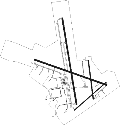
Runway info
Runway 16R / 34L  | ||
| length | 2904m (9528ft) | |
| bearing | 174° / 354° | |
| width | 46m (150ft) | |
| surface | asphalt | |
| blast zone | 59m (194ft) / 191m (627ft) | |
| Runway 10 / 28 | ||
| length | 2527m (8291ft) | |
| bearing | 110° / 290° | |
| width | 46m (150ft) | |
| surface | asphalt | |
| displ threshold | 0m (0ft) / 210m (689ft) | |
| blast zone | 61m (200ft) / 0m (0ft) | |
| Runway 4 / 22 | ||
| length | 1403m (4603ft) | |
| bearing | 58° / 238° | |
| width | 23m (75ft) | |
| surface | asphalt | |
| blast zone | 61m (200ft) / 0m (0ft) | |
| Runway 16L / 34R | ||
| length | 1298m (4259ft) | |
| bearing | 177° / 357° | |
| width | 30m (100ft) | |
| surface | asphalt | |
Nearby beacons
| code | identifier | dist | bearing | frequency |
|---|---|---|---|---|
| MAF | MIDLAND VORTAC | 4 | 10° | 114.80 |
| MA | FARLY (MIDLAND) NDB | 6.8 | 290° | 326 |
| BGS | BIG SPRING VORTAC | 45.1 | 58° | 117.20 |
| FST | FORT STOCKTON VORTAC | 71.4 | 218° | 116.90 |
Instrument approach procedures
| runway | airway (heading) | route (dist, bearing) |
|---|---|---|
| RW04 | TOKRE (56°) | TOKRE 5000ft |
| RNAV | TOKRE 5000ft DILBE (7mi, 58°) 4500ft KMAF (6mi, 53°) 2896ft (6026mi, 107°) 3051ft AYUPA (6015mi, 287°) 4700ft AYUPA (turn) | |
| RW10 | JEMMO (110°) | JEMMO 5000ft |
| RNAV | JEMMO 5000ft BOOST (7mi, 110°) 4900ft KMAF (7mi, 110°) 2923ft (6026mi, 107°) 3069ft EASYY (6014mi, 287°) 4700ft EASYY (turn) | |
| RW16R | PERAE (174°) | PERAE 5100ft |
| RNAV | PERAE 5100ft SIXVE (7mi, 174°) 4600ft KMAF (6mi, 173°) 2922ft (6026mi, 107°) 3072ft ICORO (6026mi, 287°) 4700ft ICORO (turn) | |
| RW22 | AYUPA (240°) | AYUPA 4700ft |
| RNAV | AYUPA 4700ft KITLE (7mi, 238°) 4500ft FONAX (3mi, 238°) 3700ft KMAF (3mi, 247°) 2905ft (6026mi, 107°) 3055ft TOKRE (6036mi, 287°) 5000ft TOKRE (turn) | |
| RW28 | EASYY (291°) | EASYY 4700ft |
| RNAV | EASYY 4700ft SELNE (7mi, 291°) 4700ft KMAF (6mi, 291°) 2908ft (6026mi, 107°) 3058ft JEMMO (6038mi, 287°) 5000ft JEMMO (turn) | |
| RW34L | ICORO (355°) | ICORO 4700ft |
| RNAV | ICORO 4700ft DAPCA (7mi, 354°) 4500ft KMAF (6mi, 355°) 2901ft (6026mi, 107°) 3058ft PERAE (6025mi, 287°) 5100ft PERAE (turn) |
Disclaimer
The information on this website is not for real aviation. Use this data with the X-Plane flight simulator only! Data taken with kind consent from X-Plane 12 source code and data files. Content is subject to change without notice.