Marianna - Marianna Muni
Airport details
| Country | United States of America |
| State | Florida |
| Region | K7 |
| Airspace | Jacksonville Ctr |
| Municipality | Marianna |
| Elevation | 108ft (33m) |
| Timezone | GMT -6 |
| Coordinates | 30.83780, -85.18189 |
| Magnetic var | |
| Type | land |
| Available since | X-Plane v11.50 |
| ICAO code | KMAI |
| IATA code | n/a |
| FAA code | MAI |
Communication
| Marianna Muni ASOS | 133.525 |
| Marianna Muni CTAF/UNICOM | 123.000 |
| Marianna Muni CAIRNS Approach/Departure | 133.750 |
Nearby Points of Interest:
Erwin House
-Great Oaks
-Pender's Store
-Theophilus West House
-Marianna Historic District
-St. Luke Baptist Church
-Joseph W. Russ Jr. House
-Ely-Criglar House
-Robert Lee Norton House
-Chipley City Hall
-South Third Street Historic District
-Seminole County Courthouse
-Old Calhoun County Courthouse
-Joshua Davis House
-Federal Building and United States Courthouse
-Purcell-Killingsworth House
-Gretna School
-Decatur County Courthouse
-J. W. Callahan House
-Bainbridge Commercial Historic District
-Keith Cabin
-Willoughby Gregory House
-E. C. Love House
-Quincy Library
-Judge P. W. White House
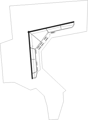
Runway info
Runway 18 / 36  | ||
| length | 1497m (4911ft) | |
| bearing | 180° / 0° | |
| width | 30m (100ft) | |
| surface | asphalt | |
| blast zone | 33m (108ft) / 43m (141ft) | |
| Runway 8 / 26 | ||
| length | 1494m (4902ft) | |
| bearing | 83° / 263° | |
| width | 30m (100ft) | |
| surface | asphalt | |
Nearby beacons
| code | identifier | dist | bearing | frequency |
|---|---|---|---|---|
| SMY | SOYYA (MARIANNA) NDB | 3 | 308° | 329 |
| MAI | MARIANNA VORTAC | 4.2 | 132° | 114 |
| RRS | WIREGRASS (DOTHAN) VORTAC | 29.7 | 331° | 111.60 |
| LYZ | WILLIS (BAINBRIDGE) NDB | 34.8 | 78° | 359 |
| OZR | CAIRNS (FT RUCKER) VOR/DME | 38.1 | 308° | 111.20 |
| OZ | RUCKR (FT RUCKER) NDB | 40 | 301° | 212 |
| HEY | HANCHEY (FT RUCKER) VOR | 40.2 | 319° | 110.60 |
| HYE | HANCHEY (FT RUCKER) NDB | 40.4 | 319° | 221 |
| LOR | LOWE (FORT RUCKER) NDB | 42.7 | 313° | 269 |
| PFN | LYNNE (PANAMA CITY) NDB | 43.6 | 230° | 278 |
| SZW | SEMINOLE VORTAC | 45 | 109° | 117.50 |
| EDN | ENTERPRISE VOR | 46.1 | 302° | 116.60 |
| PAM | TYNDALL (PANAMA CITY) TACAN | 50.1 | 207° | 133.70 |
| BVG | BOLL WEEVIL (ENTERPRISE) NDB | 50.9 | 302° | 352 |
| PZD | PECAN (ALBANY) VOR/DME | 67 | 47° | 116.10 |
Instrument approach procedures
| runway | airway (heading) | route (dist, bearing) |
|---|---|---|
| RW18 | KUTEE (179°) | KUTEE 2000ft |
| RW18 | SEELY (145°) | SEELY KUTEE (7mi, 90°) 2000ft |
| RW18 | WALEN (214°) | WALEN KUTEE (7mi, 270°) 2000ft |
| RNAV | KUTEE 2000ft ELTOP (6mi, 180°) 1800ft JUMIG (3mi, 180°) 880ft KMAI (2mi, 175°) 148ft (5157mi, 110°) 600ft KUTEE (5157mi, 290°) 2000ft KUTEE (turn) |
Disclaimer
The information on this website is not for real aviation. Use this data with the X-Plane flight simulator only! Data taken with kind consent from X-Plane 12 source code and data files. Content is subject to change without notice.