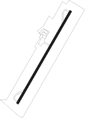
Marion - Marion County
Airport details
| Country | United States of America |
| State | South Carolina |
| Region | K7 |
| Airspace | Jacksonville Ctr |
| Municipality | Marion County |
| Elevation | 90ft (27m) |
| Timezone | GMT -5 |
| Coordinates | 34.18117, -79.33472 |
| Magnetic var | |
| Type | land |
| Available since | X-Plane v10.40 |
| ICAO code | KMAO |
| IATA code | n/a |
| FAA code | MAO |
Communication
| Marion County AWOS-3 | 119.875 |
| Marion County CTAF/UNICOM | 122.800 |
| Marion County FLORENCE Approach/Departure | 135.250 |
Nearby Points of Interest:
Marion High School
-Mullins Commercial Historic District
-Rasor and Clardy Company Building
-A.H. Buchan Company Building
-Neal and Dixon's Warehouse
-J.C. Teasley House
-Liberty Warehouse
-Imperial Tobacco Company Building
-Dillard Barn
-Christ Episcopal Church
-Galivants Ferry Historic District
-Rankin-Harwell House
-Smith Tobacco Barn
-Dillon Downtown Historic District
-McMillan House (Latta, South Carolina)
-John Hayes Farmstead
-Dillon County Courthouse
-James W. Dillon House
-Claussen House
-Mt. Zion Rosenwald School
-Red Doe
-James W. Hamer House
-St. Paul's Methodist Church
-John P. Derham House
-Hamer Hall
Nearby beacons
| code | identifier | dist | bearing | frequency |
|---|---|---|---|---|
| DLC | DILLON NDB | 16.2 | 353° | 274 |
| FLO | FLORENCE VORTAC | 16.3 | 279° | 115.20 |
| HYW | HORRY (CONWAY) NDB | 23.8 | 150° | 370 |
| JB | JIGEL (LUMBERTON) NDB | 23.9 | 28° | 384 |
| FL | ALCOT (FLORENCE) NDB | 25.7 | 269° | 335 |
| CFY | EVANS (LAKE CITY) NDB | 29 | 233° | 420 |
| CPC | CAMP (WHITEVILLE) NDB | 31.4 | 82° | 227 |
| UDG | DARLINGTON NDB | 31.6 | 295° | 245 |
| BES | BENNETTSVILLE NDB | 32.9 | 318° | 230 |
| ME | MAXTN (MAXTON) NDB | 33.5 | 349° | 257 |
| CRE | GRAND STRAND VORTAC | 37.5 | 121° | 114.40 |
| HVS | HARTSVILLE NDB | 41.2 | 286° | 341 |
| PHH | ANDREWS NDB | 44.8 | 195° | 255 |
| FAY | FAYETTEVILLE VOR/DME | 53.3 | 30° | 108.80 |
| CTF | CHESTERFIELD VOR/DME | 54.4 | 297° | 108.20 |
| MNI | MANNING NDB | 56.1 | 236° | 381 |
| POB | POPE (FAYETTEVILLE) TACAN | 61.3 | 18° | 113.80 |
| FGP | FORT BRAGG NDB | 63 | 29° | 393 |
| CTZ | CLINTON NDB | 67.7 | 51° | 412 |
Instrument approach procedures
| runway | airway (heading) | route (dist, bearing) |
|---|---|---|
| RW04 | HUXOS (66°) | HUXOS 3200ft OCAGI (6mi, 120°) 2000ft |
| RW04 | JINOB (9°) | JINOB 2700ft OCAGI (6mi, 300°) 2000ft |
| RW04 | OCAGI (40°) | OCAGI 2000ft |
| RNAV | OCAGI 2000ft FOKAV (6mi, 40°) 1700ft ILQAP (2mi, 40°) 920ft KMAO (3mi, 40°) 131ft (4876mi, 113°) 342ft SEROY (4871mi, 293°) 2000ft SEROY (turn) | |
| RW22 | SEROY (220°) | SEROY 2000ft |
| RW22 | TIPGE (242°) | TIPGE SEROY (6mi, 282°) 2000ft |
| RW22 | UBHAX (195°) | UBHAX SEROY (6mi, 139°) 2000ft |
| RNAV | SEROY 2000ft RUCOD (6mi, 220°) 1700ft KMAO (5mi, 220°) 129ft (4876mi, 113°) 396ft OCAGI (4882mi, 293°) 2000ft OCAGI (turn) |
Disclaimer
The information on this website is not for real aviation. Use this data with the X-Plane flight simulator only! Data taken with kind consent from X-Plane 12 source code and data files. Content is subject to change without notice.
