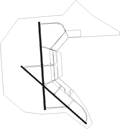
Malden - Malden Regl
Airport details
| Country | United States of America |
| State | Missouri |
| Region | K3 |
| Airspace | Memphis Ctr |
| Municipality | Malden |
| Elevation | 293ft (89m) |
| Timezone | GMT -6 |
| Coordinates | 36.59821, -89.99255 |
| Magnetic var | |
| Type | land |
| Available since | X-Plane v10.40 |
| ICAO code | KMAW |
| IATA code | MAW |
| FAA code | MAW |
Communication
| Malden Regl AWOS 3 | 119.825 |
| Malden Regl CTAF/UNICOM | 122.800 |
Nearby Points of Interest:
Piggott National Guard Armory
-Pfeiffer House and Carriage House
-Stoddard County Courthouse
-J. Herbert Moore House
-Butler County Courthouse
-Wright-Dalton-Bell-Anchor Department Store Building
-Rodgers Theatre
-St. Louis-San Francisco Railroad Depot
-John Archibald Phillips House
-Moore-Dalton House
-Thomas Moore House
-Williams-Gierth House
-Ely and Walker Shirt Factory No. 5
-Alfred W. Greer House
-Scatterville Cemetery
-Sikeston St. Louis, Iron Mountain and Southern Railway Depot
-Caldwell-Hopson House
-Knob School
-Murphy Mound Archeological Site
-Oliver House
-Sheeks House
-Big Oak Tree State Park
Nearby beacons
| code | identifier | dist | bearing | frequency |
|---|---|---|---|---|
| MAW | MALDEN VORTAC | 4.6 | 118° | 111.20 |
| CG | DUTCH (CAPE GIRARDEAU) NDB | 41.7 | 24° | 248 |
| CGI | GIRARDEAU DME | 42.8 | 34° | 112.90 |
| CIR | CAIRO NDB | 46.2 | 59° | 397 |
| DYR | DYERSBURG VORTAC | 47.7 | 131° | 116.80 |
| TNZ | LAWRENCE COUNTY (WALNUT RIDGE) NDB | 50.7 | 247° | 227 |
| UC | OBION (UNION CITY) NDB | 51.4 | 107° | 212 |
| JBR | JONESBORO VOR/DME | 52.1 | 219° | 108.60 |
| ARG | WALNUT RIDGE VORTAC | 54.9 | 243° | 114.50 |
Instrument approach procedures
| runway | airway (heading) | route (dist, bearing) |
|---|---|---|
| RW14 | EPOPY (129°) | EPOPY 2100ft |
| RW14 | FODUM (163°) | FODUM EPOPY (7mi, 232°) 2100ft |
| RW14 | HESIK (102°) | HESIK EPOPY (7mi, 52°) 2100ft |
| RNAV | EPOPY 2100ft ARZOH (6mi, 129°) 2100ft IZELU (4mi, 129°) 920ft KMAW (2mi, 128°) 333ft (5405mi, 112°) 494ft JARKO (5396mi, 292°) 2100ft JARKO (turn) | |
| RW18 | CODED (216°) | CODED GOSTE (7mi, 271°) 2100ft |
| RW18 | GOSTE (180°) | GOSTE 2100ft |
| RW18 | LEPER (134°) | LEPER ESAGE (25mi, 129°) 2200ft GOSTE (7mi, 90°) 2100ft |
| RNAV | GOSTE 2100ft RASOE (6mi, 181°) 2100ft CUBOP (4mi, 181°) 880ft KMAW (2mi, 179°) 335ft (5405mi, 112°) 495ft DROSS (5405mi, 292°) 2100ft DROSS (turn) | |
| RW32 | FIVEK (283°) | FIVEK JARKO (7mi, 233°) 2100ft |
| RW32 | JARKO (310°) | JARKO 2100ft |
| RW32 | WASKA (343°) | WASKA JARKO (7mi, 52°) 2100ft |
| RNAV | JARKO 2100ft ILOSE (6mi, 310°) 2100ft KMAW (6mi, 310°) 332ft (5405mi, 112°) 543ft EPOPY (5413mi, 292°) 2100ft EPOPY (turn) | |
| RW36 | ARG (63°) | ARG CHRLS (43mi, 70°) 2100ft DROSS (7mi, 90°) 2100ft |
| RW36 | DROSS (1°) | DROSS 2100ft |
| RW36 | SHRRN (325°) | SHRRN DROSS (7mi, 271°) 2100ft |
| RNAV | DROSS 2100ft VRNEL (6mi, 1°) 2100ft ONCEF (4mi, 1°) 820ft KMAW (2mi, 3°) 332ft (5405mi, 112°) 495ft GOSTE (5405mi, 292°) 2100ft GOSTE (turn) |
Disclaimer
The information on this website is not for real aviation. Use this data with the X-Plane flight simulator only! Data taken with kind consent from X-Plane 12 source code and data files. Content is subject to change without notice.

