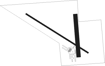
Mobridge - Mobridge Muni
Airport details
| Country | United States of America |
| State | South Dakota |
| Region | K3 |
| Airspace | Minneapolis Ctr |
| Municipality | Walworth County |
| Elevation | 1713ft (522m) |
| Timezone | GMT -6 |
| Coordinates | 45.54628, -100.40628 |
| Magnetic var | |
| Type | land |
| Available since | X-Plane v10.40 |
| ICAO code | KMBG |
| IATA code | MBG |
| FAA code | MBG |
Communication
| Mobridge Muni ASOS | 121.425 |
| Mobridge Muni CTAF/UNICOM | 122.800 |
Instrument approach procedures
| runway | airway (heading) | route (dist, bearing) |
|---|---|---|
| RW12 | ALENS (91°) | ALENS DIYEN (29mi, 86°) 5500ft JIGVO (5mi, 46°) 4000ft |
| RW12 | ILECU (348°) | ILECU DIYEN (34mi, 319°) 5500ft JIGVO (5mi, 46°) 4000ft |
| RW12 | JIGVO (117°) | JIGVO 4000ft |
| RW12 | YAITS (168°) | YAITS HUTIG (22mi, 191°) 5500ft JIGVO (5mi, 227°) 4000ft |
| RNAV | JIGVO 4000ft GAMOW (6mi, 117°) 4000ft PUCBI (5mi, 118°) 2400ft KMBG (3mi, 117°) 1743ft (5842mi, 114°) 2120ft JIGVO (5851mi, 294°) 4000ft JIGVO (turn) | |
| RW30 | CALOG (48°) | CALOG KEKPE (23mi, 77°) 4000ft OVDOE (9mi, 45°) 4000ft |
| RW30 | ILECU (348°) | ILECU OVDOE (19mi, 27°) 4000ft |
| RW30 | OVDOE (298°) | OVDOE 4000ft |
| RW30 | YAITS (168°) | YAITS ZILEL (40mi, 140°) 4000ft OVDOE (9mi, 228°) 4000ft |
| RNAV | OVDOE 4000ft LALGE (7mi, 298°) 3500ft KMBG (6mi, 298°) 1740ft (5842mi, 114°) 1992ft JIGVO (5851mi, 294°) 4000ft JIGVO (turn) |
Disclaimer
The information on this website is not for real aviation. Use this data with the X-Plane flight simulator only! Data taken with kind consent from X-Plane 12 source code and data files. Content is subject to change without notice.

