Madison - Bruce Campbell Fld
Airport details
| Country | United States of America |
| State | Mississippi |
| Region | K7 |
| Airspace | Memphis Ctr |
| Municipality | Madison |
| Elevation | 326ft (99m) |
| Timezone | GMT -6 |
| Coordinates | 32.44332, -90.10491 |
| Magnetic var | |
| Type | land |
| Available since | X-Plane v10.40 |
| ICAO code | KMBO |
| IATA code | DXE |
| FAA code | MBO |
Communication
| Bruce Campbell Fld AWOS 3 | 119.125 |
| Bruce Campbell Fld CTAF/UNICOM | 122.800 |
| Bruce Campbell Fld JACKSON Approach/Departure | 123.900 |
| Bruce Campbell Fld JACKSON Approach/Departure | 125.250 |
Nearby Points of Interest:
Fountainhead
-Castle Crest
-Warren-Guild-Simmons House
-Manship House
-Garner Wynn Green House
-Millsaps-Buie House
-Sims House
-Virden-Patton House
-Joseph Henry Morris House
-Mississippi State Capitol
-Farish Street Neighborhood Historic District
-Old Mississippi State Capitol
-Mississippi Governor's Mansion
-Spengler–Thomas Building
-Central Fire Station
-Sub Rosa
-Jackson City Hall
-Smith Park Architectural District
-Woodrow Wilson Bridge
-Pearl Street Historic District
-Downtown Brandon Historic District
-Mississippi Petrified Forest
-Stevens-Buchanan House
-The Cedars
-John F. Cates House
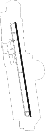
Runway info
| Runway 17 / 35 | ||
| length | 1360m (4462ft) | |
| bearing | 174° / 354° | |
| width | 23m (75ft) | |
| surface | asphalt | |
Nearby beacons
| code | identifier | dist | bearing | frequency |
|---|---|---|---|---|
| MHZ | MAGNOLIA (MADISON) VORTAC | 0.6 | 151° | 113.20 |
| JA | ALLEN (JACKSON) NDB | 1.9 | 205° | 365 |
| JH | BRENZ (JACKSON) NDB | 8.1 | 259° | 260 |
| TKH | TALLULAH (VICKSBURG/TALLULAH) NDB | 48.2 | 258° | 344 |
| MTQ | METCALF (GREENVILLE) NDB | 73.7 | 318° | 359 |
Instrument approach procedures
| runway | airway (heading) | route (dist, bearing) |
|---|---|---|
| RW17 | DUHAB (175°) | DUHAB 6000ft DUHAB (turn) 2400ft |
| RNAV | DUHAB 2400ft AKALY (6mi, 174°) 2000ft KMBO (5mi, 175°) 365ft (5410mi, 110°) 1200ft DUHAB (5411mi, 290°) 2400ft DUHAB (turn) | |
| RW35 | WOSAL (354°) | WOSAL 6000ft WOSAL (turn) 3500ft |
| RNAV | WOSAL 3500ft HAPAN (8mi, 355°) 2100ft KMBO (6mi, 354°) 362ft (5410mi, 110°) 643ft DUHAB (5411mi, 290°) 2400ft DUHAB (turn) |
Disclaimer
The information on this website is not for real aviation. Use this data with the X-Plane flight simulator only! Data taken with kind consent from X-Plane 12 source code and data files. Content is subject to change without notice.