Saginaw - Mbs Intl
Airport details
| Country | United States of America |
| State | Michigan |
| Region | K5 |
| Airspace | Cleveland Ctr |
| Municipality | Tittabawassee Township |
| Elevation | 666ft (203m) |
| Timezone | GMT -5 |
| Coordinates | 43.53292, -84.07964 |
| Magnetic var | |
| Type | land |
| Available since | X-Plane v10.40 |
| ICAO code | KMBS |
| IATA code | MBS |
| FAA code | MBS |
Communication
| MBS Intl ATIS | 125.925 |
| MBS Intl CTAF | 120.100 |
| MBS Intl UNICOM | 122.950 |
| MBS Intl Clearance DEL | 121.850 |
| MBS Intl Ground Control | 121.700 |
| MBS Intl SAGINAW Tower | 120.100 |
| MBS Intl SAGINAW Approach/Departure | 120.950 |
| MBS Intl SAGINAW Approach/Departure | 126.450 |
Approach frequencies
| ILS-cat-I | RW05 | 108.7 | 18.00mi |
| ILS-cat-I | RW23 | 108.7 | 18.00mi |
| 3° GS | RW23 | 108.7 | 18.00mi |
| 2.7° GS | RW05 | 108.7 | 18.00mi |
Nearby Points of Interest:
Russell Sackett House
-Roethke Houses
-James Clements Municipal Airport
-Central Warehouse
-Flint and Pere Marquette Railroad East Saginaw Depot
-Odd Fellows Valley Lodge No. 189 Building
-Davis Carriage House
-North Michigan Avenue Historic District
-East Saginaw Historic Business District
-Trombley House
-Bearinger Building
-Michigan Bell Building
-Sage Library
-F.W. Lewis House
-Donald L. Conner House
-John S. Whitman House
-Midland County Courthouse
-Mr. and Mrs. Robert C. Reinke House
-Herbert H. Dow House
-Joseph A. Cavanagh House
-Midland Street Commercial District
-East Genesee Historic Business District
-Mr. and Mrs Frank Boonstra House
-Mr. and Mrs. Louis P. Butenschoen House
-The Grove
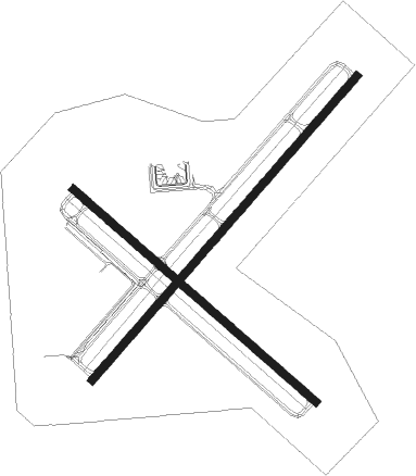
Runway info
Runway 5 / 23  | ||
| length | 2437m (7995ft) | |
| bearing | 55° / 235° | |
| width | 46m (151ft) | |
| surface | asphalt | |
| blast zone | 31m (102ft) / 61m (200ft) | |
| Runway 14 / 32 | ||
| length | 1950m (6398ft) | |
| bearing | 127° / 307° | |
| width | 46m (151ft) | |
| surface | asphalt | |
| blast zone | 61m (200ft) / 61m (200ft) | |
Nearby beacons
| code | identifier | dist | bearing | frequency |
|---|---|---|---|---|
| MBS | SAGINAW VOR/DME | 0.1 | 119° | 112.90 |
| MB | OLSTE (SAGINAW) NDB | 6.1 | 235° | 257 |
| MOP | MOUNT PLEASANT VOR/DME | 29.1 | 278° | 110.60 |
| FNT | FLINT VORTAC | 36.9 | 150° | 116.90 |
| PSI | DME | 55.4 | 147° | 111 |
| ASP | SABLE (OSCODA) DME | 62.4 | 37° | 116.10 |
Instrument approach procedures
| runway | airway (heading) | route (dist, bearing) |
|---|---|---|
| RW05 | WERDO (55°) | WERDO 2300ft |
| RNAV | WERDO 2300ft OTILE (6mi, 54°) 2300ft KMBS (6mi, 55°) 715ft (5148mi, 117°) 866ft FOROX (5140mi, 298°) 2300ft FOROX (turn) | |
| RW14 | OGREE (126°) | OGREE 2300ft |
| RNAV | OGREE 2300ft NURGE (6mi, 126°) 2300ft PIBYI (4mi, 127°) 1160ft KMBS (2mi, 123°) 713ft (5148mi, 117°) 868ft OTANE (5139mi, 297°) 2700ft OTANE (turn) | |
| RW23 | FOROX (234°) | FOROX 2300ft |
| RNAV | FOROX 2300ft JURBO (6mi, 235°) 2300ft KMBS (6mi, 234°) 704ft (5148mi, 117°) 861ft WERDO (5155mi, 297°) 2300ft WERDO (turn) | |
| RW32 | OTANE (307°) | OTANE 2700ft |
| RNAV | OTANE 2700ft WURBA (6mi, 307°) 2300ft GICEV (3mi, 307°) 1220ft KMBS (2mi, 310°) 709ft (5148mi, 117°) 865ft OGREE (5156mi, 297°) 2300ft OGREE (turn) |
Disclaimer
The information on this website is not for real aviation. Use this data with the X-Plane flight simulator only! Data taken with kind consent from X-Plane 12 source code and data files. Content is subject to change without notice.