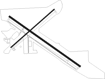
Moberly - Omar N Bradley
Airport details
| Country | United States of America |
| State | Missouri |
| Region | K3 |
| Airspace | Kansas City Ctr |
| Municipality | Moberly |
| Elevation | 867ft (264m) |
| Timezone | GMT -6 |
| Coordinates | 39.46342, -92.42639 |
| Magnetic var | |
| Type | land |
| Available since | X-Plane v10.40 |
| ICAO code | KMBY |
| IATA code | MBY |
| FAA code | MBY |
Communication
| Omar N Bradley AWOS 3 | 120.025 |
| Omar N Bradley CTAF/UNICOM | 122.700 |
Nearby Points of Interest:
Moberly Junior High School
-Burkholder-O'Keefe House
-Blees Military Academy
-Macon County Courthouse and Annex
-Wardell House
-Fabrishous and Sarah A. Thomas House
-Salisbury Square Historic District
-Harrisburg School
-Paris Male Academy
-Albert Bishop Chance House and Gardens
-Chatol
-Benjamin House
-Dr. Uriel S. Wright Office
-Fayette Courthouse Square Historic District
-St. Mary's Episcopal Church
-Redding-Hill House
-First Presbyterian Church
-Campbell Chapel African Methodist Episcopal Church
-Chariton County Jail and Sheriff's Residence
-Glasgow Presbyterian Church
-Glasgow Public Library
-Edwin and Nora Payne Bedford House
-Greenwood
-Mark Twain State Park Picnic Shelter at Buzzard's Roost
-David Guitar House

Nearby beacons
| code | identifier | dist | bearing | frequency |
|---|---|---|---|---|
| MCM | DME | 11.7 | 344° | 112.90 |
| HLV | HALLSVILLE VORTAC | 25.1 | 140° | 114.20 |
| COU | COLUMBIA VOR/DME | 40.3 | 162° | 110.20 |
| IRK | KIRKSVILLE VORTAC | 41 | 346° | 114.60 |
| JE | ALGOA (JEFFERSON CITY) NDB | 57.4 | 159° | 397 |
Instrument approach procedures
| runway | airway (heading) | route (dist, bearing) |
|---|---|---|
| RW13 | DRADE (123°) | DRADE 2900ft |
| RW13 | POYOL (111°) | POYOL DRADE (7mi, 91°) 2900ft |
| RW13 | WOGOL (165°) | WOGOL DRADE (14mi, 209°) 2900ft |
| RNAV | DRADE 2900ft EFAHA (8mi, 123°) 2500ft PEBOY (3mi, 123°) 1440ft KMBY (2mi, 122°) 904ft (5518mi, 113°) 1117ft VETTS (5509mi, 293°) 3200ft VETTS (turn) | |
| RW31 | ALHAH (271°) | ALHAH VETTS (24mi, 257°) 3100ft |
| RW31 | HLV (320°) | HLV VETTS (15mi, 335°) 3100ft |
| RW31 | VETTS (303°) | VETTS 3100ft |
| RNAV | VETTS 3100ft REWAK (6mi, 303°) 2500ft CASAS (3mi, 303°) 1420ft KMBY (2mi, 303°) 898ft (5518mi, 113°) 1117ft DRADE (5527mi, 293°) 2900ft DRADE (turn) |
Disclaimer
The information on this website is not for real aviation. Use this data with the X-Plane flight simulator only! Data taken with kind consent from X-Plane 12 source code and data files. Content is subject to change without notice.