Mc Cook - Mc Cook Ben Nelson Regl
Airport details
| Country | United States of America |
| State | Nebraska |
| Region | K3 |
| Airspace | Denver Ctr |
| Municipality | McCook |
| Elevation | 2583ft (787m) |
| Timezone | GMT -6 |
| Coordinates | 40.20628, -100.59209 |
| Magnetic var | |
| Type | land |
| Available since | X-Plane v10.40 |
| ICAO code | KMCK |
| IATA code | MCK |
| FAA code | MCK |
Communication
| Mc Cook Ben Nelson Regl ASOS | 119.025 |
| Mc Cook Ben Nelson Regl CTAF/UNICOM | 122.800 |
Approach frequencies
| ILS-cat-I | RW12 | 110.95 | 18.00mi |
| 3° GS | RW12 | 110.95 | 18.00mi |
Nearby Points of Interest:
Red Willow County Courthouse
-McCook YMCA
-Harvey P. Sutton House
-St. Paul's Methodist Protestant Church
-Weyl Service Station
-Mowry Bluff Archeological Site
-W. H. Faling House
-Bank of Oberlin
-St. John's Evangelical Lutheran German Church and Cemetery
-Ideal Cement bridge (Stratton, Nebraska)
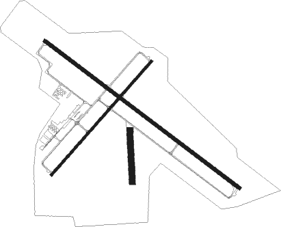
Runway info
Runway 12 / 30  | ||
| length | 1964m (6444ft) | |
| bearing | 124° / 304° | |
| width | 30m (100ft) | |
| surface | concrete | |
| displ threshold | 0m (0ft) / 229m (751ft) | |
| Runway 4 / 22 | ||
| length | 1219m (3999ft) | |
| bearing | 53° / 233° | |
| width | 23m (75ft) | |
| surface | concrete | |
| Runway 17 / 35 | ||
| length | 412m (1352ft) | |
| bearing | 182° / 2° | |
| width | 49m (160ft) | |
| surface | grass | |
Nearby beacons
| code | identifier | dist | bearing | frequency |
|---|---|---|---|---|
| MCK | MC COOK VOR/DME | 0.1 | 221° | 115.30 |
| HCT | HAYES CENTER VORTAC | 21.2 | 307° | 117.70 |
| OIN | OBERLIN NDB | 22.7 | 172° | 341 |
| NRN | NORTON NDB | 38.5 | 117° | 230 |
| JDM | WHEATFIELD (COLBY) NDB | 46.8 | 213° | 408 |
| OZB | COZAD VOR | 48 | 42° | 109 |
| LBF | NORTH PLATTE VOR/DME | 51 | 350° | 117.40 |
| LB | PANBE (NORTH PLATTE) NDB | 51.7 | 1° | 416 |
| HLC | HILL CITY VORTAC | 59.3 | 159° | 113.70 |
Instrument approach procedures
| runway | airway (heading) | route (dist, bearing) |
|---|---|---|
| RW12 | HCT (127°) | HCT TRUNK (9mi, 130°) 5000ft |
| RW12 | QWILT (85°) | QWILT TRUNK (14mi, 51°) 5000ft |
| RW12 | TRUNK (124°) | TRUNK 5000ft |
| RNAV | TRUNK 5000ft PANTS (6mi, 124°) 4400ft KMCK (6mi, 125°) 2622ft OPUXE (12mi, 124°) 5000ft OPUXE (turn) | |
| RW22 | AQFAV (233°) | AQFAV 4300ft |
| RW22 | SULIW (256°) | SULIW 4900ft AQFAV (5mi, 308°) 4300ft |
| RW22 | VIVFE (205°) | VIVFE 4900ft AQFAV (5mi, 128°) 4300ft |
| RNAV | AQFAV 4300ft IHEXU (5mi, 234°) 4200ft KMCK (5mi, 233°) 2596ft (5890mi, 112°) 2983ft AJBUF (5898mi, 292°) 5000ft AJBUF (turn) | |
| RW30 | LIDIC (256°) | LIDIC OPUXE (20mi, 229°) 5000ft |
| RW30 | MCK (41°) | MCK OPUXE (12mi, 123°) 5000ft OPUXE (turn) 5000ft |
| RW30 | QWILT (85°) | QWILT KETEC (26mi, 107°) 5000ft OPUXE (5mi, 49°) 5000ft |
| RNAV | OPUXE 5000ft HUGIL (6mi, 304°) 4300ft KMCK (6mi, 304°) 2590ft (5890mi, 112°) 2810ft TRUNK (5898mi, 292°) 5000ft TRUNK (turn) |
Disclaimer
The information on this website is not for real aviation. Use this data with the X-Plane flight simulator only! Data taken with kind consent from X-Plane 12 source code and data files. Content is subject to change without notice.