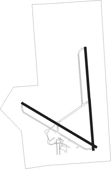
Mason City - Mason City Muni
Airport details
| Country | United States of America |
| State | Iowa |
| Region | K3 |
| Airspace | Minneapolis Ctr |
| Municipality | Cerro Gordo County |
| Elevation | 1210ft (369m) |
| Timezone | GMT -6 |
| Coordinates | 43.15781, -93.33125 |
| Magnetic var | |
| Type | land |
| Available since | X-Plane v10.40 |
| ICAO code | KMCW |
| IATA code | MCW |
| FAA code | MCW |
Communication
| Mason City Muni Mason City ASOS | 120.300 |
| Mason City Muni Mason City CTAF/UNICOM | 123.000 |
Approach frequencies
| ILS-cat-I | RW36 | 109.5 | 18.00mi |
| 2.9° GS | RW36 | 109.5 | 18.00mi |
Nearby Points of Interest:
John L. Etzel House
-Rogers-Knutson House
-Amaziah and Cornelia (Wait) Cannon House
-Tessa Youngblood House
-Hotel Lester-Lester Cafe
-Jewell Apartments
-Lippert House
-St. John Baptist Church
-Mier Wolf House
-E.R. Gibson House
-Charles Seney House
-First Church of Christ, Scientist
-The Kirk
-Mason City Downtown Historic District
-Winnebago River Bridge
-First National Bank of Mason City
-Parker's Opera House
-MBA (Modern Brotherhood of America) Building
-Keerl-Decker House
-Mason City YMCA
-Mason City Public Library
-William C. and Margaret Egloff House
-C.F. Franke House
-Duncan Rule House
-Curtis Yelland House
Nearby beacons
| code | identifier | dist | bearing | frequency |
|---|---|---|---|---|
| MCW | MASON CITY VOR/DME | 3.7 | 179° | 114.90 |
| MC | SURFF (MASON CITY) NDB | 6.3 | 178° | 348 |
| IY | CHUKK (CHARLES CITY) NDB | 26.4 | 92° | 417 |
| JAY | AUSTIN VOR/DME | 30.9 | 45° | 108.20 |
| AEL | ALBERT LEA VOR/DME | 31.5 | 356° | 109.80 |
| RST | ROCHESTER VOR/DME | 49.3 | 50° | 112 |
| FQ | MONTZ (FAIRMONT) NDB | 49.7 | 293° | 420 |
| FOD | FORT DODGE VORTAC | 53.6 | 240° | 113.50 |
| ALO | WATERLOO VOR/DME | 54.6 | 123° | 112.20 |
| OW | TONNA (OWATONNA) NDB | 55.5 | 11° | 379 |
| FO | BARRO (FORT DODGE) NDB | 57.7 | 237° | 341 |
Instrument approach procedures
| runway | airway (heading) | route (dist, bearing) |
|---|---|---|
| RW18 | FREED (164°) | FREED QOJIP (22mi, 155°) 3000ft |
| RW18 | LIYIK (231°) | LIYIK QOJIP (26mi, 247°) 3000ft |
| RW18 | QOJIP (181°) | QOJIP 6000ft QOJIP (turn) 3000ft |
| RNAV | QOJIP 3000ft UHGEP (7mi, 180°) 2800ft FABIT (3mi, 180°) 1840ft KMCW (2mi, 185°) 1268ft (5551mi, 115°) 1413ft IKUWY (5551mi, 295°) 3000ft IKUWY (turn) | |
| RW30 | ALOCK (10°) | ALOCK ZIGUV (30mi, 36°) 3000ft |
| RW30 | AREDA (306°) | AREDA ZIGUV (12mi, 315°) 3000ft |
| RW30 | FOYDE (268°) | FOYDE ZIGUV (28mi, 256°) 3000ft |
| RW30 | POUND (289°) | POUND ZIGUV (12mi, 280°) 3000ft |
| RW30 | ZIGUV (298°) | ZIGUV 3000ft |
| RNAV | ZIGUV 3000ft XENYO (7mi, 297°) 2800ft KMCW (5mi, 299°) 1232ft (5551mi, 115°) 2500ft ZUTIG (5562mi, 295°) 3000ft ZUTIG (turn) | |
| RW36 | ALOCK (10°) | ALOCK IKUWY (22mi, 16°) 3000ft |
| RW36 | AREDA (306°) | AREDA IKUWY (18mi, 282°) 3000ft |
| RW36 | IKUWY (359°) | IKUWY 6000ft IKUWY (turn) 3000ft |
| RW36 | TICUV (59°) | TICUV IKUWY (31mi, 74°) 3000ft |
| RNAV | IKUWY 3000ft UDCEC (7mi, 360°) 2800ft YOPUB (3mi, 360°) 1900ft KMCW (3mi, 355°) 1233ft (5551mi, 115°) 1393ft QOJIP (5550mi, 295°) 3000ft QOJIP (turn) |
Disclaimer
The information on this website is not for real aviation. Use this data with the X-Plane flight simulator only! Data taken with kind consent from X-Plane 12 source code and data files. Content is subject to change without notice.

