Williamston - Martin County
Airport details
| Country | United States of America |
| State | North Carolina |
| Region | K7 |
| Airspace | Washington Ctr |
| Municipality | Martin County |
| Elevation | 76ft (23m) |
| Timezone | GMT -5 |
| Coordinates | 35.86219, -77.17820 |
| Magnetic var | |
| Type | land |
| Available since | X-Plane v10.40 |
| ICAO code | KMCZ |
| IATA code | n/a |
| FAA code | MCZ |
Communication
| Martin County CTAF | 122.800 |
Nearby Points of Interest:
First Christian Church
-Robersonville Primitive Baptist Church
-Skewarkey Primitive Baptist Church
-Williamston Colored School
-Asa Biggs House and Site
-Martin County Courthouse
-King House
-Pitt County Courthouse
-United States Post Office
-James L. Fleming House
-Greenville Commercial Historic District
-Robert Lee Humber House
-Jesse R. Moye House
-E. B. Ficklen House
-Jones-Lee House
-Greenville Tobacco Warehouse Historic District
-Dickinson Avenue Historic District
-Grimesland Plantation
-Skinnerville-Greenville Heights Historic District
-North Market Street Historic District
-Bowers-Tripp House
-Bank of Washington, West End Branch
-Beaufort County Courthouse
-Scotland Neck Historic District
-Hope Plantation (North Carolina)
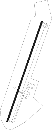
Runway info
| Runway 3 / 21 | ||
| length | 1526m (5007ft) | |
| bearing | 28° / 208° | |
| width | 23m (75ft) | |
| surface | asphalt | |
Nearby beacons
| code | identifier | dist | bearing | frequency |
|---|---|---|---|---|
| AQE | ALWOOD (GREENVILLE) NDB | 13.2 | 231° | 230 |
| RNW | CHOCOWINITY NDB | 21.4 | 169° | 388 |
| TYI | TAR RIVER (ROCKY MOUNT) VORTAC | 26.4 | 282° | 117.80 |
| CVI | COFIELD VORTAC | 34 | 31° | 114.60 |
| ISO | KINSTON VORTAC | 34.8 | 218° | 109.60 |
| IS | STALS (KINSTON) NDB | 44.9 | 220° | 276 |
| EWN | NEW BERN VOR/DME | 47.8 | 170° | 113.60 |
| LLW | WOODVILLE (ELIZABETH CITY) NDB | 49 | 66° | 254 |
| GSB | SEYMOUR JOHNSON TACAN | 50 | 236° | 116.50 |
| EW | KAFTI (NEW BERN) NDB | 50.7 | 173° | 362 |
| FKN | FRANKLIN VORTAC | 51.7 | 11° | 110.60 |
| NKT | CHERRY POINT TACAN | 59.5 | 162° | 112.80 |
| LVL | LAWRENCEVILLE VORTAC | 67.2 | 323° | 112.90 |
| OR | INGLE (NORFOLK) NDB | 73.9 | 43° | 329 |
Instrument approach procedures
| runway | airway (heading) | route (dist, bearing) |
|---|---|---|
| RW03 | TALOE (28°) | TALOE 2400ft |
| RNAV | TALOE 2400ft FABDA (5mi, 28°) 1600ft BUTGE (3mi, 28°) 640ft KMCZ (2mi, 28°) 110ft (4783mi, 115°) 336ft WOBGO (4780mi, 295°) 3500ft WOBGO (turn) 3500ft | |
| RW21 | WOBGO (208°) | WOBGO 2400ft |
| RNAV | WOBGO 2400ft NASIE (5mi, 208°) 1600ft HOBVU (3mi, 208°) 640ft KMCZ (2mi, 208°) 119ft (4783mi, 115°) 337ft TALOE (4786mi, 295°) 2400ft TALOE (turn) 2400ft |
Disclaimer
The information on this website is not for real aviation. Use this data with the X-Plane flight simulator only! Data taken with kind consent from X-Plane 12 source code and data files. Content is subject to change without notice.