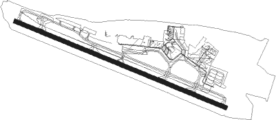
Harrisburg - Harrisburg Intl
Airport details
| Country | United States of America |
| State | Pennsylvania |
| Region | K6 |
| Airspace | New York Ctr |
| Municipality | Dauphin County |
| Elevation | 310ft (94m) |
| Timezone | GMT -5 |
| Coordinates | 40.19319, -76.76262 |
| Magnetic var | |
| Type | land |
| Available since | X-Plane v10.40 |
| ICAO code | KMDT |
| IATA code | MDT |
| FAA code | MDT |
Communication
| Harrisburg Intl ATIS | 118.800 |
| Harrisburg Intl Ground Control | 121.700 |
| Harrisburg Intl Tower | 124.800 |
| Harrisburg Intl Approach/Departure | 126.450 |
| Harrisburg Intl Approach/Departure | 118.250 |
| Harrisburg Intl Approach/Departure | 124.100 |
| Harrisburg Intl Approach/Departure | 122.450 |
Approach frequencies
| ILS-cat-III | RW13 | 110.9 | 18.00mi |
| ILS-cat-I | RW31 | 110.9 | 18.00mi |
| 3° GS | RW31 | 110.9 | 18.00mi |
| 3° GS | RW13 | 110.9 | 18.00mi |
Nearby Points of Interest:
B'nai Jacob Synagogue
-Swatara Ferry House
-Charles and Joseph Raymond Houses
-Simon Cameron House and Bank
-Highspire High School
-Star Barn Complex
-Calver Island
-Henry Smith Farm
-Goldsboro Historic District
-Conrad and Margaret Allerman House
-Hummelstown Brownstone Company
-Steelton High School
-Zion Lutheran Church and Graveyard
-Dr. William Henderson House
-Hammersly-Strominger House
-Kise Mill Bridge Historic District
-Enoch Matlack House
-Harrisburg 19th Street Armory
-William Black Homestead
-Simon Cameron House
-Harrisburg Cemetery
-Salem United Church of Christ
-Old Downtown Harrisburg Commercial Historic District
-Keystone Building
-Dauphin County Courthouse
Nearby beacons
| code | identifier | dist | bearing | frequency |
|---|---|---|---|---|
| MD | ENOLA (HARRISBURG) NDB | 7 | 291° | 204 |
| CX | LATLE (HARRISBURG) NDB | 11.1 | 266° | 219 |
| HAR | HARRISBURG VORTAC | 15.5 | 290° | 112.50 |
| BZJ | BELLGROVE (INDIANTOWN GAP) NDB | 17.4 | 41° | 328 |
| LRP | LANCASTER VOR/DME | 22 | 99° | 117.30 |
| RAV | RAVINE VORTAC | 22.8 | 24° | 114.60 |
| SEG | SELINSGROVE VOR/DME | 36.3 | 349° | 110.40 |
| EMI | WESTMINSTER VORTAC | 43 | 197° | 117.90 |
| MIP | MILTON VORTAC | 50 | 7° | 109.20 |
| MTN | MARTIN (BALTIMORE) TACAN | 54.2 | 158° | 134.10 |
| FND | ELLICOTT (BALTIMORE) NDB | 54.4 | 181° | 371 |
| FDK | FREDERICK VOR | 54.7 | 218° | 109 |
| UN | PENUE (STATE COLLEGE) NDB | 62 | 306° | 388 |
Instrument approach procedures
| runway | airway (heading) | route (dist, bearing) |
|---|---|---|
| RW13 | ARRUY (111°) | ARRUY 3500ft |
| RW13 | ITGUW (129°) | ITGUW 3500ft ARRUY (5mi, 213°) 3500ft |
| RW13 | TIHYI (95°) | TIHYI 3500ft ARRUY (5mi, 33°) 3500ft |
| RNAV | ARRUY 3500ft AXAJI (6mi, 111°) 2500ft KMDT (7mi, 111°) 362ft NERVY (4mi, 111°) CURNA (8mi, 34°) 3500ft CURNA (turn) | |
| RW31 | ILLIW (308°) | ILLIW 3500ft OJIJE (5mi, 33°) 3500ft |
| RW31 | OJIJE (291°) | OJIJE 3500ft |
| RW31 | RIYWY (276°) | RIYWY 3500ft OJIJE (5mi, 214°) 3500ft |
| RNAV | OJIJE 3500ft YOLSU (8mi, 291°) 2200ft KMDT (6mi, 291°) 359ft SAKEY (2mi, 291°) ITGUW (12mi, 313°) 3500ft ITGUW (turn) |
Disclaimer
The information on this website is not for real aviation. Use this data with the X-Plane flight simulator only! Data taken with kind consent from X-Plane 12 source code and data files. Content is subject to change without notice.