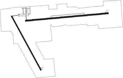
Medford - Taylor Co.
Airport details
| Country | United States of America |
| State | Wisconsin |
| Region | K5 |
| Airspace | Minneapolis Ctr |
| Municipality | Town of Deer Creek |
| Elevation | 1478ft (450m) |
| Timezone | GMT -6 |
| Coordinates | 45.10132, -90.30018 |
| Magnetic var | |
| Type | land |
| Available since | X-Plane v10.40 |
| ICAO code | KMDZ |
| IATA code | MDF |
| FAA code | MDZ |
Communication
| Taylor Co. AWOS 3 | 119.025 |
| Taylor Co. CTAF/UNICOM | 122.800 |
Nearby Points of Interest:
Medford Free Public Library
-Medford Post Office
-Taylor County Courthouse
-J. W. Benn Building
-Owen High School
-Fromm Brothers Fur and Ginseng Farm
-Robert Schofield House
-First Street Bridge (Merrill, Wisconsin)
-T.B. Scott Free Library
-Jump River Town Hall
-Merrill City Hall
-Willard D. Purdy Junior High and Vocational School
-D. R. Moon Memorial Library

Nearby beacons
| code | identifier | dist | bearing | frequency |
|---|---|---|---|---|
| AUW | WAUSAU VOR/DME | 33.9 | 110° | 111.60 |
| RCX | RUSK COUNTY (LADYSMITH) NDB | 38.1 | 300° | 356 |
| RH | ARSHA (RHINELANDER) NDB | 42.7 | 52° | 272 |
| RHI | RHINELANDER VOR/DME | 47.8 | 58° | 109.20 |
| DO | DOUGY (MINOCQUA WOODRUFF) NDB | 50.1 | 38° | 236 |
Instrument approach procedures
| runway | airway (heading) | route (dist, bearing) |
|---|---|---|
| RW09 | HUXUB (90°) | HUXUB 3500ft |
| RNAV | HUXUB 3500ft OMXIV (7mi, 89°) 3000ft WAKUV (2mi, 89°) 2440ft KMDZ (3mi, 91°) 1503ft (5418mi, 117°) 1800ft JAQKU (5405mi, 297°) 3500ft JAQKU (turn) | |
| RW16 | HORMA (146°) | HORMA 4000ft |
| RNAV | HORMA 4000ft ICESA (7mi, 147°) 3000ft FIMEK (2mi, 148°) 2200ft KMDZ (3mi, 139°) 1504ft (5418mi, 117°) 1878ft HAXAN (5413mi, 296°) 4000ft HAXAN (turn) | |
| RW27 | AUW (290°) | AUW TAZLN (13mi, 303°) 3600ft JAQKU (10mi, 303°) 3000ft |
| RW27 | BAITS (173°) | BAITS ZICIC (5mi, 122°) 3300ft ERWEN (12mi, 123°) 3100ft JAQKU (3mi, 123°) 3000ft JAQKU (turn) 3000ft |
| RNAV | JAQKU 3000ft EJOPY (8mi, 270°) 3000ft BAYSH (3mi, 270°) 2060ft KMDZ (2mi, 268°) 1524ft (5418mi, 117°) 2000ft BAITS (5419mi, 297°) 3300ft BAITS (turn) | |
| RW34 | HAXAN (330°) | HAXAN 4000ft |
| RNAV | HAXAN 4000ft ZOKOK (7mi, 328°) 3000ft YERUC (3mi, 328°) 2020ft KMDZ (2mi, 339°) 1496ft (5418mi, 117°) 1780ft HORMA (5423mi, 297°) 4000ft HORMA (turn) |
Disclaimer
The information on this website is not for real aviation. Use this data with the X-Plane flight simulator only! Data taken with kind consent from X-Plane 12 source code and data files. Content is subject to change without notice.